

Not every good day of wheeling needs a three-day plan and a tank of gas each way. Some of the best trails in the state sit close enough to Denver that you can leave after breakfast, air down by mid-morning, and be back on the couch by dinner. That is the whole appeal of the Front Range. You are never more than an hour or so from real dirt.
The catch is that “close to Denver” gets thrown around loosely, and a lot of lists pad themselves with trails that are either a two-hour haul or a full-day commitment once you factor in the drive. So we drew a hard line. Every trail here is within about 90 minutes of driving from the metro to the trailhead, and every one can be run comfortably in six hours or less on the trail. That leaves room for the drive, a slow lunch, and airing back up without watching the sun go down.
Here are five that clear that bar, spread across easy scenic cruises and a couple that will actually make you work.
Chinns Lake: alpine payoff for the least effort
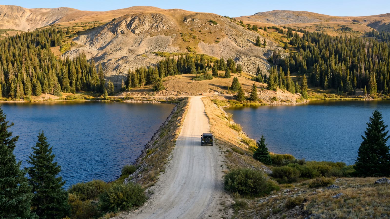 Photo: Offroad4x4Nation
If you want the biggest scenery-to-effort ratio on this list, Chinns Lake is it. The trailhead sits above St. Mary’s Glacier, west of Idaho Springs, which is roughly a 45 to 50 minute run up I-70 from Denver plus a short climb on Fall River Road. The route itself is about 6.8 miles in and back out, and most people plan on around an hour of actual trail time each way with stops for photos.
What makes it worth it: you finish at a pair of gorgeous high-country lakes, Chinns and its neighbor Sherwin, tucked into a granite basin well above treeline. It is the kind of view people drive four hours for, and you got it before lunch.
The honest catch: the first mile lulls you into thinking it is easy, then it gets rocky and rutted as you climb toward the lake. This is high-clearance 4x4 territory, not a Subaru cruise. Snow lingers in the basin into early summer, so this is a mid-summer through early-fall trail. Check conditions before you commit, because a snowbank can turn you around a half mile from the payoff.
We have a full write-up on this one if you want the turn-by-turn: see our Chinns Lake trail guide.
Slaughterhouse Gulch: the local hard-core loop
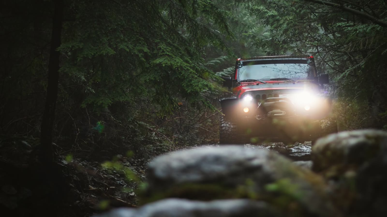 Photo: Greg Rosenke / Unsplash
Slaughterhouse Gulch near Bailey is where a lot of Front Range wheelers go to actually use their rigs. Denver to Bailey is about 55 minutes on US-285, then a few more up Deer Creek Road to the trailhead. The loop runs roughly 11.5 miles and FunTreks rates it Difficult, with a typical run around three hours on the trail. That leaves you plenty of daylight to spare.
What makes it worth it: it is a genuine rock-and-rut playground close to the city. Narrow, tippy, washed out in spots, with small rock obstacles and tree roots that will flex out your suspension and keep you honest. It is a favorite for winter snow runs too, which is rare for something this technical this close in.
The honest catch: most of it is in the trees and not particularly scenic, so come for the wheeling, not the views. There are tight, tippy sections through close trees where roof and body damage is a real possibility, so this is a rig-with-armor trail, not your daily driver. Note that the old mud bogs on the east end are permanently closed for reclamation, so stick to the established route and respect the signs.
Mount Herman Road: the easy scenic cruise
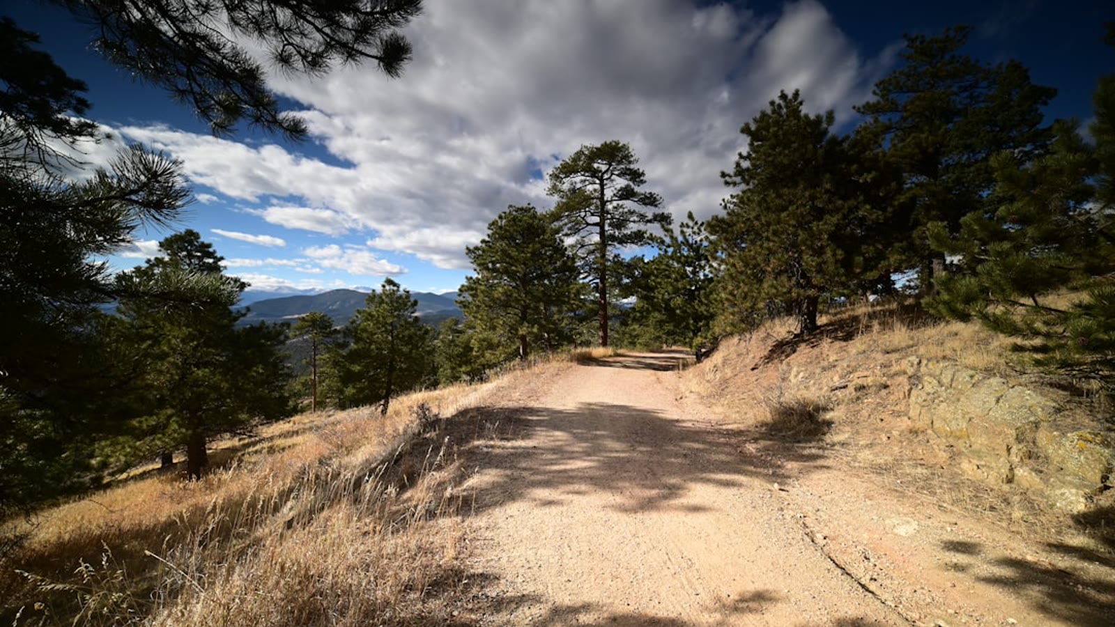 Photo: Gennady Zakharin / Unsplash
Not every day trip needs to be a beating. Mount Herman Road above Monument is the one you bring the family or the stock rig on. It is a graded dirt Forest Service road, easy by any measure, winding up through ponderosa pines with big overlooks back toward the plains. Denver to Monument is about an hour and 15 minutes down I-25, right at the edge of our 90-minute rule, and the road climbs from there.
What makes it worth it: it is the definition of a low-stress scenic drive that still gets you into real national forest. Great fall-color run, plenty of pullouts, and it connects into a wider network of Forest Service roads if you want to wander and make an afternoon of it.
The honest catch: it is easy, and if you are chasing obstacles you will be bored. It is also popular with hikers, mountain bikers, and dispersed campers, so keep your speed down and give people room. After rain or snow the clay surface gets greasy, which is the only time this mellow road bites people.
Rampart Range Road: miles of ridgeline with no drama
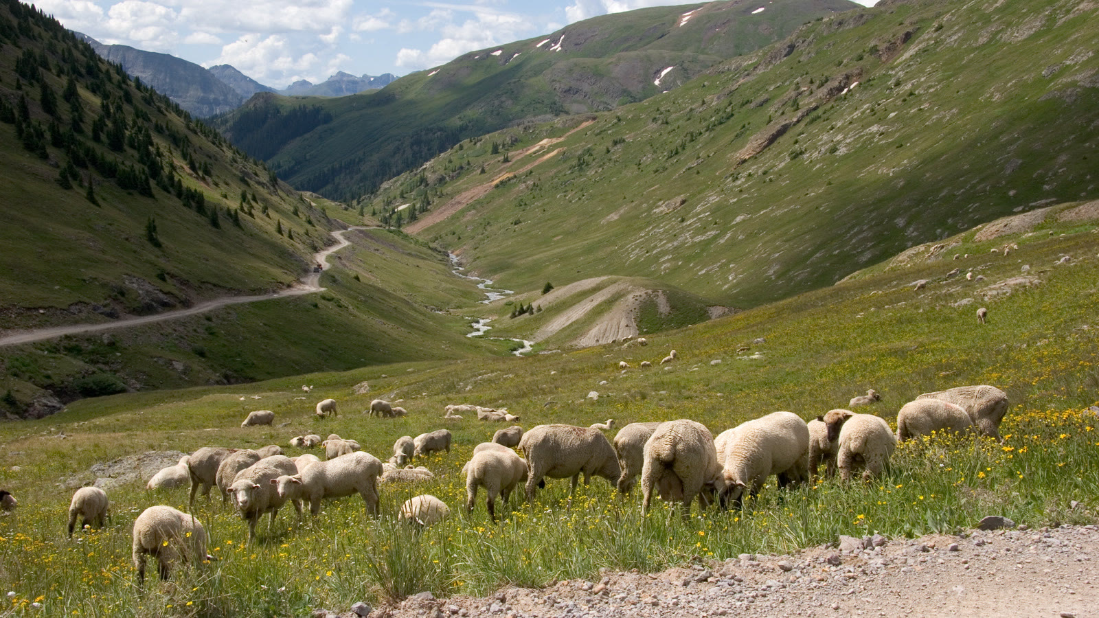 Photo: Offroad4x4Nation
Rampart Range Road is the long, gorgeous cruise that connects the Sedalia area down toward Woodland Park along the top of the range. From Denver you take Santa Fe (US-85) south to Sedalia, then Highway 67 west about ten miles to the well-marked start, which puts the trailhead around 50 minutes to an hour out. The full road is a long one, but the beauty of it is you drive as much or as little as your day allows and turn around whenever.
What makes it worth it: it is absolutely stunning ridgeline scenery with almost no technical difficulty, so it is another one you can do in nearly anything with decent clearance. Endless pullouts, big views, and it links to the Rampart Range OHV area if you want to add some tougher spurs.
The honest catch: there is a real seasonal gate on this one. The Rampart Range Recreation Area roads close annually by December 1 and reopen in spring when conditions allow, generally around April 1. So this is a spring-through-fall trail. Confirm the road is open with the Pike-San Isabel National Forest before you drive down, because a closed gate at Sedalia is a long way to come for nothing.
Kingston Peak: above treeline and back before dark
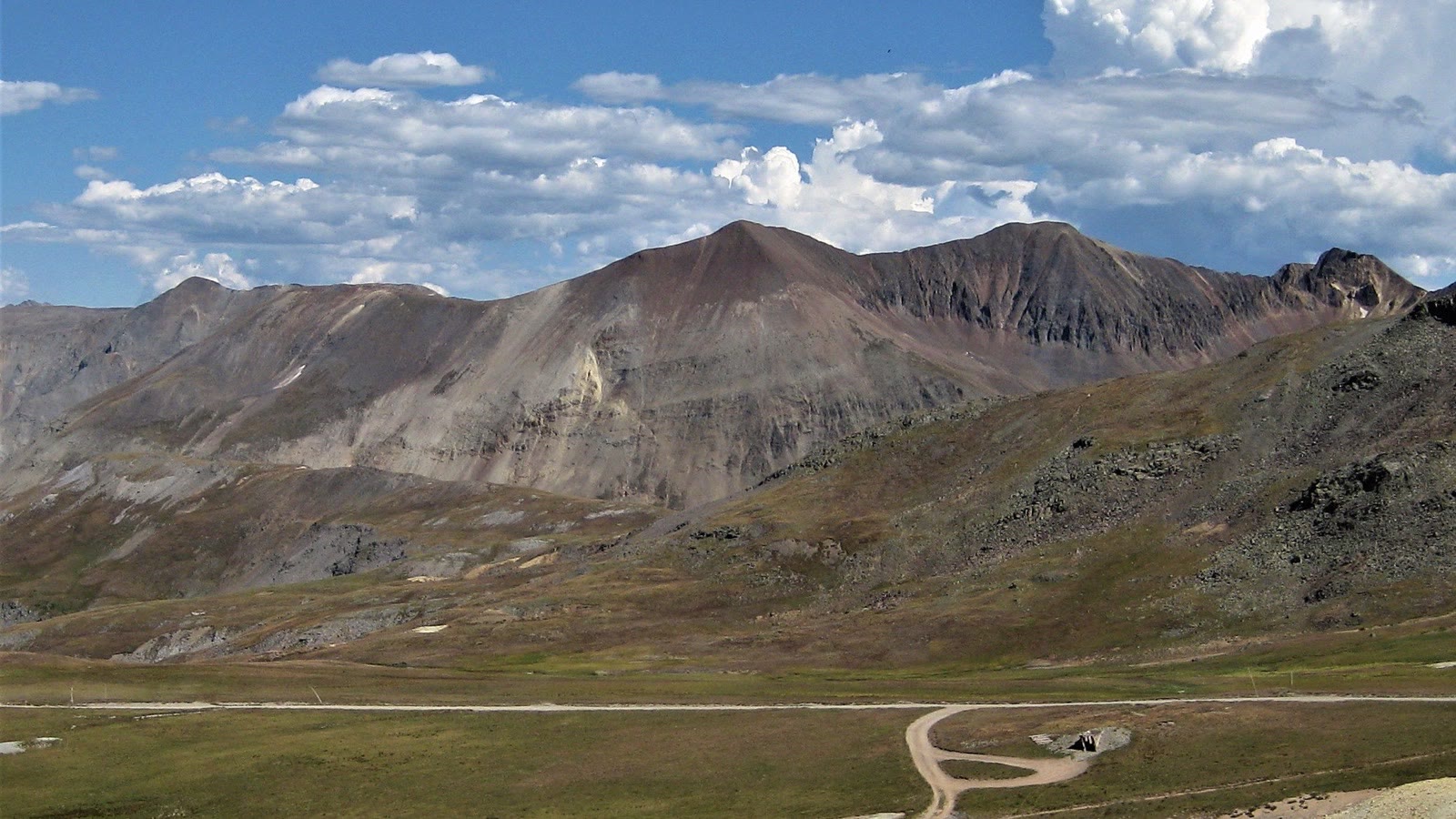 Photo: Offroad4x4Nation
Kingston Peak is the one that feels like a real mountain expedition without the four-hour drive to the San Juans. It runs the high country between Rollinsville and St. Mary’s Glacier, and from Denver you are looking at about an hour to the general area up I-70 or US-40 depending on which end you start. Much of the road sits above timberline, so the views are wide open and huge.
What makes it worth it: alpine tundra, big ridgelines, and access to spots like James Peak Lake and Loch Lomond. It is the closest thing to a classic Colorado high-alpine 4x4 run you can knock out in a day from the city, and the scenery genuinely competes with trails much farther away.
The honest catch: it earns a moderate-to-difficult rating for a reason. There are steep, rocky sections and a couple of committing spots, so bring a high-clearance 4x4 and know your rig. It is also very seasonal. Snow closes the high stretches well into June some years, so this is a July-through-September trail, and afternoon thunderstorms roll in fast up on the tundra. All vehicles must be street-legal or carry a Colorado OHV registration, so sort that out first.
Day-trip smart, and tread lightly out there
A few things that make a Front Range day trip actually work. Check the trail status the morning you leave, not the week before, because seasonal gates and mud closures change fast up here. Air down at the trailhead and air back up before you hit pavement. Carry recovery gear and the tools to change a full-size spare even on the easy ones, because a flat an hour from town is still an hour from town. And build in daylight buffer, especially on the technical loops, so one slow recovery does not turn into a headlamp finish.
Most important, these trails are close to a lot of people, which means they are under real access pressure. Stay on the designated route, honor every closure sign like the reclaimed bogs at Slaughterhouse, pack out everything you bring in, and give hikers, bikers, and horses the right of way. The reason we still get to wheel this close to a major city is that people before us did not wreck it. Tread Lightly, keep it clean, and these will still be here for the next crew.
Now quit reading and go air down. You have all afternoon and you will still make it home for dinner.
Hero photo: Brady Stoeltzing / Unsplash