Some trails you drive for the challenge. Chinns Lake you drive for the payoff. It is short, it is close to Denver, and at the top of it sit two little reservoirs tucked up against timberline with camping right on the water. You can be off I-70 and airing down inside an hour of the city, and you can be parked next to an alpine lake with a fishing rod out by lunch. That combination is exactly why this road gets hammered every summer weekend, and it is exactly why you need to know how to run it right and, just as importantly, how to leave it.
This is not a big-name Colorado trail. It does not have the reputation of Black Bear or the Alpine Loop, and it will not eat your whole day. What it has is a genuinely rewarding destination at the end of a genuinely rough little climb, and a real problem with people treating it like a landfill. We are going to cover both.
What Chinns Lake actually is
Chinns Lake is a short out-and-back forest road, Forest Service Road 174.1D, that climbs off the Fall River drainage west of Idaho Springs and dead-ends at a pair of high alpine reservoirs, Upper and Lower Chinns, sitting right around 11,100 feet. There is a third little pond, Slater Lake, nearby. The whole run is about 6.8 miles in and back out, roughly 3.4 miles each way, and you can knock it out in a couple of hours if you are not stopping. Most people stop. That is the point.
The road starts easy and gets progressively rougher the higher you climb. The first stretch off the pavement is a wide, smooth dirt road that passes through a chunk of private land and cabins, and a Subaru could handle that part in its sleep. Then you hit the fork, bear left onto 174.1D, and the character changes. The road narrows to a thin, rocky mountain track that climbs the side of the valley, and the last mile or so is where it earns its rating. Rock ledges, off-camber sections, and a few taller steps that will stop a stock crossover cold.
There is real disagreement on the exact mileage depending on where you start counting and which app you trust. onX lists the trail portion around 3.7 miles one way. Trails-and-Errors, which measured the full in-and-out, puts it at 6.8 miles round trip. We are going with the round-trip figure because that is what actually matters when you are planning your day. Whatever number you land on, the takeaway is the same: this is a short road that delivers a big reward for the mileage.
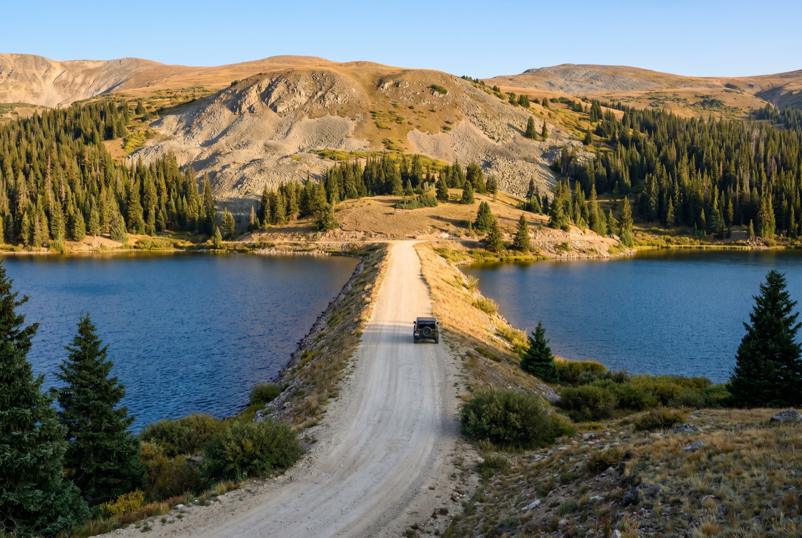 The signature view: two alpine reservoirs with the road running right between them.
How to get there
Getting to the bottom of the trail is the easy part. From Denver, take I-70 west to exit 238, Fall River Road, just past Idaho Springs. This is the same exit you would take for St. Mary’s Glacier, so if you have run that hike you already know the turn.
Head north up Fall River Road. You will climb past the St. Mary’s area and keep going, following the drainage up toward Fall River Reservoir. The pavement gives way to a good dirt road that most anything can travel for the first few miles. Around the 2.5 mile mark past where the dirt starts you reach a fork. The right fork continues to Fall River Reservoir. You want the left fork, which is Chinns Lake road, FR 174.1D. There is a nice house right at the turn, which is a decent landmark, and plenty of private property signs to remind you to stay on the road.
That left turn is where the real trail begins. From here up it is 4WD territory, and the road only gets steeper and rockier the higher you go. The Continental Divide National Scenic Trail crosses the road up near the top, so you will share the area with hikers and backpackers. Give them room.
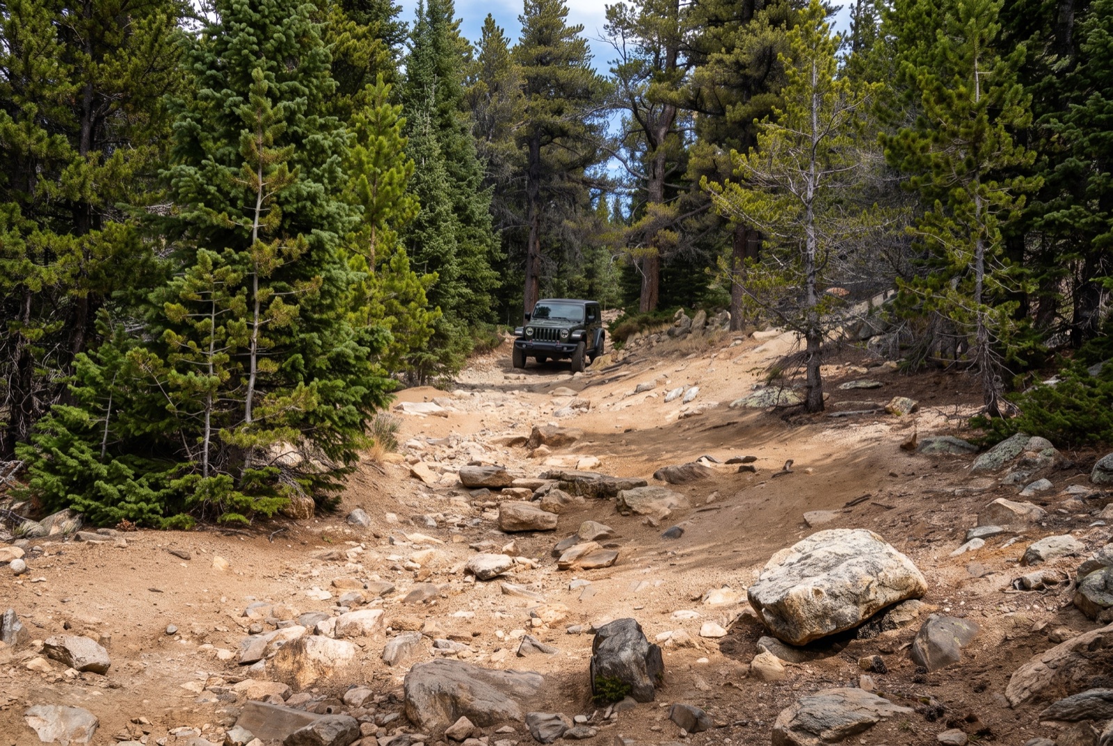 The high-clearance dirt climb up toward the lakes.
The trail character and the obstacles
Do not let the “short and close to Denver” framing fool you into thinking this is a Sunday-drive gravel road all the way up. It is not. The lower section is, but the upper section is legitimately rough, and it is why this trail carries a Moderate rating instead of Easy.
After you bear left at the fork, the road tightens and starts climbing the valley wall. The surface goes from packed dirt to loose rock and embedded ledges. You will pick your way over a series of rock steps, some of them tall enough that a stock, unmodified crossover will drag its belly or hang up if you do not place your tires carefully. This is where line choice matters. A driver who knows how to read a rock and put a tire exactly where it needs to go will find the whole thing manageable. A driver who just points and sends it will scrape, and possibly get stuck.
There are a few optional obstacles along the way for people who want to play, but the main line is what most people run, and the main line is a careful high-clearance crawl, not a technical rock-crawling test. onX rates it a technical 4 out of a possible scale, and Trails-and-Errors puts the difficulty around a 2 to 3 out of 10. Both of those are honest. This is a rough road, not a hardcore trail. The danger here is less about extreme obstacles and more about impatient drivers in the wrong vehicle trying to muscle up ledges they should be crawling.
Expect off-camber sections where the road is cut into the hillside, expect puddles and mud after rain, and expect ice lingering in the shaded spots well into early summer and again in fall. Some of the trickiest moments people report are not the rocks at all but a patch of ice right after the fork.
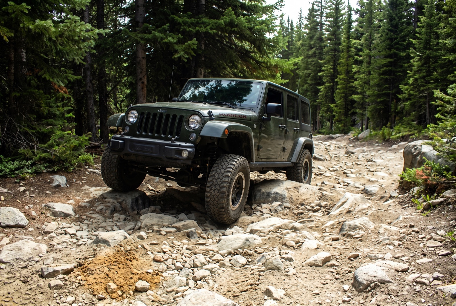 A high-clearance rig on the dirt road between the lakes near the top.
The lakes, the camping, and the fishing
This is what you came for. At the top of the climb the road delivers you to Upper and Lower Chinns Reservoir, two small alpine lakes sitting in a narrow valley just below timberline, with Slater Lake tucked in nearby. The setting is the whole reason this trail is worth the effort. Water, rock, spruce, and open alpine country above, all around 11,100 feet.
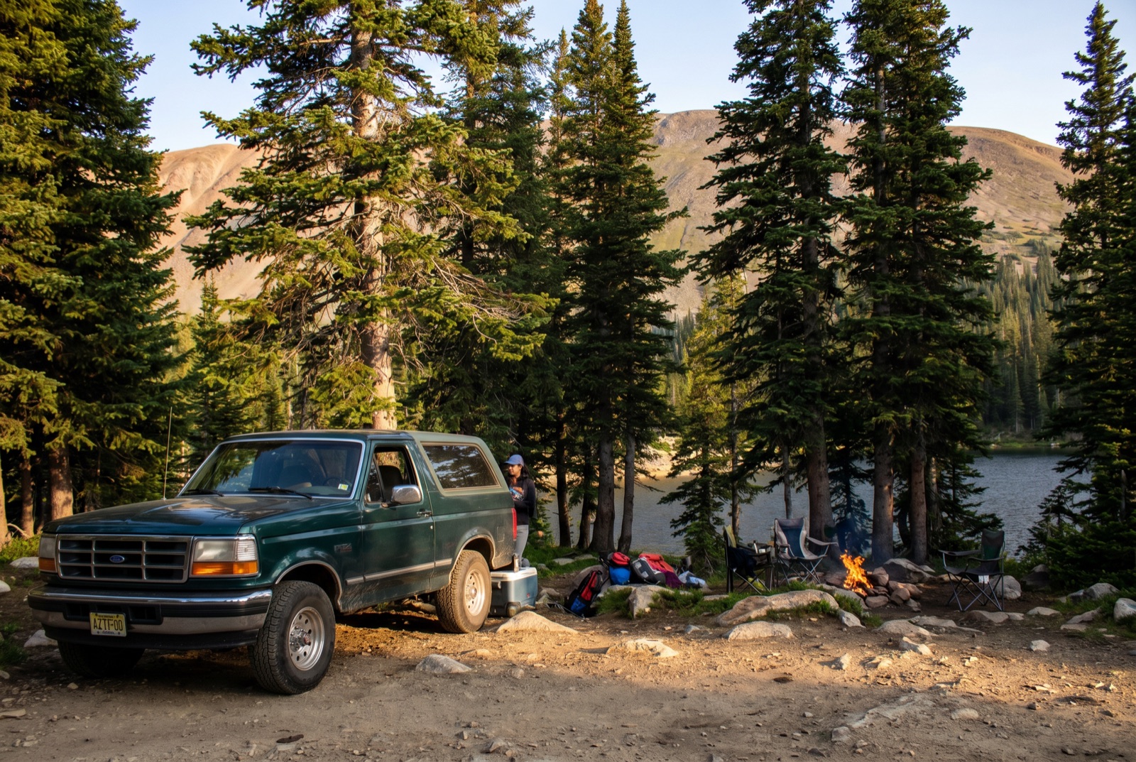
The dispersed camping here is the draw. There are established-ish sites right on the water, and if you are willing to pack your gear in a short distance you can grab a spot with a view straight across the lake. Waking up next to an alpine reservoir an hour from Denver is a genuinely special thing, and it is free. That accessibility is a double-edged sword, which we will get to.
The fishing is real. Two lakes to work, plus the option to hike higher into the basin. People pull trout out of the Chinns reservoirs, and the water is right there next to your rig. Bring a rod even if fishing is not your main plan. Beyond the lakes, the hiking is excellent. From the end of the road it is roughly a mile and around 800 feet of gain to get above 12,000 feet, and the Continental Divide Trail runs through, so you can turn a wheeling trip into a real alpine hike without much effort.
The rig you actually need
Here is the honest minimum. You need a high-clearance, four-wheel-drive vehicle to reach the lakes. Not all-wheel drive, not a soft-roader with a “trail” badge. Real 4WD with real ground clearance.
A stock 4Runner, Tacoma, Wrangler, Bronco, or a properly-built midsize truck will get up there without drama in the hands of a careful driver. A lifted rig on 33s will not even notice the road. Where people run into trouble is trying to take a stock RAV4, Subaru, or CR-V to the lakes. Reviews from people who have run it are consistent on this: those vehicles struggle on a few of the taller ledges near the top, and while an experienced driver might scrape one up there, most will turn around, and some will do real damage to a bumper or an oil pan trying.
You do not need lockers, you do not need armor, and you do not need a winch for the main line. What you need is clearance, 4WD, decent tires, and the patience to pick lines instead of bashing over rocks. Good all-terrain tires make a real difference on the loose rock and any ice. If your vehicle is stock and low, do the smart thing: drive the easy lower section, park before the rough part, and hike the last stretch to the lakes. It is a short walk and a lot cheaper than a tow.
Rules, permits, and the pack-out problem
The land is managed by the Arapaho and Roosevelt National Forests, Clear Creek Ranger District. There is no permit or fee to run the road or to camp at the lakes. It is dispersed camping on national forest land, which means it is free and it is first-come, first-served, and it also means the responsibility to keep it clean falls entirely on the people using it.
That responsibility is being failed, badly. Chinns Lake has a well-earned reputation as one of the more trashed dispersed areas in the Front Range. Because it is so close to Denver and so easy to reach, it gets absolutely hammered, and a chunk of the people coming up here leave fire rings full of garbage, bottles, broken glass, and worse. Nearly every recent trail report mentions the litter, and more than one long-time visitor has watched the place get worse year over year.
Check for fire restrictions before you go and take them seriously. Recent visitors have reported active fire bans with signage at the lakes, and given how dry the Colorado high country gets, a ban is common. If there is a ban, there is no fire, full stop. Beyond that, the rules are the simple ones that apply to all dispersed camping: pack out everything you bring in, use existing sites and fire rings rather than making new ones, camp at least 100 feet from the water, and do not drive off the established road.
Best season and the snow window
Chinns Lake sits high enough that it is really a summer and early fall trail, whatever the apps say about it being open year round. There is no formal seasonal gate closing it, but at 11,100 feet the snow closes it for you.
Realistically your window is roughly June through September or into October, and it is entirely snow-dependent year to year. Early in the season you can expect lingering snow and ice, especially in the shaded sections and right after the fork where the road climbs the north-facing valley wall. Late in the fall the first real storms will shut the top down. The sweet spot is mid-to-late summer, when the road is dry, the lakes are open, and the wildflowers are up in the basin. Fall brings cold nights and thinning crowds, which some people prefer despite the risk of an early snow.
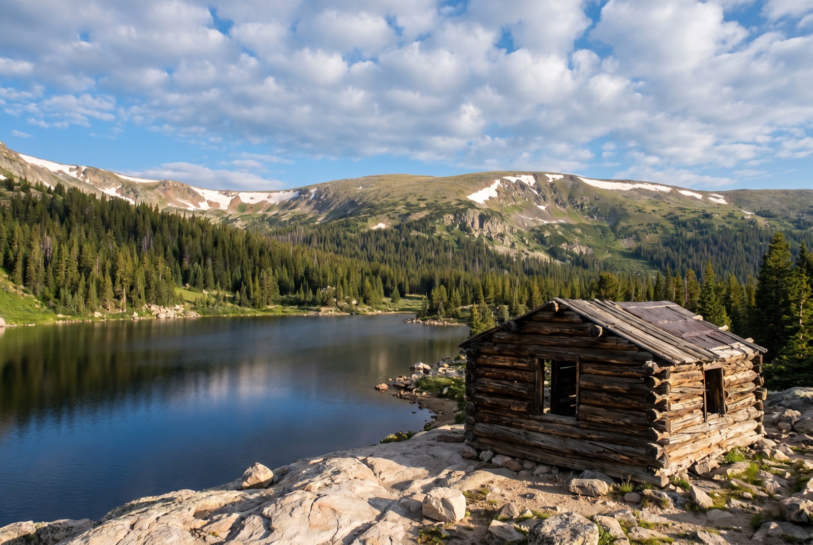 The mellow, rounded high country that Chinns Lake sits in.
Check current conditions before you commit. onX trail reports are updated frequently by people who just ran it, and they will tell you whether the ice is still holding at the fork or whether it is clear to the top.
Stewardship, and why it matters here more than most
We do not usually put this section this high on the priority list, but Chinns Lake earns it. This is one of those places where the off-road community’s reputation is being written in real time, and right now the story being told is not a good one.
The reality is simple. Places this beautiful and this accessible get loved to death when people treat them carelessly, and the response from land managers to abused areas is to close them. Dispersed camping gets restricted, roads get gated, access disappears. Every piece of trash left at Chinns Lake is an argument for shutting it down, and every one of us who wants to keep driving to alpine lakes an hour from the city has a direct stake in not letting that happen.
So do the obvious thing. Follow Tread Lightly principles. Pack out your own garbage, and then pack out someone else’s too. Bring an extra trash bag and fill it. Multiple recent visitors have said the same thing: bring a bag and help leave it better than you found it. That is not preachy, it is self-interest. Keep this place clean and it stays open. Trash it and we all lose it. Chinns Lake is a short, gorgeous, easy-to-reach reward of a trail, and it is worth protecting.