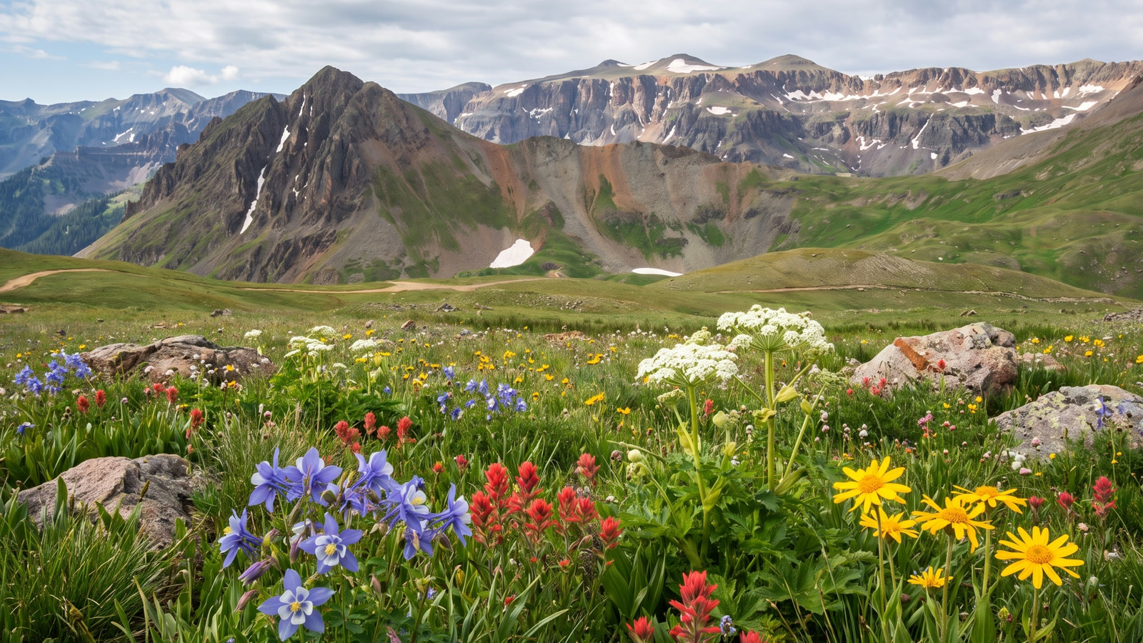
There is a moment on the way up Yankee Boy Basin, somewhere after the road pulls out of the trees and the whole head of the valley opens up in front of you, where you understand why photographers set alarms for this place in July. The tundra goes green and then it goes loud with color, columbine and paintbrush and acres of tall cow parsnip, and above all of it the volcanic spires of Mount Sneffels and Gilpin Peak and Stony Mountain wrap around the basin like the walls of an amphitheater. It is one of the most beautiful drives in Colorado, and you can do most of it in the right stock SUV. That combination is exactly why it gets so busy, and why it deserves to be treated with more care than a lot of people give it.
This is a guide to running it right. Yankee Boy is not a hard-core rock trail, but it is not a drive-up either, and the top mile has humbled plenty of people who read “wildflower road” and left the low-range vehicle at home. Here is what it actually is, how to get on it, what the road does in order, and what you need to bring.
What Yankee Boy Basin Actually Is
Yankee Boy Basin is a high alpine cirque in the San Juan Mountains, southwest of Ouray, sitting inside the Grand Mesa, Uncompahgre and Gunnison National Forests. The route most people call “Yankee Boy Basin” is really the whole run up Camp Bird Road (County Road 361) and then up County Road 26 into the basin itself, climbing from around 8,500 feet at the highway to roughly 12,400 feet at the top. onX Offroad measures the full route at about 9.4 miles one way, and rates it a technical 4 out of 10, which lands it squarely at Moderate. That rating hides an important detail, though: the lower two-thirds are genuinely easy, and the top is where the Moderate comes from.
The basin earned its reputation on two things. First, the wildflowers, which in a good year are as good as anything in the state. Second, the history. This is old mining country, and you drive straight through it: the Camp Bird Mine, the Atlas Mill, and a scatter of relics that are still standing because the dry, cold air up here preserves everything. The Camp Bird was one of the richest gold mines in Colorado history, and the road you are driving was built to serve it. You are not on a recreational trail that happens to be scenic. You are on a working mining road that the mountains happened to make gorgeous.
Yankee Boy is also the launching point for one of Colorado’s classic fourteeners. The trailhead for Mount Sneffels, at 14,150 feet, sits at the top of the drivable road, which means on a summer weekend you are sharing the basin with peak-baggers, Jeep tours out of Ouray, side-by-sides, photographers, and dispersed crowds. Go early if you want it quiet. By ten in the morning in July it is not quiet.
Getting There: The Camp Bird Road
Everything starts in Ouray. Head south out of town on U.S. 550, the Million Dollar Highway, and about 0.4 mile past the Beaumont Hotel, as the highway begins its first big switchback climbing toward Red Mountain Pass, watch for the right turn onto Camp Bird Road, County Road 361. There is a sign for Camp Bird Mine, Yankee Boy Basin, and Box Canyon Falls. Take it.
Right after the turn the road forks. The right fork drops to Box Canyon Falls; you want to continue straight ahead (the left option), cross the bridge over Canyon Creek, and start the climb. The first few miles are graded dirt shelf road above the Uncompahgre gorge, and this is where you get your first taste of the exposure. The shelf is wide enough for the traffic it carries, but there are drop-offs, there is oncoming Jeep-tour and side-by-side traffic, and uphill traffic generally has the right of way. Take the pullouts, be patient, and do not crowd the edge.
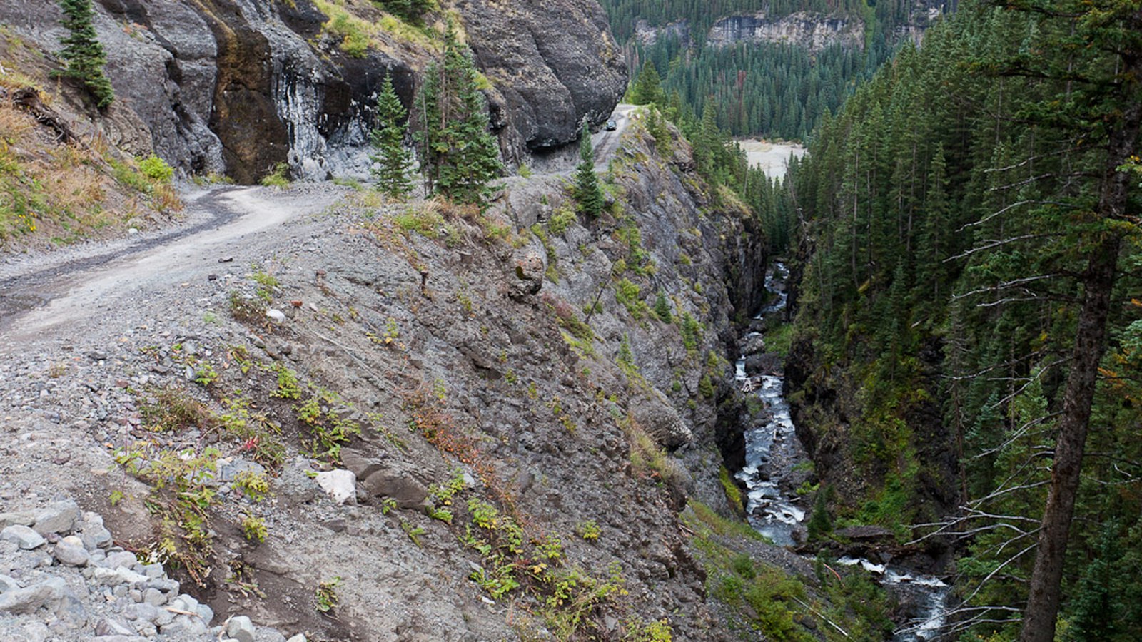 Photo: Greg Willis / Wikimedia Commons (CC BY-SA 2.0)
You will pass the turnoff for Camp Bird Mine and the historic Imogene Pass road on the way up. Stay on the main road for Yankee Boy. Around mile 7.75 the road branches, with Governor Basin road climbing off to the left near the Atlas Mill. Most passenger cars and crossovers can make it this far in dry conditions if the driver is careful, and there is good parking near the Atlas Mill. This is the natural line between “anyone can drive it” and “now you want the real 4x4.”
The Shelf and the Rock Overhang
The stretch of Camp Bird Road below the basin is the part people photograph the most and respect the least. It is a narrow shelf cut into the mountainside with the creek far below, and it includes the famous rock overhang, a cantilevered slab of rock the road ducks under where two rigs can barely pass. It is not technical driving. There are no obstacles that will stop a stock vehicle here. What it demands is patience and good manners: yield at the wide spots, do not stop under the overhang for photos while traffic is stacking up behind you, and remember that a lot of the vehicles coming down are rented side-by-sides being driven by people on their first mountain road.
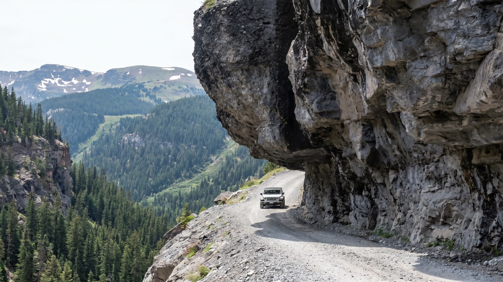
This lower section had its ratings bumped over the years for a reason. It is exposed, weather moves fast up here, and an afternoon thunderstorm can turn a comfortable shelf into a greasy one in minutes. None of it is hard in the dry. All of it is unforgiving if you get careless.
Twin Falls and the Wildflowers
As the road climbs into the basin proper it passes Twin Falls, a pair of cascades dropping off the tundra shelf, and this is the postcard everyone comes for. Time it for mid-to-late July and the meadows below the falls are a full wall of wildflowers. This is genuinely one of the great wildflower displays in the Rockies, which is why photographers “flock to the area,” in the words of the guidebooks, at the height of the bloom.
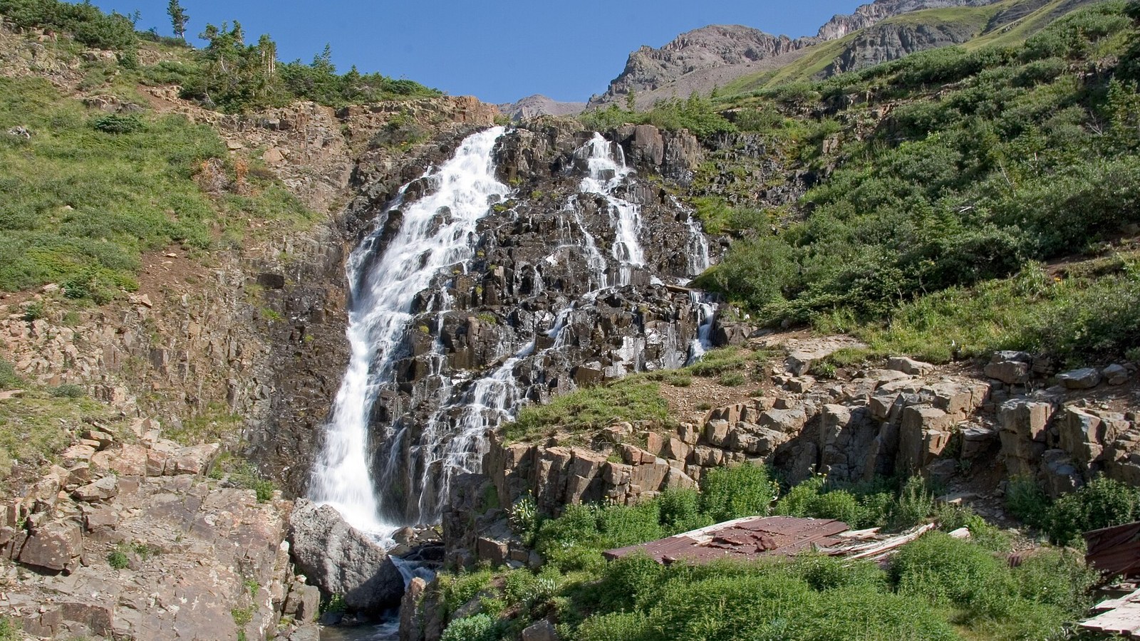 Photo: Kimon Berlin / Wikimedia Commons (CC BY-SA 2.0)
That popularity is also the basin’s biggest problem, and it is worth being honest about it. The alpine tundra here is fragile, and it recovers on a timescale of decades, not seasons. Years of people cutting new tracks around snowbanks and pulling off the road to park in the meadow have braided informal roads across the basin and scarred the tundra badly enough that Ouray County spent 2024 and 2025 studying whether to close the upper mile to motorized traffic entirely. The county ultimately decided against a closure in the spring of 2026 and is instead working with the Forest Service and volunteer groups to define the main road, restore the damaged areas, and keep drivers on the established route. The takeaway for you is simple: stay on the main road, park only in established pullouts and lots, and do not create a new line around a snowbank because someone else did. Access to this place is not guaranteed forever, and how we drive it now decides that.
The Upper Basin and the Rough Mile
Here is the part that catches people. Above the basin there is a solar-powered vault toilet at a large pullout around 11,380 feet, and the road up to that point is in good shape, no real obstacles, manageable by a careful stock 4x4 and even some crossovers driven with commitment. Beyond the toilet, the character changes. The road gets rocky, narrow, and steep as it climbs the last stretch toward the Blue Lakes and Mount Sneffels trailhead near 12,400 feet, and there is a seasonal gate on the upper portion that stays closed until the snow clears, usually late June or early July.
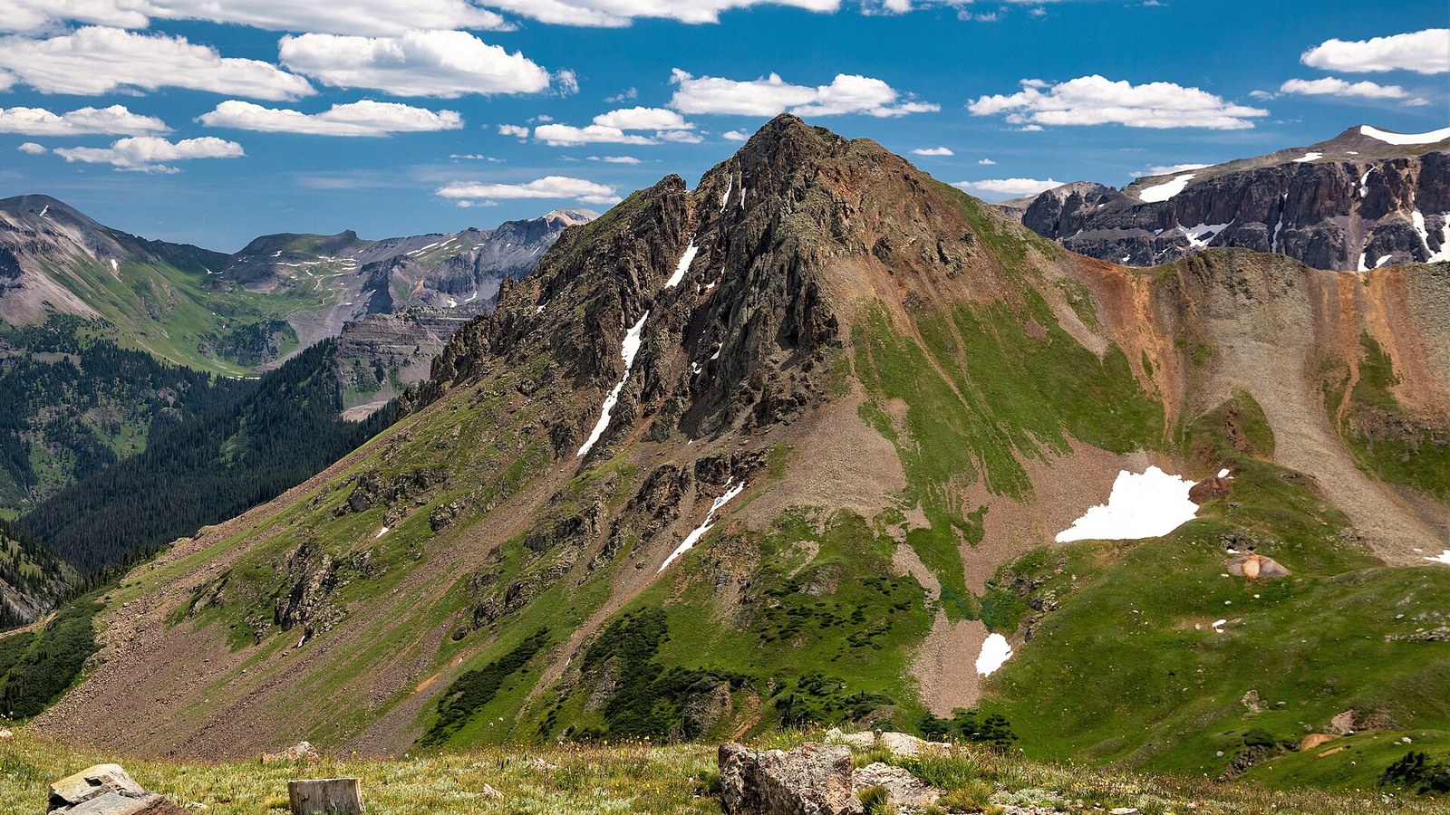 Photo: dana.m.wilson / Wikimedia Commons (CC BY 2.0)
This top mile is the reason the trail carries a Moderate rating and why some guidebooks list it as Difficult near the top. It is not a rock garden, but there are ruts and rock steps where you will want low range, deliberate tire placement, and real clearance. Plenty of drivers park at the toilet and walk the last mile rather than drag an undercarriage over it. There is no shame in that, and if you are in a low-clearance vehicle it is the right call. Know where your rig’s limit is before you commit to that last pitch, because turning around up there is not easy.
The Rig You Actually Need
Be honest about which trip you are doing. To reach the Atlas Mill and Governor Basin turnoff around mile 7.75 in dry summer conditions, a careful driver in a crossover or stock SUV is usually fine. To reach the vault toilet at 11,380 feet, you want a real 4x4 with a little clearance and low gears, but no aggressive build. To drive the final rough mile to the Sneffels trailhead at the top, you want honest high clearance, low range, and a willingness to place your tires carefully on rock steps. Skid plates are nice insurance up there.
Beyond the vehicle, this is high country and the altitude does not care how capable your truck is. Carry layers, water, and rain gear, watch the sky and be off the exposed high sections before afternoon storms build, and remember that from the top you are at over 12,000 feet where weather turns fast and cell service is thin. There is one emergency call box on the whole route, at the junction of County Road 26 and the old Imogene cutoff. Do not count on your phone.
Permits, Rules, and Camping
There are no permits or use fees to drive Yankee Boy Basin, and the road is open to street-legal and off-highway vehicles from May 1 to November 11, with the upper gate held closed until the snow melts out. What is regulated hard is camping. Because the area is loved to the point of damage, dispersed camping is not allowed in the basin. Camping is restricted to designated sites, historically the Thistledown and Angel Creek areas lower on Camp Bird Road, and there is a fee to camp. This is enforced. The Ouray County sheriff restarted an expanded backcountry alpine ranger program in 2025 specifically to bring education and enforcement to the high country, so do not plan on quietly pitching a tent in the meadow. If you want to camp near the basin, use the designated sites and pay the fee, or base out of Ouray.
The other hard rule is the tundra itself. Stay on the established road, pack out everything including human waste where facilities are absent, and use the vault toilet at the top. This is the single most-visited high basin in the Ouray area, and every rig that stays on the main line is the reason it stays open to rigs at all.
Best Season
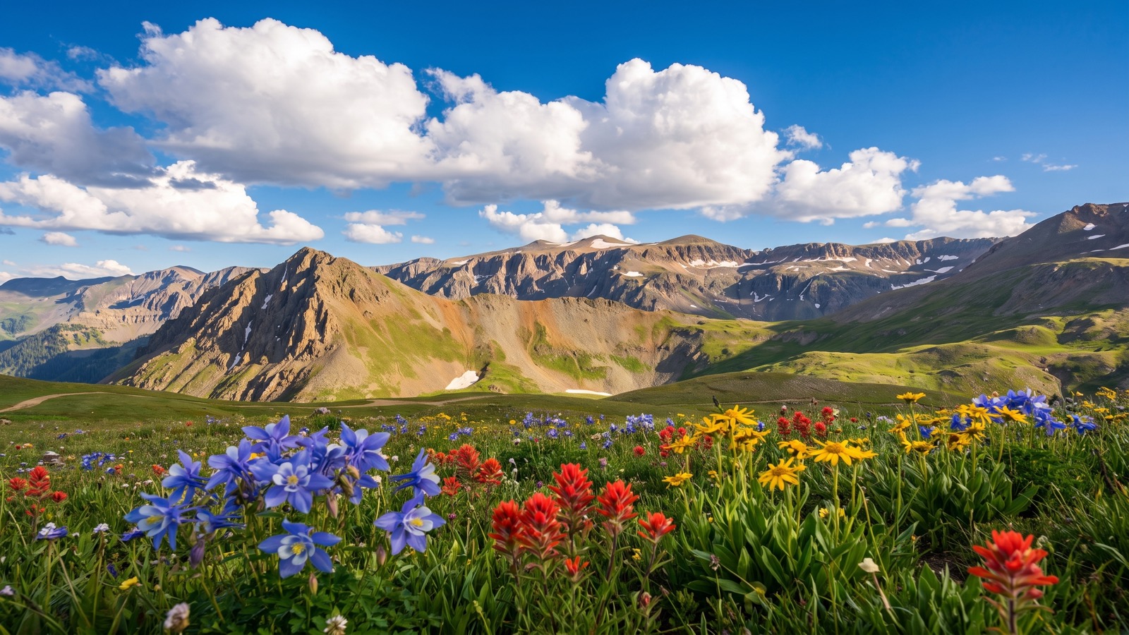
The window is short and worth planning around. The full road is generally drivable from late June, once the upper gate opens, through early October before snow closes it again. For wildflowers, mid-to-late July is the target, and that is also the busiest stretch, so go on a weekday or start at dawn if you can. September brings gold in the willows and aspen lower down, thinner crowds, and the first real cold, and it is a quieter, arguably better time to drive the basin if flowers are not your priority. Whenever you go, check current conditions before you commit to the top, because snowbanks linger in the upper basin well into summer and can close the last mile even when the rest of the road is dry.
The Bottom Line
Yankee Boy Basin is the rare trail that rewards a first-timer in a stock 4x4 and still gives a built rig something to do at the top, wrapped in scenery that ranks with anything in the state. Run it early, run it in July for the flowers or in September for the quiet, keep your rig on the established road, and match your ambition on that last rough mile to what your vehicle can actually handle. Do that and you get one of the best days of driving Colorado has to offer, and you help make sure it stays open for the next rig behind you.