

✅ Update 9/21/2026 — The San Juan County CR-2 (Animas Forks approach) has reopened. The scheduled September 14–18 road work closure per San Miguel County Road & Bridge has ended; all approaches to Engineer Pass are now accessible for the remainder of the 2026 season.
⚠️ Update 9/7/2026 — Engineer Pass was temporarily closed on the San Juan County side (CR-2, Animas Forks approach) from September 14–18, 2026, per San Miguel County Road & Bridge. The Lake City/Hinsdale side (CR-20) and the Ouray/Mineral Creek approach (CR-18) were not affected.
There is a stretch on the west side of Engineer Pass, up in the switchbacks between Animas Forks and the summit, where the road narrows down to one rocky lane, the basin drops away below your door, and the top of the pass sits above you at 12,800 feet with snow still hiding in the shadows in July. That is the moment Engineer earns its reputation. It is the highest and most exposed piece of the Alpine Loop, and it strings the old mining country of the San Juans into one of the great high-country drives in Colorado.
Engineer gets talked about two ways, and both are true. Seasoned drivers will tell you it is not a hard trail, and by rock-crawling standards they are right. There is no single obstacle up here that will fold your rig. What Engineer actually is instead is a long, high, exposed shelf road where the altitude, the weather, and the drop-offs do the intimidating for it. Bring the right vehicle, run it in the right window, and treat it with respect, and it will hand you a day you do not forget.
What Engineer Pass Is
Engineer Pass tops out at 12,800 feet in the heart of the San Juan Mountains, and it is one of the two high passes that anchor the Alpine Loop. The Loop is a 65-mile network of old four-wheel-drive mining roads that the Bureau of Land Management manages as a Backcountry Byway, connecting the mountain towns of Lake City, Silverton, and Ouray. Engineer and its sister crossing, Cinnamon Pass at 12,600 feet, are what earn the Loop its name. The land up here is split between the BLM Gunnison Field Office and the surrounding national forests, and most of the route above 11,000 feet runs above the tree line.
The road itself is old. Otto Mears, the Estonian-born toll-road builder they called the Pathfinder of the San Juans, pushed the original route over Engineer in the late 1870s to move ore and people between Lake City and the mines around Animas Forks. You are driving history the whole way. The pass carried freight wagons and pack mules long before it carried Broncos and side-by-sides.
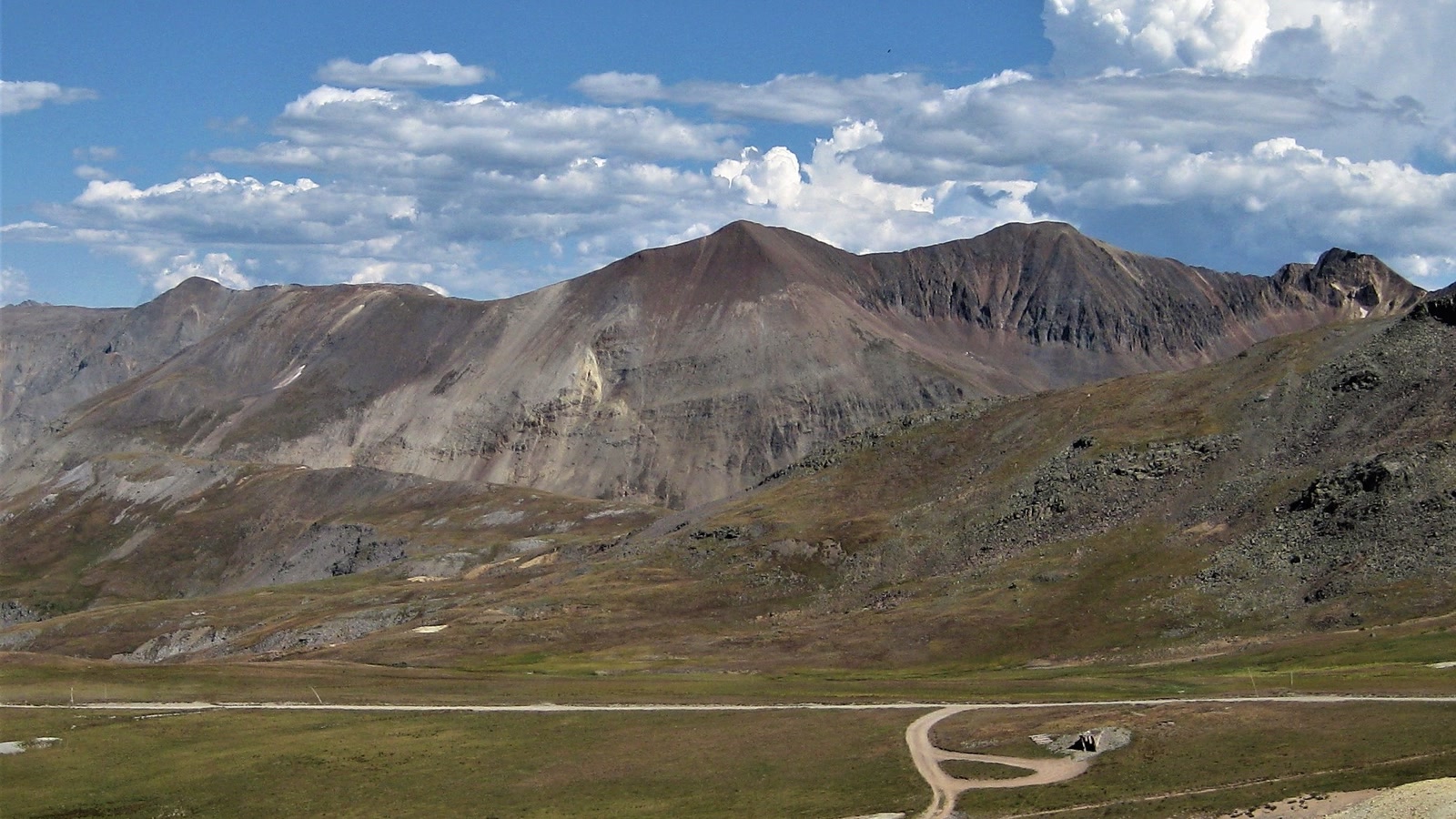 Photo: Kyle Harmon / Wikimedia Commons (CC BY 2.0)
Run as a point-to-point between Lake City and Ouray over the summit, the pass road covers roughly 20 miles, and it is the most technical and most scenic stretch of the whole Loop. Most people fold it into a full Alpine Loop day, dropping over Cinnamon Pass first and picking up Engineer near Animas Forks, but you can absolutely run Engineer on its own from either end.
Getting There
There are two main ways onto Engineer, and they set up very different days.
From the Lake City side, you head out of town on Henson Creek Road, County Road 20, which follows Henson Creek up past the old townsite of Capitol City and the Ute-Ulay mining area. This side is the gentler climb. The lower stretch is graded dirt that a careful driver in a stock high-clearance rig handles fine, and it steepens and roughens as you gain the basin below the summit. This is the classic Lake City approach, and it is the direction most guides recommend as the friendlier climb.
From the Ouray side, access is off US 550, the Million Dollar Highway, a few miles south of town. You turn up County Road 18, the Engineer Pass Road proper, and climb a narrow shelf that is already real work before you ever reach the pass junction. This side is steeper and more exposed, and it is the piece that gets first-timers’ hearts going on the way down.
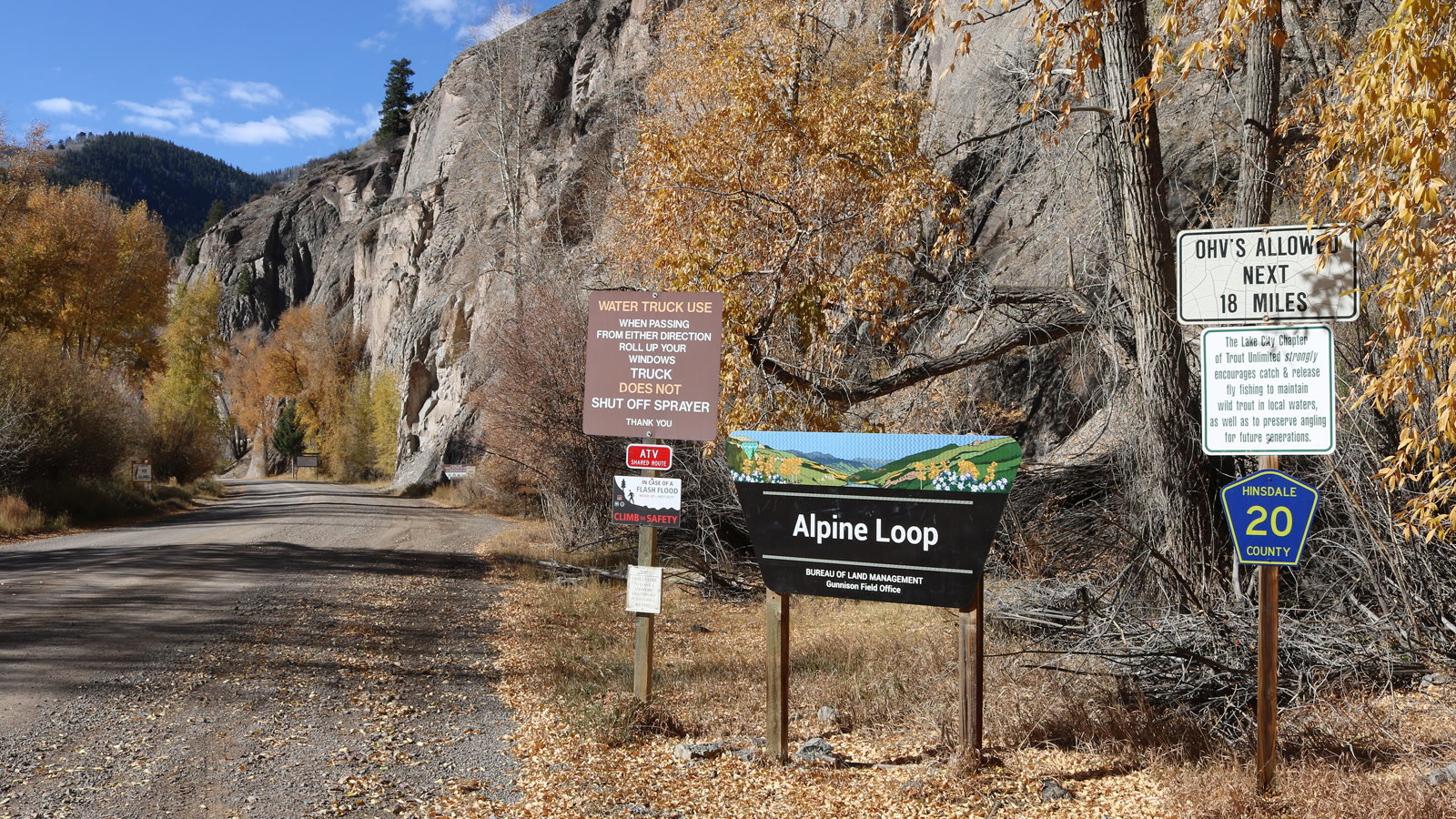 Photo: Jeffrey Beall / Wikimedia Commons (CC BY 4.0)
The BLM recommends running the Alpine Loop clockwise, and there is a good reason for it. Clockwise sends you up the Lake City and Cinnamon side first and puts you on the steep, loose Engineer switchbacks going the direction that flows best. If you are stitching the whole Loop together, follow that advice. If you are just running Engineer, climbing from Lake City and dropping toward Ouray is the sequence I prefer for a first run, because you do the exposed descent with fresh brakes and a warm engine.
The Route: Obstacles and Key Sections
Let me be straight about the difficulty, because Engineer gets rated all over the map. onX tags the main Engineer Pass track as a moderate, tech-4 trail, and a lot of drivers finish it and say it was easier than they expected. The reason we still call it difficult here is not the rock. It is the exposure, the altitude, and the consequences. There is a real difference between a trail that is technically hard and a trail that is unforgiving of a mistake, and Engineer is squarely the second kind.
The heart of the route is the upper west side, the switchbacks between Animas Forks and the summit. The surface here is rocky and loose in stretches, the road pinches to a single lane, and there is nothing but air on the downhill side. There are no guardrails anywhere up here. When you meet oncoming traffic on a one-lane shelf, and you will, somebody has to back up to a wide spot. The mountain convention is that the vehicle heading downhill yields and reverses, because backing downhill is safer than backing up. Know how to reverse your rig on a narrow shelf before you come here. That single skill matters more than lockers or tire size on this trail.
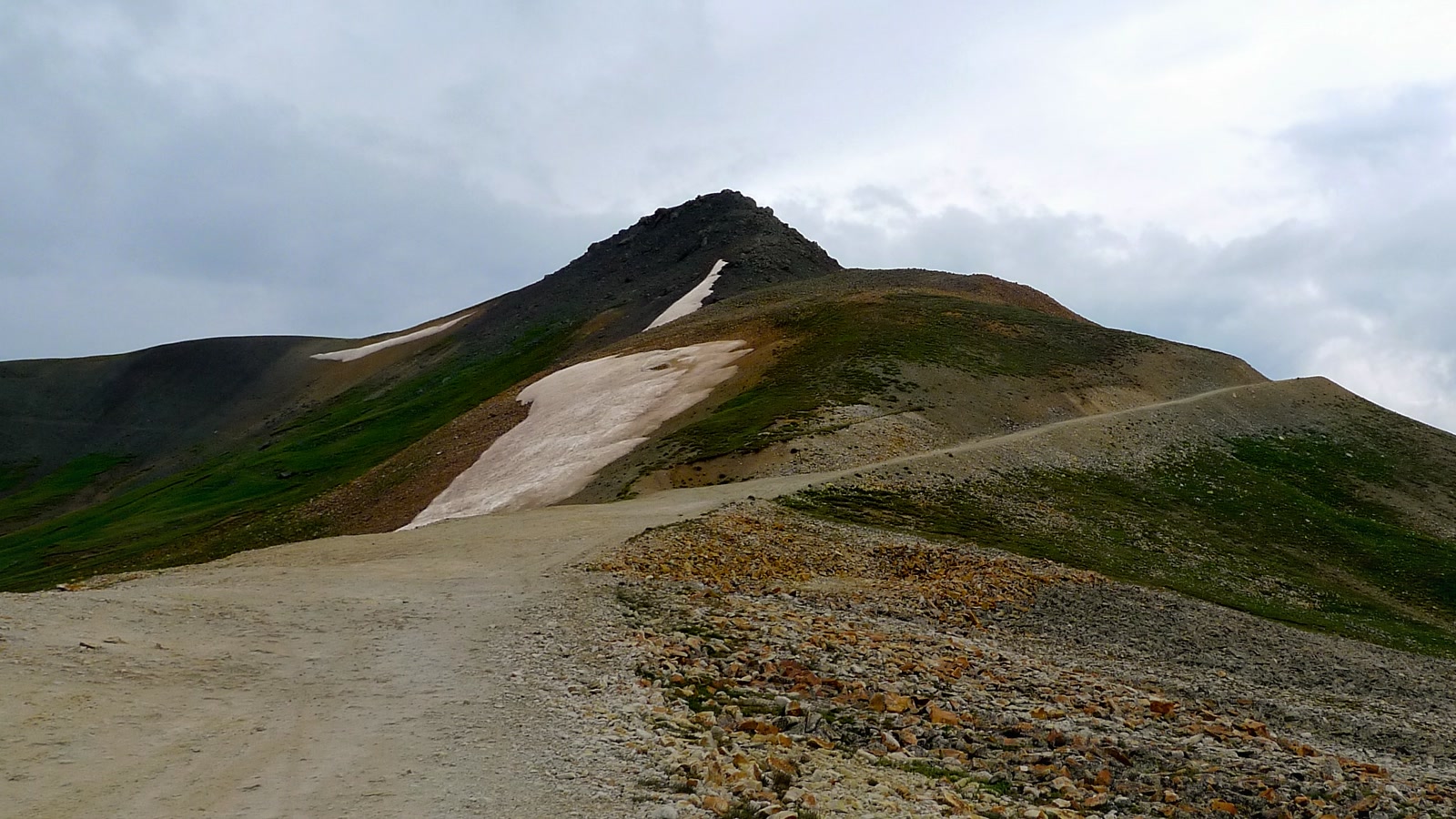 Photo: robert thigpen / Wikimedia Commons (CC BY-SA 2.0)
Near the top you pass Oh Point, sometimes spelled Odem Point, a shoulder just below the summit with a panorama that goes on forever. On a clear day you can see across a sea of San Juan peaks, and folks swear you can pick out Utah far to the west. The summit itself opens into a broad rocky saddle with room to park, catch your breath, and read the old Engineer Pass sign that marks the 12,800-foot mark. At this altitude the weather can turn in minutes, so take the view but keep an eye on the sky.
The Lake City side down Henson Creek is the mellower half. It still throws rocky, rutted sections at you and a few tight spots, but the exposure eases as you drop toward the creek. It is a beautiful, less white-knuckle way to end the day.
Waypoints and Landmarks
The best thing about Engineer is that you do not just read about the mining history, you drive right through it.
The centerpiece is Animas Forks, the restored ghost town that sits at almost 11,200 feet where the Engineer and Cinnamon roads meet. In its heyday around 1900 this was a real town with homes, a store, and a mill, all built to serve the mines strung through these basins. Today several structures still stand, including the well-known Duncan house with its bay window, and the BLM has stabilized many of them so you can walk the site. Treat it like the museum it is. Do not camp or build a fire within 800 feet of the Animas Forks historic site, and do not remove anything you find.
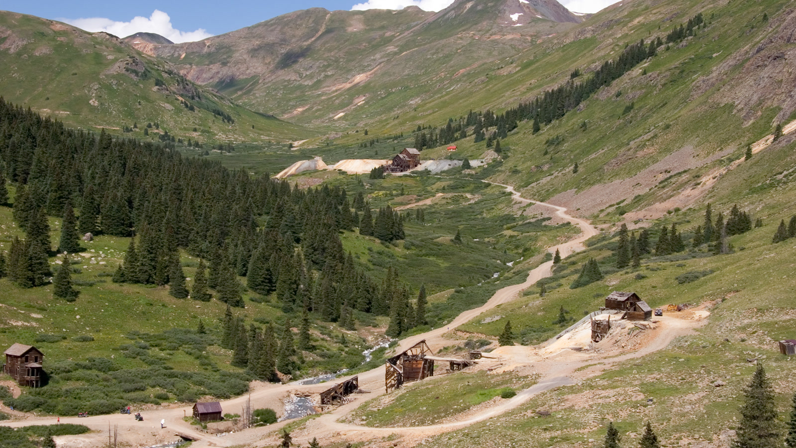 Photo: Kimon Berlin / Wikimedia Commons (CC BY-SA 2.0)
Below the summit on the Lake City side, watch for the Whitmore Falls overlook off Henson Creek Road, where a short, steep footpath drops down to a genuinely pretty waterfall. It is a good leg-stretch and a great spot for lunch. Higher up, the old cabins and mine remnants scattered through the basins tell the story of just how many people once worked this brutal, gorgeous country.
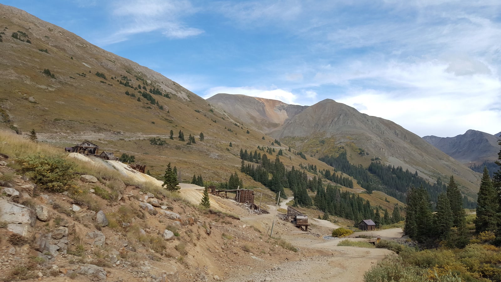 Photo: D&RG Railfan / Wikimedia Commons (CC BY 3.0)
One rule that trips people up: much of the land along the Loop looks abandoned but is not public. Old cabins and mine sites are often on private mining claims. Look, photograph, and keep moving. The fact that this history is still standing for us to drive past is a privilege.
The Rig You Need
Here is the honest minimum. The managing agencies and every local outfitter say the same thing: you want a high-clearance, four-wheel-drive vehicle with low range. A stock 4Runner, Tacoma, Wrangler, Bronco, or a capable full-size with decent tires will run Engineer comfortably in good conditions. Low range is your friend on the descents, where engine braking saves your brakes from cooking on the long grade.
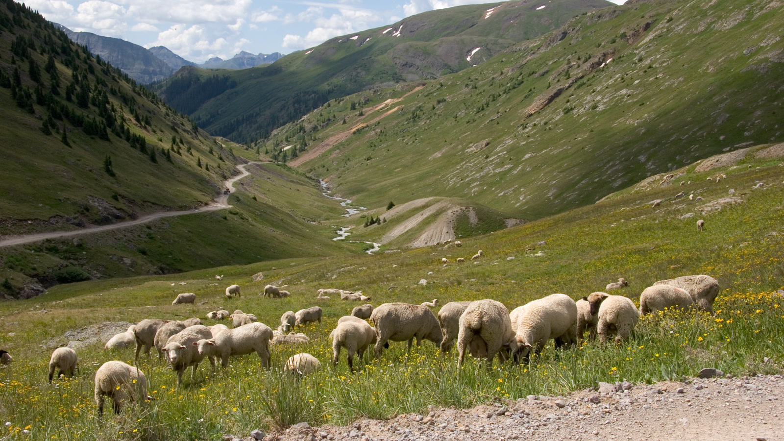 Photo: KimonBerlin / Wikimedia Commons (CC BY-SA 2.0)
What does not belong up here is an all-wheel-drive crossover on street tires with no low range and no real clearance. People try it every summer, and the loose rock and shelf switchbacks eventually find the weak link. You want good tires, real clearance, working brakes, and recovery gear you actually know how to use. Air down a little for the rough sections. Carry more water and warm layers than you think you need, because a bluebird morning can turn into sleet at 12,800 feet in the time it takes to eat a sandwich. There is no cell service across most of the route, so download your maps ahead of time and bring a real spare. This is genuine high country, not a city park.
Permits, Rules, and Pack-Out Requirements
There is no entry fee and no permit to drive Engineer Pass in a street-licensed truck or Jeep. If you are running an off-highway vehicle, though, the rules are stricter. Every OHV, which includes most ATVs and side-by-sides, must display a current Colorado Parks and Wildlife OHV registration or use permit. Colorado does not honor OHV permits from other states, so if you are trailering your machine in from elsewhere you need to buy a Colorado permit before you ride. Watch for posted county rules too, since Hinsdale, Ouray, and San Juan counties each layer their own regulations on top of the BLM route.
The stewardship rules up here are not suggestions. Stay on the designated route, because the alpine vegetation is so fragile that a single set of tire tracks can take decades to heal, and blazing a new line can bring a real fine. Around the historic sites, do not camp, smoke, or build a fire within 150 feet of any structure, keep pets leashed, do not enter the buildings, and do not remove artifacts. Pack out everything you bring in. Report vandalism or looting to BLM law enforcement.
Best Season and Weather
Engineer is a summer trail, full stop. The crews clear the pass of snow through late spring, and the road typically opens by early July, though the exact date moves every year with the snowpack. Some years it is passable in late June, other years not until well into July. It usually stays open into late September, then closes for the season once winter snow returns, and heavy years can shut it early.
The sweet spot is mid-July through mid-September. July and August bring the wildflowers that make the San Juans famous, with American Basin over on the Cinnamon side putting on one of the best displays in Colorado. September trades flowers for golden aspens down low and crisp, clear air up high, but you start gambling against early snow. Whatever month you pick, check current conditions with the BLM Gunnison Field Office or a Lake City outfitter before you commit. Weather at 12,800 feet is its own animal. Afternoon thunderstorms build fast in summer, and being the highest thing on an exposed ridge in a lightning storm is a bad place to be. Start early and be off the top by early afternoon.
Stewardship
Engineer Pass stays open because generations of drivers have treated it right. The alpine tundra you cross is one of the slowest-healing landscapes in the country, the historic sites are irreplaceable, and the agencies that keep this road open watch closely for abuse. Follow Tread Lightly ethics. Stay on the established route, do not cut switchbacks or carve new lines into the meadow, yield to uphill traffic, and slow way down around hikers, cyclists, and the folks poking around the ghost towns.
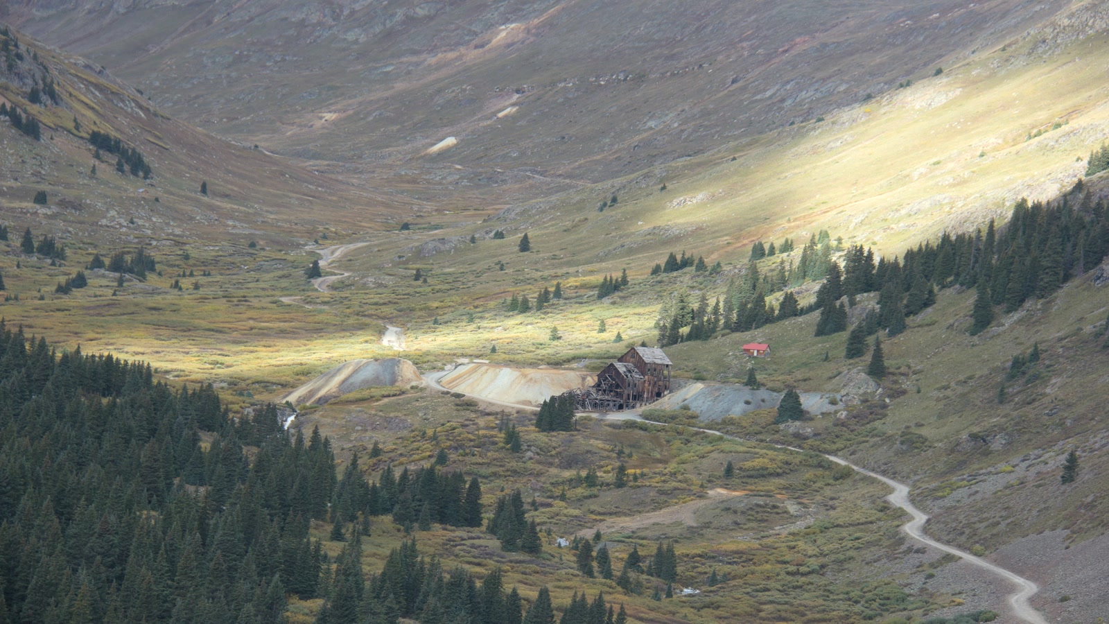 Photo: Bureau of Land Management / Wikimedia Commons (Public domain)
Give a wave, pack out your trash, and leave the cabins and artifacts exactly where you found them. This country has been open to the public for well over a century because people respected it. Do your part and Engineer will still be handing out unforgettable days to the next crew rolling out of Lake City with the whole San Juan high country ahead of them.
Hero photo: robert thigpen / Wikimedia Commons (CC BY-SA 2.0)