

🚨 Update 10/16/2026 — Black Bear Pass and the Bridal Veil switchbacks are indefinitely closed to vehicles and pedestrians due to rockfall and road damage, per the San Miguel County Sheriff’s Office. Do not attempt the descent until the closure is lifted.
There is a sign that used to stand at the top of this road, off US 550, and it told you everything you needed to know. It read “TELLURIDE - CITY OF GOLD - 12 MILES - 2 HOURS. YOU DON’T HAVE TO BE CRAZY TO DRIVE THIS ROAD BUT IT HELPS. JEEPS ONLY.” People kept stealing it, the local authorities got tired of replacing it, and now it is gone. But the road it warned you about is still very much there, and it is still one of the most talked about pieces of dirt in Colorado.
Black Bear Pass, officially Forest Service Road 648, drops off Red Mountain Pass on the highway between Ouray and Silverton, climbs over a 12,840 foot saddle, and then pours itself down a wall of switchbacks into the box canyon at the head of Telluride. Most of it is a moderate high country road. One stretch of it is not, and that stretch is why people fly in to drive this thing and why it shows up on every “most dangerous road” list on the internet. Here is the honest version of what you are getting into.
What Black Bear Pass actually is
Start with the geography, because it explains the whole personality of the road. The trail begins on the east side at Red Mountain Pass, elevation 11,018 feet, where it leaves US Highway 550 as Forest Road 823. It climbs quickly through Ingram Basin to the actual summit of Black Bear Pass at 12,840 feet, a wide spot with parking and a big view down into the basin. So far this is a normal, if high and rocky, San Juan mining road. A lot of capable drivers run up to the pass from the highway, take in the view, and turn around right there, and that out and back is genuinely moderate.
The famous part is what happens after the summit. The road tips over the edge and descends toward Telluride, and somewhere around the 5.6 mile mark it hits the Steps, a series of steep rock ledges, and then the tight switchbacks above Bridal Veil Falls. That is the section that earns the difficult rating, and it is the section that is one way only. You go down. You do not come back up. We will get to why that matters so much.
The full route from the highway down into Telluride runs roughly nine miles depending on how you measure it, and there is real disagreement on that number. The old sign said 12. onX Offroad lists it just under ten. The Forest Service describes the road to the Bridal Veil powerplant at about 6.6 miles, with the rest being the run out to town. Whatever number you trust, the point stands: this is a short road that eats a big chunk of your day. Plan on two to three hours, more if there is traffic stacked up on the switchbacks.
The one-way rule, and why it is not optional
This is the single most important thing to understand before you commit, so I am putting it near the top. The steep section from the Steps down to the Bridal Veil powerplant, roughly the last mile of hard road, is one way only, downhill, toward Telluride. There is no reversing your decision once you are into it. The switchbacks are too tight and too exposed to turn a full size vehicle around, and there is no room to pass an oncoming rig.
The practical consequence is that you must commit to the descent before you start down the Steps. If the difficult section is beyond your comfort or your vehicle, the time to bail is up top, before you drop in, by turning around and going back out to the highway the way you came. Unlicensed or oversized vehicles in particular should turn around before the one way switchbacks, or stage a pickup vehicle waiting at the bottom in Telluride. The lone exception to the downhill rule is the annual Jeepers Jamboree, when the direction of travel is reversed for a single day by special arrangement. Every other day of the year, down means down.
This rule exists because people have died here, and because rigs regularly get stuck wheels off the edge on those switchbacks and have to be winched or towed out, which closes the road for everyone. Respect it.
The Steps and the switchbacks: the heart of the road
After the summit the road descends through Ingram Basin, past the site of the old Black Bear Mine, and along Ingram Lake. This part is rocky and high but manageable. Then comes the business.
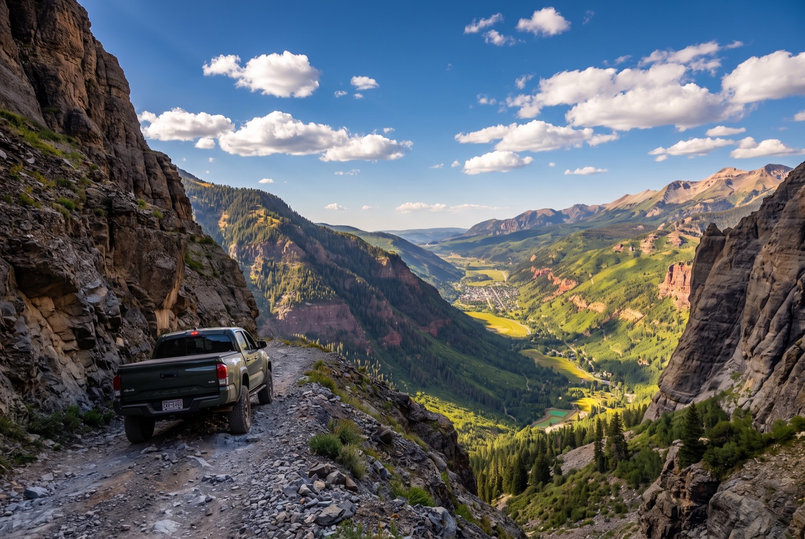
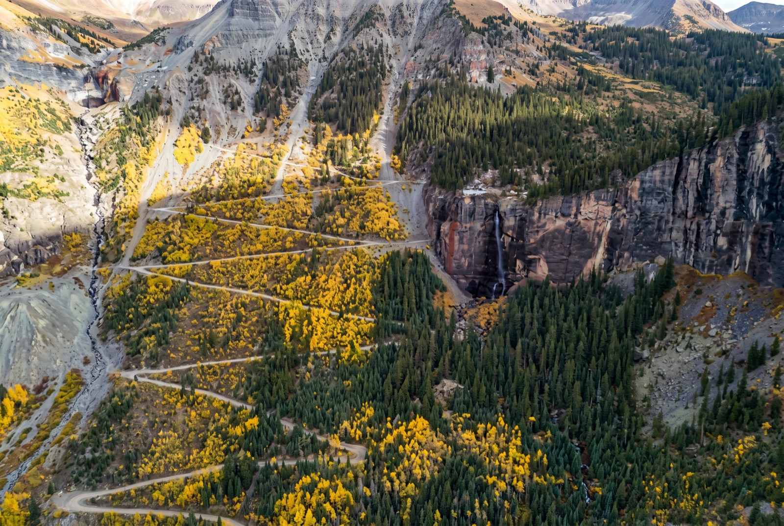
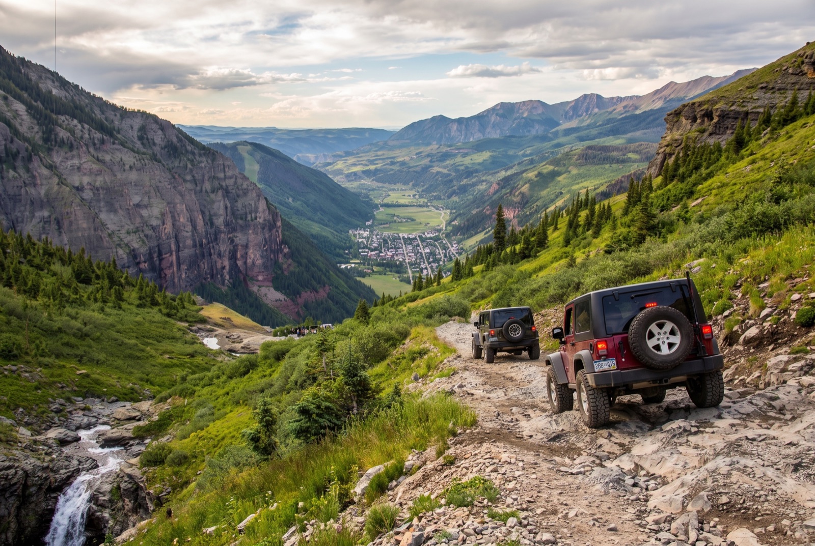
The Steps are exactly what they sound like, a series of steep, off camber rock ledges that drop you off the upper basin. Pick your line, go slow, and let your lockers and low range do the work. Spotters earn their keep here. Below the Steps the road threads past Ingram Falls and begins the section everybody comes for: a set of brutally tight, narrow switchbacks carved into the cliff directly above Bridal Veil Falls. These are not gentle hairpins. Several of them are so tight that a longer wheelbase vehicle has to do a three point shuffle to make the turn, easing the nose out over open air with the back tires near the inside wall. The exposure is total. There is no guardrail, the drop is hundreds of feet, and the views straight down into the Telluride valley are the kind of thing that makes passengers go quiet.
This is why the Forest Service strongly recommends a high clearance, short wheelbase four wheel drive for this section. A short rig turns the switchbacks far more easily than a long one. Full size trucks and long wheelbase SUVs can and do make it, but they do it slowly and carefully, and an inexperienced driver in a big rig is exactly the recipe for the wheels off the edge situations the sheriff has to respond to. If your vehicle is long, know that going in and drive accordingly.
Bridal Veil Falls and the powerhouse
The reward for all that white knuckle driving is one of the great scenes in Colorado. Bridal Veil Falls is the tallest free falling waterfall in the state, a 365 foot plunge off the cliff at the head of the box canyon, and the road takes you right past it. Perched on the rock at the lip of the falls is the Bridal Veil Falls powerhouse, a historic hydroelectric plant that is one of the most photographed buildings in the San Juans.
That little building matters more than it looks. It is the Smuggler Union hydroelectric powerplant, which came online in 1907 to feed power to the Smuggler Union mine below. It sits in the heart of mining country that was a proving ground for alternating current, just a few miles up the valley from Lucien Nunn’s pioneering Ames AC plant of 1891, the first to transmit industrial AC power over distance in the region. The structure you see today is a restored private residence and working micro hydro plant that still feeds the Telluride grid, so admire it from the road and do not trespass. Between the falls, the powerhouse, and Ingram Falls just upstream, this is the most scenic mile of the entire descent, which is a cruel joke given that it is also the most technical.
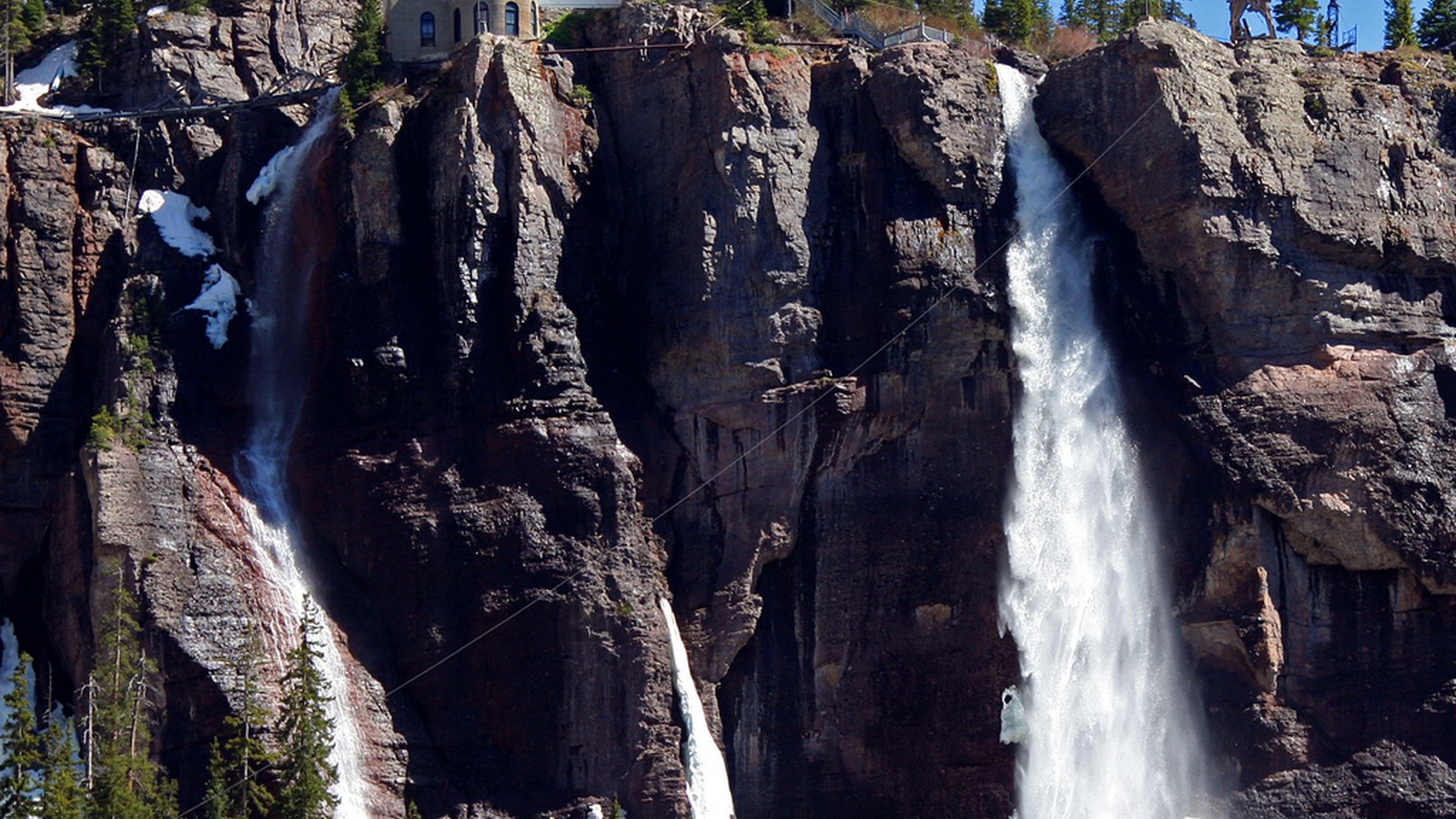 Photo: Terry Foote / Wikimedia Commons (CC BY-SA 3.0)
The run into Telluride
Below the powerplant the road relaxes. It becomes a maintained gravel road that follows the creek down the floor of the box canyon and into Telluride proper, popping you out at the east end of town near the old mining structures. After the switchbacks this final stretch feels like a victory lap, and it is a beautiful one, with waterfalls on the canyon walls and the town spread out ahead.
Telluride itself is the payoff at the bottom: fuel, food, cold drinks, and a place to air back up and let your hands stop shaking. If you staged a second vehicle here, this is where you reunite. If you came down as a group, this is where you compare notes on which switchback got everybody’s attention.
The rig you actually need
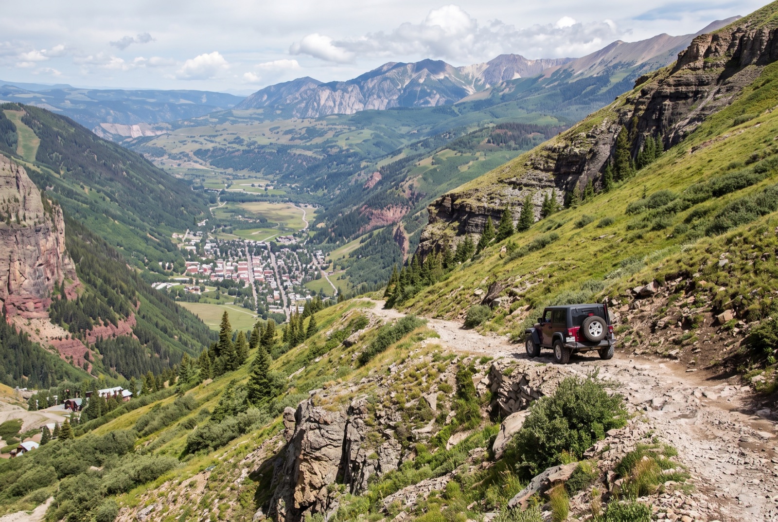
Let me be blunt, because this road punishes the underprepared and the overconfident in equal measure. The Forest Service recommendation is plain: a high clearance, short wheelbase, four wheel drive vehicle for the difficult section. That is the real minimum. A stock 4Runner, a two door Wrangler, a Bronco, or a built side by side are all in their element here. What does not belong on this road is an all wheel drive crossover, a long wheelbase pickup driven by someone without shelf road experience, or anything without real low range gearing.
You do not need a heavily built rock buggy. The Steps are the only place that asks for serious articulation, and a locker front or rear plus good tires handles them. What you need far more than flex is the right vehicle dimensions, low range for engine braking on the descent, good brakes, and the head for exposure. The whole challenge of Black Bear is mental and precision driving, not horsepower or huge obstacles.
Bring the basics anyway. Air down for the rocky upper sections, carry a real spare and a plug kit because sharp rock punctures tires up high, and bring recovery gear and a buddy. Do not run this road solo. Cell coverage is spotty to nonexistent across most of it, and if you do get hung up on a switchback, your group is your only fast way out. A winch is not strictly required, but a recovery strap, boards, and a second capable vehicle are smart insurance.
Permits, rules, and staging
The good news on paperwork: there is no permit and no fee just to drive Black Bear Pass in a street legal vehicle. It is a public Forest Service road. If you are running an OHV or side by side, you need a current Colorado OHV registration, and note that Colorado does not honor out of state OHV permits, so buy one before you ride. Street legal full size rigs do not need it.
Stage and fuel up before you start. Coming from Ouray, drive south on US 550 about 13 miles to Red Mountain Pass and look for the Black Bear Pass road, Forest Road 823, turning west just south of the summit. There is no fuel, no water, and no services anywhere on the road, so top off in Ouray, Silverton, or Telluride first. Download or print your maps, because you will lose signal. And give the road your full morning. Starting early is not just about beating crowds, it is a safety call, which brings us to weather.
Best season and the weather window
Black Bear is open only a few months a year. Snow buries the high switchbacks deep into summer, so the road typically does not open until late July, and it closes again with the first serious fall storms, usually by early to mid October. That late July to early October window is narrow, and it shifts year to year with the snowpack, so always check current conditions with the Forest Service or a local source before you drive out. Do not be the person who drives all the way to Red Mountain Pass to find the gate still closed by snow.
Even inside the season, time of day matters enormously. The San Juans cook up afternoon thunderstorms nearly every summer day, and you do not want to be on those exposed switchbacks in lightning, hail, or on rock that just went greasy with rain. Wet rock on a one way descent above a 365 foot waterfall is a genuinely dangerous combination. Start early, aim to be through the difficult section and down into Telluride by early afternoon, and watch the sky. If storms are building, that is your cue to move or to wait it out somewhere safe rather than commit to the switchbacks.
Drive it like the road deserves
Black Bear Pass has a reputation, and unlike a lot of trails that get hyped, this one earns it. The danger is real, the one way rule is real, and the cliff does not care how good your rig is. But none of that should scare off a prepared driver in the right vehicle. Thousands of people run this road safely every summer, take the best photographs of their lives at the powerhouse, and roll into Telluride grinning.
The way you stay in that group is simple. Drive the right rig, ideally short and high clearance. Commit your bailout decision up top, before the one way section. Go slow, use a spotter on the Steps and the tight turns, respect the exposure, and never run it alone or in bad weather. Do that, and Black Bear gives you a descent you will be telling stories about for years. Treat it carelessly and it will write a different kind of story. Pick the first one, take your time, and enjoy the City of Gold from the best seat in the house.

Hero photo: Jackbauerinvc / Wikimedia Commons (CC BY-SA 3.0)