Every off-roader in Colorado has heard about the descent. That is the part of Red Cone that gets talked about at trailheads and typed into forum threads: the steep, one-way plunge off the top of a bald red mountain, so committing that once you tip over the edge there is no turning around and no coming back up. It has earned its reputation honestly. But Red Cone is more than its famous finish. It is a full day of Front Range high country, a rocky forested grind up to timberline, a mile-long ridge run on cinder soil the color of rust with the ground dropping away on both sides, and one of the best summit views in central Colorado. Here is the honest breakdown of what you are signing up for.
What Red Cone actually is
Red Cone, officially Forest Service Road 565, sits on the Continental Divide in the Front Range southwest of the little town of Grant, off US Highway 285. It runs from the Hall Valley area up and over the shoulder of Red Cone Peak at just under 12,800 feet, then drops down the far side to Webster Pass. It is managed by the Pike and San Isabel National Forests out of the South Platte Ranger District, and it is rated Difficult.
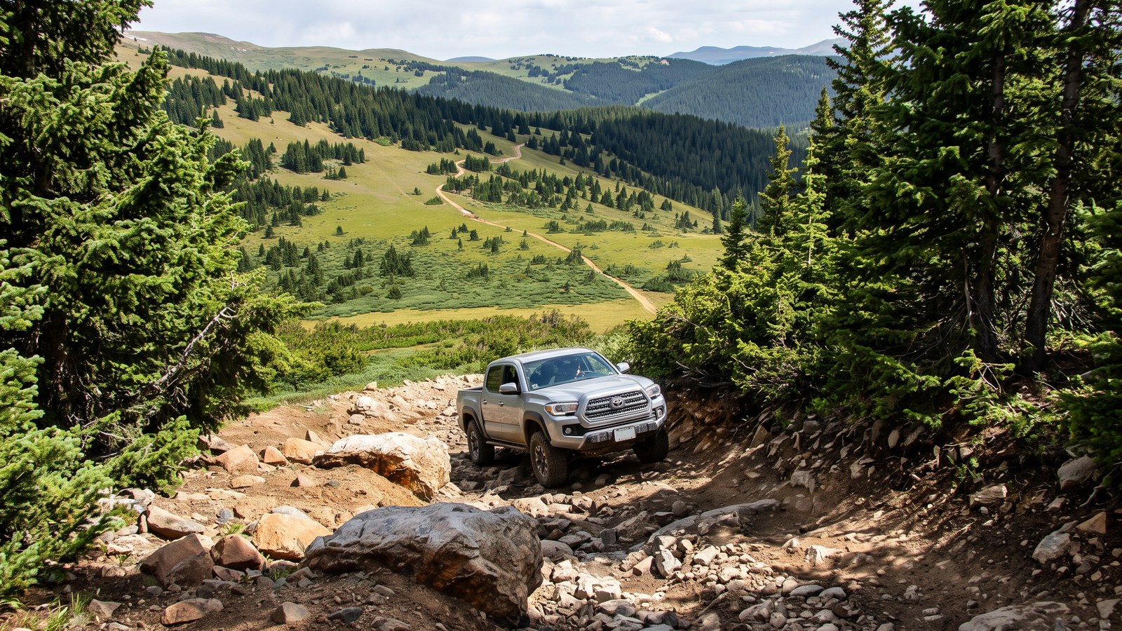
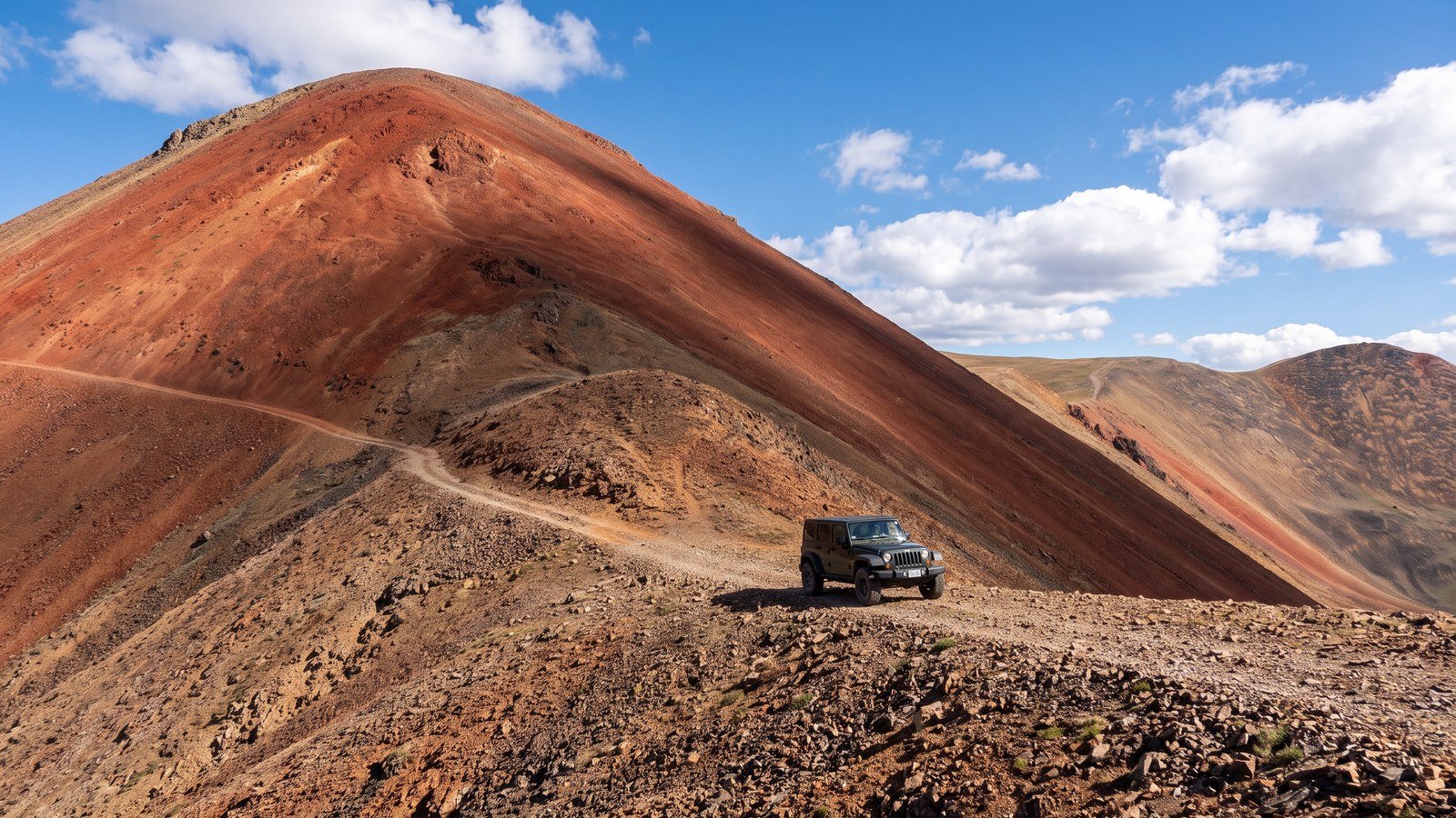
The character of the trail changes completely from bottom to top. The lower section climbs through the trees on a rough, rocky, sometimes muddy road, working its way up out of the forest with intermittent boulder fields and a few steep, eroded turns that will make you pick your line. Once you break above timberline the whole world opens up. The road narrows to a two-track running along a bald ridgeline, and the soil turns a distinctive reddish, cinder-like color that gives the mountain its name. From there you climb to the summit of Red Cone Peak, a wide bald top with room to park, a trail sign, and a 360 degree panorama across the divide. And then comes the descent.
The full run from US 285 down to Webster Pass is roughly 6.2 miles and takes about two hours of driving, though most people make a much longer day of it by connecting to the surrounding trail system. It is short in miles and big in commitment.
The one-way rule, and why it is not optional
This is the single most important thing to understand before you commit, so I am putting it near the top. The steep descent off the summit of Red Cone toward Webster Pass is one way only, downhill. You go up the mountain from the Hall Valley and US 285 side, over the top, and down the far side. You do not drive up the steep descent, and you cannot turn around partway down it.
The summit is your decision point. onX puts it plainly: the top of Red Cone Peak is your last chance to turn around before the trail becomes one-way. If you get to the summit and you do not like the look of what falls away in front of you, that is the moment to reverse course and go back down the way you came up. Once you drop off the top, you are committed. The descent is steep enough and narrow enough that turning a full-size vehicle around is not realistic, and there is no room to pass an oncoming rig.
There is one more piece of local knowledge that has stranded people up there. Do not start down if the snow at Webster Pass has not melted out, because the bottom of the descent meets the Webster Pass road, and if that junction is still blocked by a snowbank you will be boxed in at the bottom with nowhere to go but a long, sketchy reverse. FunTreks warns specifically: do not descend if both sides of Webster Pass are blocked by snow. In early season, call the South Platte Ranger District at 303-275-5610 and ask about conditions before you plan the loop.
This rule is not there to make the trail sound scarier than it is. It is there because the geometry of the mountain genuinely does not let you undo the decision. Respect it and plan for it.
The climb: rocks, mud, and the Gatekeeper
The trail starts easy enough at the Hall Valley staging area and then gets down to business. The first portion is the physically hardest four-wheeling of the day: a rocky climb through the forest with sections of large, loose rock, some of it in the six to twenty-four inch range, plus a few steep, angled turns that have eroded badly over the years. This is the part where drivers who have run it for years say the road keeps getting rougher every season. Take it slow, air down, and let your tires and low range do the work.
The one named obstacle everybody talks about is the Gatekeeper, a rocky pinch point on the climb that has gotten harder as the trail has deteriorated. It is not the crux of the whole trail, but it is the spot most likely to hang up a stock rig or a longer wheelbase vehicle. There is also an articulation section higher up that flexes your suspension and rewards a little wheel travel. None of the climb is extreme rock crawling, but all of it is genuinely rocky, and after a wet spell it gets muddy on top of that. Reviewers routinely describe the ascent as the tiring part and the descent as the scary part.
The red ridgeline above treeline
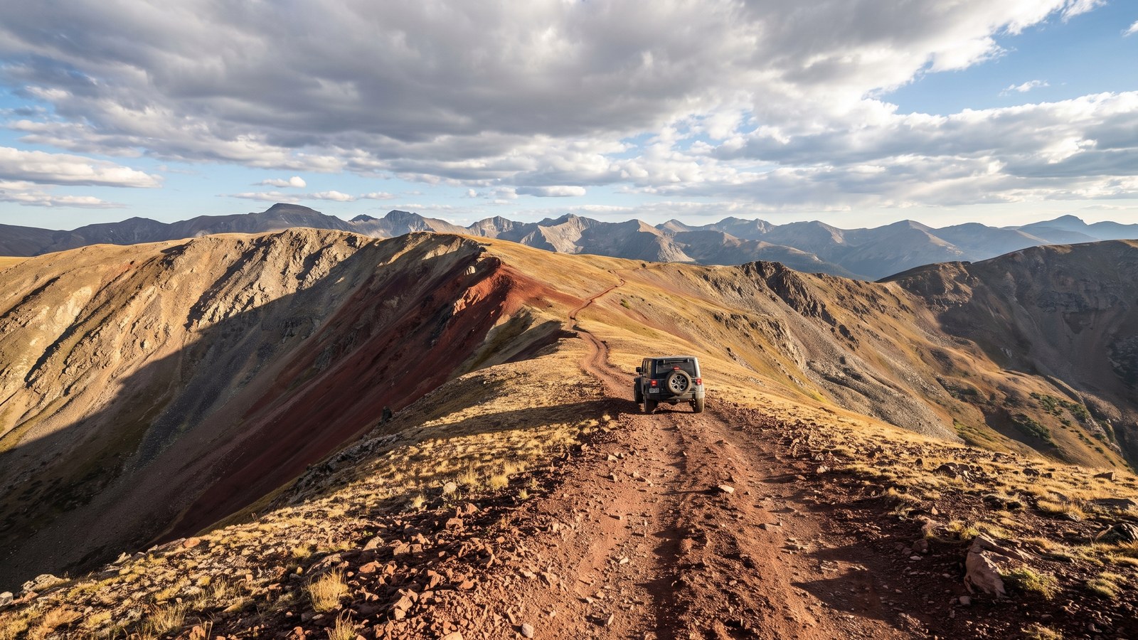
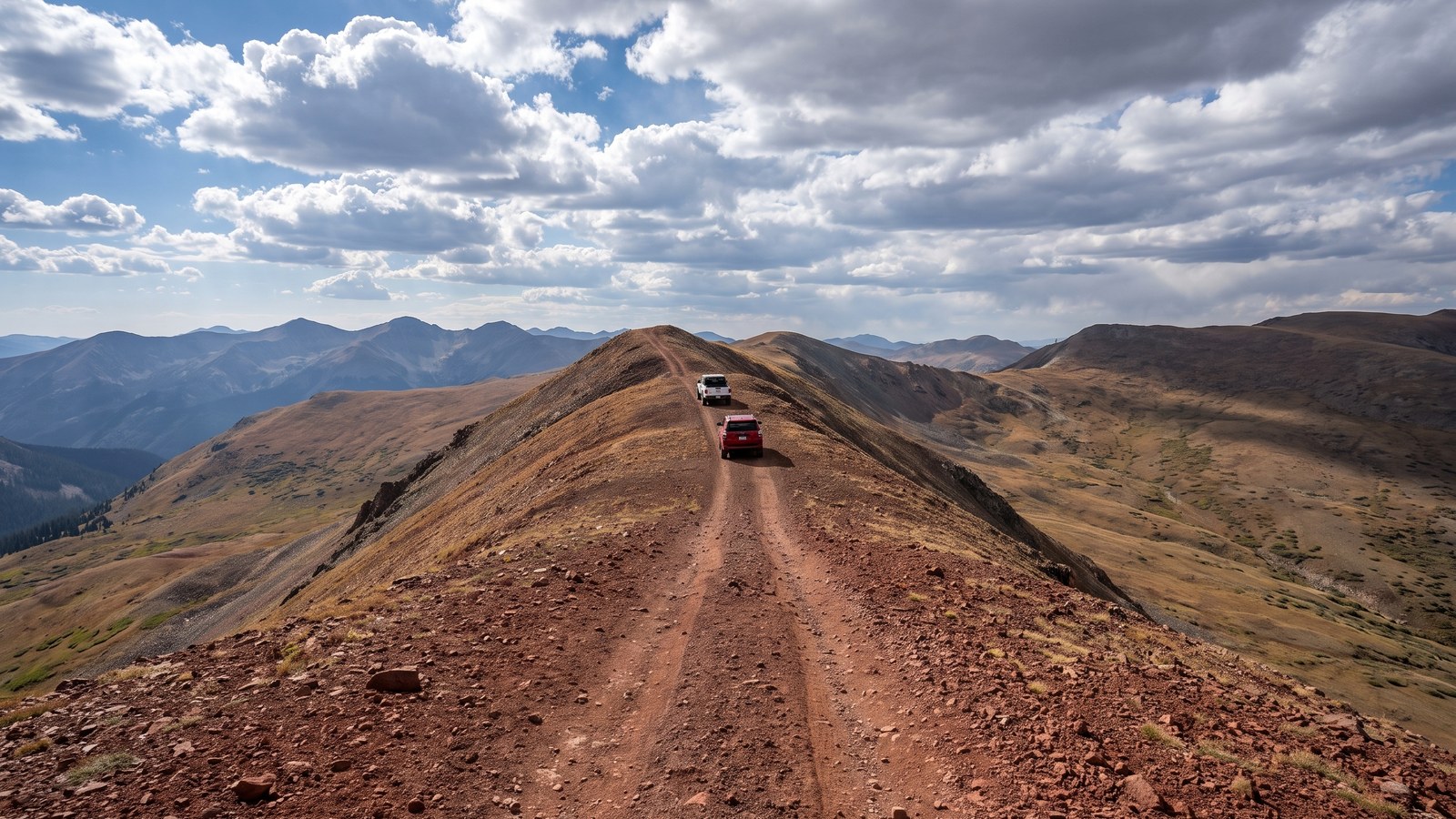
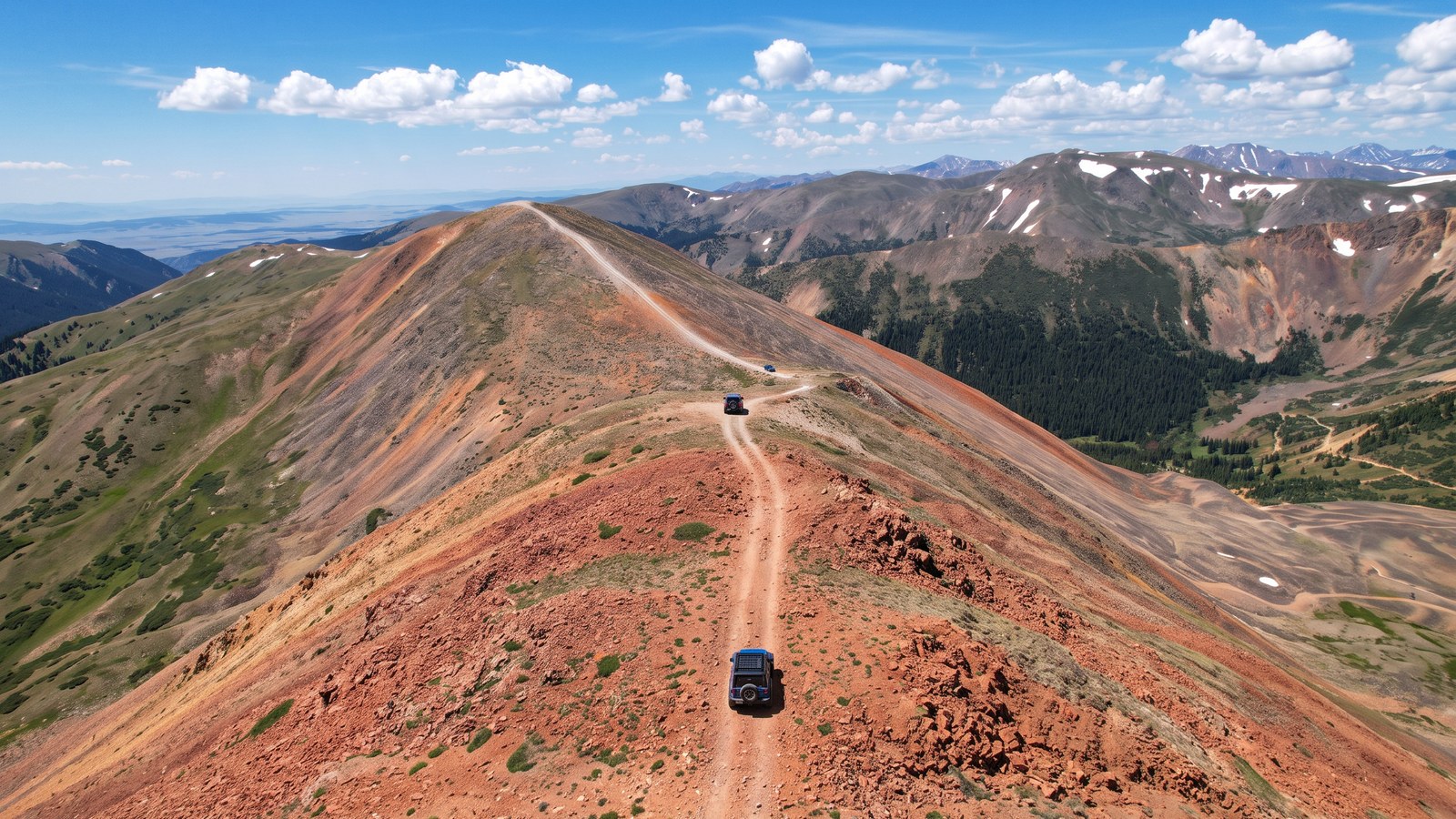
When you break out above the trees, the trail becomes something special. The road runs along a narrow ridge of reddish cinder and rock, the ground dropping away steeply on both sides into alpine tundra basins. On a clear day the views stretch for miles across the Continental Divide, and it is common to share the ridge with a herd of mountain goats. It is exposed, it is beautiful, and it demands your attention. A couple of the narrow spots between the last stunted trees near timberline can require a three-point shuffle to get a longer rig through.
This is the stretch that photographs like nowhere else on the trail, the rust-red road threading a knife-edge of tundra with peaks in every direction. It is also, in a real sense, the whole point of Red Cone. Plenty of capable drivers say the rocky climb alone would not be worth repeating, but the ridge and the summit are what bring them back.
The summit and the descent
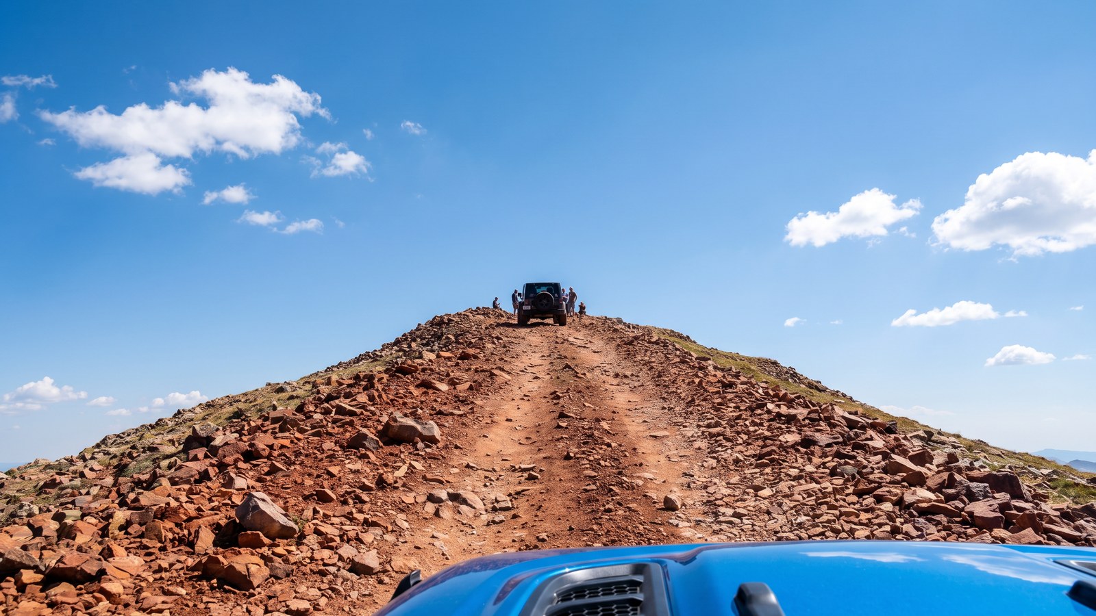
The summit of Red Cone Peak tops out at right around 12,799 to 12,801 feet depending on whose survey you trust. It is a broad, bald red top with parking for a dozen or so vehicles, a trail sign, and sometimes a flag someone has planted. This is where you stop, take in the panorama, and make your go or no-go call.
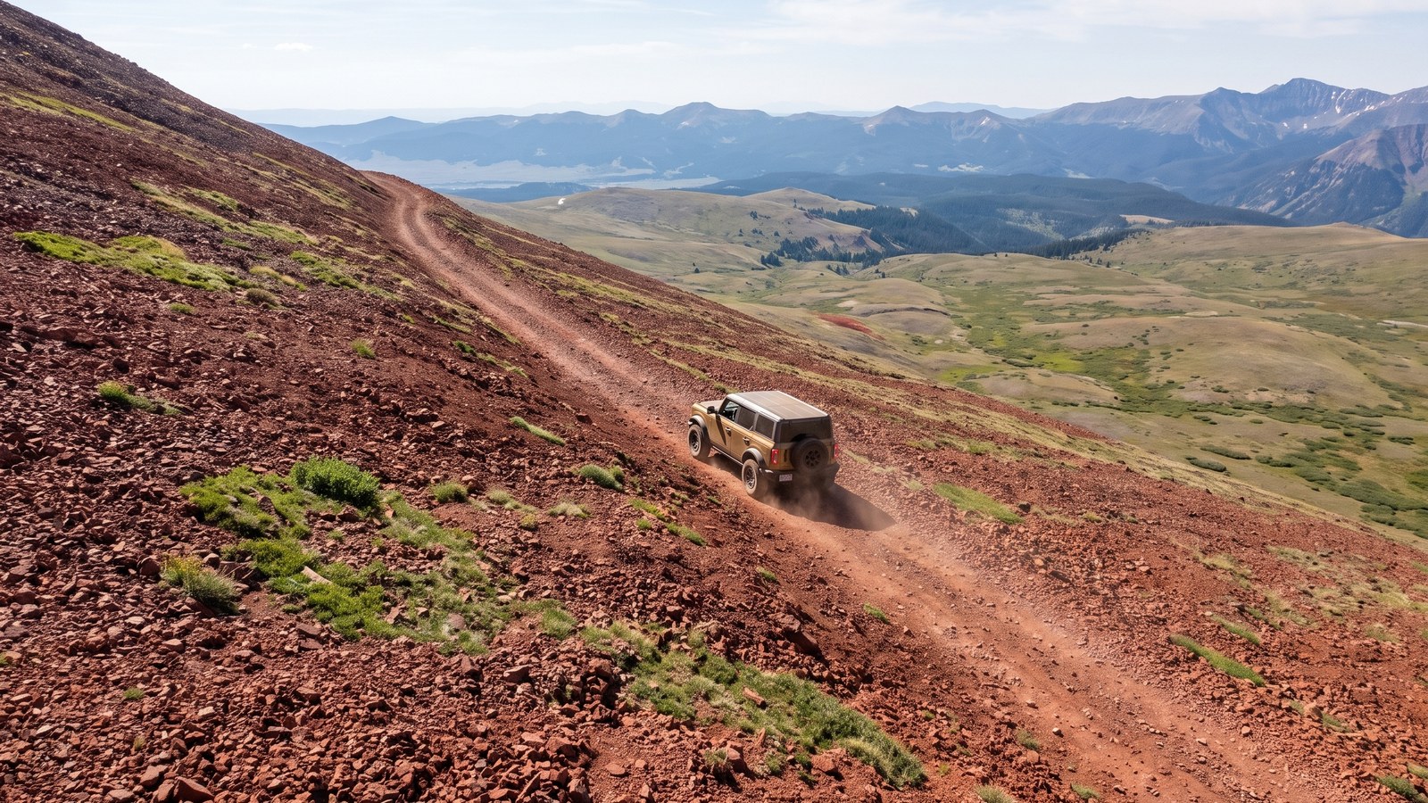
The descent is the reason people fly in to drive this thing. The road tips off the summit and drops down the far side toward Webster Pass at a genuinely steep pitch, exceeding a 25 degree grade in places, on loose red cinder and rock. The technique is simple to describe and hard to execute: use your lowest gear, let the engine hold you back, and brake as little as possible. Do not lock up your brakes. If you feel the back end starting to slide sideways, a little throttle to straighten out is better than more brake. Riders who have done it in everything from a Land Cruiser to a dirt bike consistently say the descent is more intimidating than the entire climb. It reads far steeper from behind the wheel than it looks in any photo. Take your time, keep your line, and let the rig walk itself down.
The rig you actually need
Red Cone is a real Difficult trail and it rewards the right vehicle. Here is the honest minimum.
You want a high-clearance four-wheel-drive with low range, not a soft crossover. The Forest Service describes these routes as very steep, narrow, technical, high-clearance 4x4 only, and they mean it. Aggressive stock SUVs and trucks driven by experienced people do run it, but the rocky climb and the Gatekeeper will test ground clearance and approach angles. Regulars recommend at least 33 inch tires for a four-door, and 35s are increasingly the smart choice as the trail erodes. Front and rear lockers are not strictly required but they help a lot on the rockier lines and the articulation section. A shorter wheelbase turns the narrow ridge pinch points far more easily than a long one, so if your rig is big, know that going in.
Bring recovery gear and the knowledge to use it, air-down capability, and a full-size spare, because the climb is exactly the kind of sharp rock that finds a sidewall. This is high country: run a buddy rig if you can, because doing a committing one-way trail alone is asking for trouble.
Permits, rules, and staging
Red Cone requires a Colorado OHV permit. As of recent seasons, the OHV sticker requirement applies here, so make sure you have a valid Colorado OHV registration before you run it, even on a street-legal vehicle where the rule applies. Check the current Colorado Parks and Wildlife OHV registration rules before your trip, because these requirements change.
You stage at the Hall Valley and Handcart Gulch staging area, which sits about 4.5 miles northwest of the US 285 and Webster junction off Park County Road 60. It offers limited day-use parking for vehicles and trailers, and no overnight camping is allowed at the staging area itself. Just north of the staging area the road splits three ways: Hall Valley Road, Handcart Gulch Road, and Red Cone Road (FSR 565). If you want to camp, there is dispersed camping along the lower roads plus the developed Hall Valley and Handcart campgrounds nearby, managed by the Forest Service.
Stay on the established route. The single biggest threat to this trail staying open is people driving off the two-track and tearing up the alpine tundra, which is fragile and slow to recover at this elevation. Longtime users have watched side-by-sides and dirt bikes cut the corners and park on the tundra, and they will tell you flatly that this behavior is what gets high-country trails closed. Do not be that person.
Best season and weather
Red Cone is a snow-gated high-alpine trail. It is typically not open until late June to early July, once the snow melts out enough to make the summit and the descent passable, and it stays open through roughly September before winter shuts it down again. The Forest Service does not maintain the pass in winter.
Even in the open season, weather at 12,800 feet is its own hazard. Afternoon thunderstorms build fast over the divide in July and August, and you do not want to be exposed on that bald red ridge with lightning around. Start early, watch the sky, and be off the high ground by early afternoon. Early in the season, remember the Webster Pass snowbank problem: if the bottom junction is still buried, do not commit to the descent. Late-season snow squalls can also glaze the descent with ice, which turns an intimidating downhill into a genuinely dangerous one, so check recent trail reports before you go.
Connecting trails and the bigger loop
One of the best things about Red Cone is that it does not have to be a standalone run. It is a key connector in a whole web of Front Range and Summit County high-country trails. From the bottom of the descent at Webster Pass you can continue down Handcart Gulch back toward US 285 to make a loop, or drop over the other side into Montezuma and the Keystone area. Webster Pass itself connects to Radical Hill, Deer Creek, and the Middle Fork of the Swan, opening up a full day or even a multi-day chain of trails. Many people run Red Cone as the marquee leg of a larger day precisely because the climb, on its own, is not something most want to repeat, but paired with Webster Pass and the surrounding network it becomes one of the great Front Range wheeling days.
Tread lightly and keep it open
Red Cone runs across fragile alpine tundra on public land that stays open only because most people treat it right. Stay on the established two-track, never cut switchbacks or drive on the tundra, pack out everything you bring in, and yield the right of way with common sense given the one-way descent. This is genuinely dangerous terrain with real exposure, so drive within your ability and your rig’s ability, and turn around at the summit if the descent is more than you want. The mountain will be there next year. Make sure the trail is too.