Slaughterhouse Gulch is not the trail you drive for the views. Say that out loud before you go, because half the disappointment people have with this place comes from expecting a Black Bear Pass and getting a claustrophobic tunnel of lodgepole instead. This is a wheeling trail, plain and simple. You come here to flex your suspension, thread your rig between trees close enough to leave paint on the bark, and grin your way through a rutted, tippy, rock-studded loop that sits barely an hour from downtown Denver. That accessibility is the whole appeal, and it is also why this little trail near Bailey gets absolutely hammered by locals almost every weekend.
We already gave Slaughterhouse a nod as trail number two in our roundup of off-road trails near Denver for a day trip, and it earns that spot for a simple reason: it is close, it is fun, and it runs when a lot of the high-country stuff is buried in snow. This guide is the deep version. What the trail actually is, how to find the sign, the obstacles in the order you will hit them, the rig you need, the rules that are keeping it open, and the season that makes it special.
What Slaughterhouse Gulch actually is
Slaughterhouse Gulch is a roughly 11.5 mile forest loop in the Pike National Forest, above the town of Bailey on the US-285 corridor southwest of Denver. On the map it is Forest Service Roads 101 and 105, and the loop portion is signed as the “Slaughterhouse FDR 105 4WD Loop.” FunTreks rates it Difficult, and that rating is the one to trust even though you will hear people argue about it.
Here is the honest version of that argument. On a dry day, in a well-built rig, Slaughterhouse feels like a fun moderate romp with a couple of spots that make you pay attention. The Colorado Springs 4-Wheelers, the club that has adopted and maintains the trail, call it moderate in dry conditions and note that it gets meaningfully harder when it is wet. Then a heavy snow year or a wet spring shows up, the low sections turn to churned mud, the off-camber descents get greasy, and suddenly that Difficult rating makes complete sense. So the real answer is: it depends on the day. Plan for Difficult, be pleasantly surprised if it drives easy, and never assume the trail you ran dry in August is the same trail you will meet in a soggy June.
The character is consistent, though. FunTreks describes it as “narrow, tippy and rutted with washouts, small rock obstacles, tree roots and steep sections,” and that is exactly right. The single biggest hazard here is not a giant ledge. It is the trees. There is a tippy section through tight timber where roof and body damage is a genuine, documented risk, and it has claimed more than one bumper and rock slider over the years.
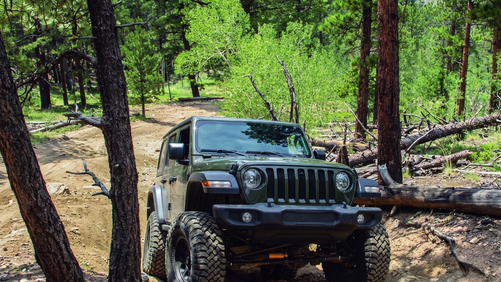 The classic Slaughterhouse move: flexing over a rock-and-root step with trees close on both sides.
The high point of the loop sits right around 9,500 feet, so this is a lower-elevation trail by Colorado standards. That matters, and we will come back to it, because it is the key to why Slaughterhouse is one of the best cold-weather runs on the Front Range.
How to get there
Getting to Slaughterhouse is refreshingly simple, which is a big part of why it is so popular. From Denver, take US-285 south and west toward Bailey. It is roughly an hour of driving, a little under, depending on where in the metro you start and how the 285 traffic is behaving.
You are looking for Deer Creek Road, also signed as Park County Road 43. Turn onto Deer Creek Road and follow it for about six miles into the forest. Then turn left onto Saddlestring Road, go about a quarter mile, and turn left onto Forest Service Road 101. Follow FSR 101 for roughly two and a half miles and watch for the steel Slaughterhouse sign that marks the trail. There are multiple large parking and staging areas near the start, which is another reason big groups love this place. You can get a whole convoy aired down without blocking anybody.
A quick orientation note that saves confusion: there is a completely different “Slaughterhouse Gulch” over on the Gunnison side of the state near Almont, the one with the Christmas Cabin and Tin Cup Basin. That is not this trail. If your navigation is sending you toward Gunnison, you have the wrong one. The trail in this guide is the Bailey loop in Pike National Forest, managed by the South Platte Ranger District.
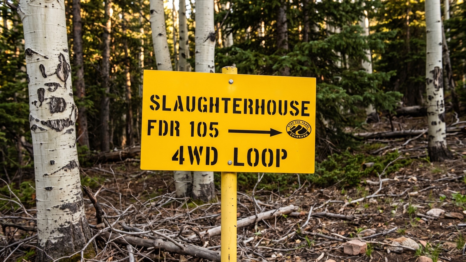 The FDR 105 loop sign. If you see this, you are on the right Slaughterhouse.
The obstacles, in order
The loop is best run west, which is the direction the club and most locals recommend, and the guide below follows that flow. Think of the trail in three acts: the approach, the loop descent, and the climb back out.
The approach. The trail starts as a gentle uphill climb. Almost immediately you meet your first decision point: a rock that will either throw you off camber to the left if you go around it, or give you a small clean climb if you take it straight over. Take it over. Do not, as the club signage begs, take the road that shoots straight up the hill to the right. Continue left. From there the road rolls past old clear-cuts and through corridors of lodgepole pine and aspen, with small rock challenges and some seasonal standing water to keep it interesting.
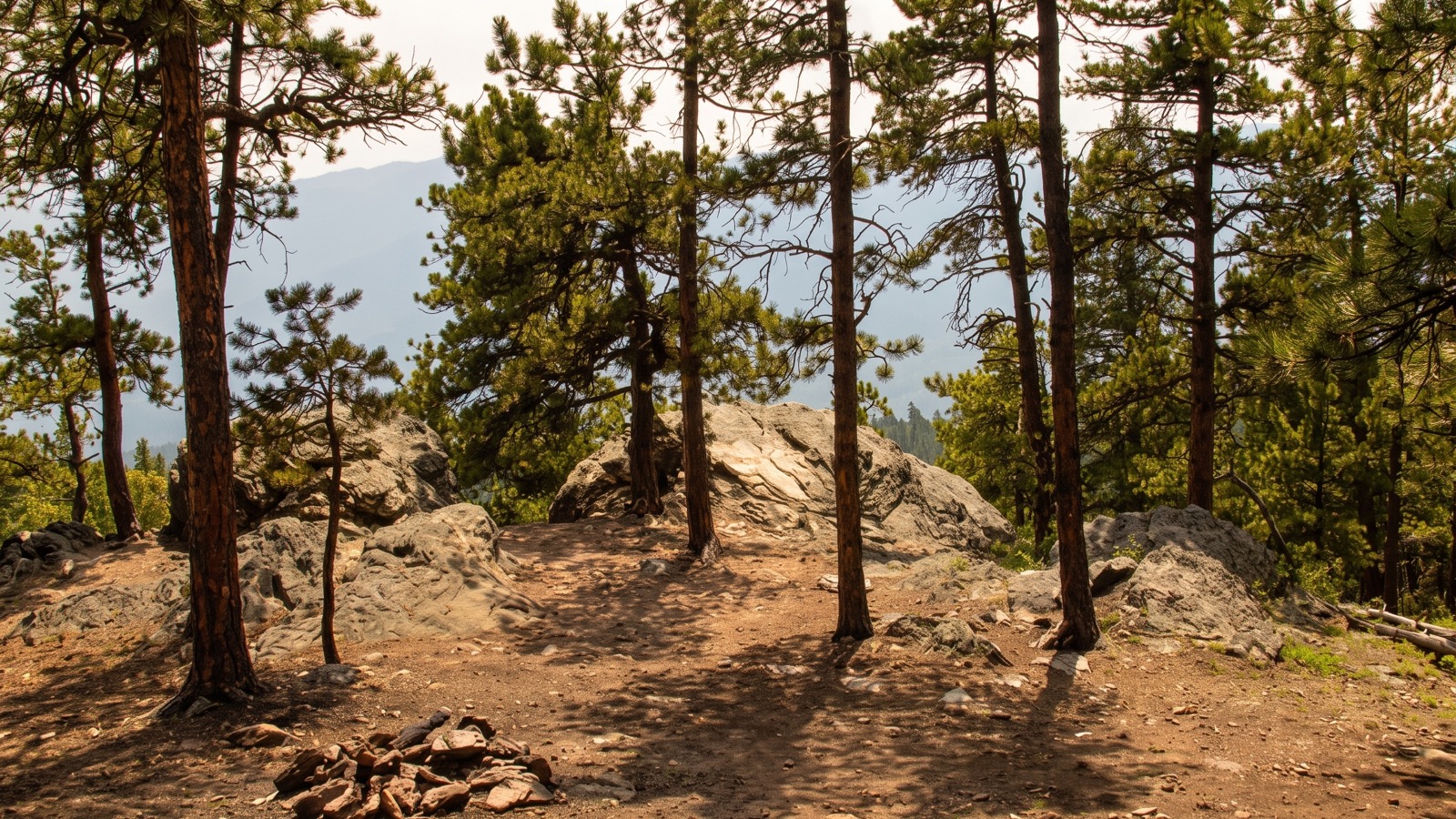 Open ponderosa and granite outcrops line the gentler approach before the loop tightens up.
Watch for Stump Hill along here. It is a bare hill that used to be a shortcut into the loop and is now closed to let it recover. There may or may not be a sign on any given day. Stay off it regardless. That single piece of self-control is part of why this trail is still open.
The loop and the descent. The loop proper is marked with a sign pointing right. Left goes toward Crow Gulch and the controversial, now-closed mud bogs. Take the right and climb to a small saddle. This is where the trail bares its teeth. The descent off the saddle is steep and slightly off camber, dropping through aspen to a small valley floor over moderate rocks and, in the wet, potentially deep mud. This is the section that has historically needed a winch on bad days, though trail maintenance has tamed some of it. The bottom opens into a clearing that is the natural lunch spot, a good place to stop, air your nerves back down, and look back up at what you just came down.
The climb out. The second half starts with an articulation section where you can flex a rig out for fun, with a smoother bypass to the right if you would rather not. Then come undulating, rocky challenges tucked in among ponderosa and aspen. The headline obstacle on this half is a rock roughly two and a half to three feet tall that, taken wrong, can slide you sideways down the hill. There is a bypass to the left, but it is off camber and leans you straight into a tree, so pick your poison and use a spotter. As you approach the end of the loop, the trail drops through lodgepole with some serious washouts that will twist your suspension up and put your sheet metal uncomfortably close to the trunks. This is the tippy-in-the-trees section FunTreks warns about. Go slow, keep a spotter out, and protect your roof line.
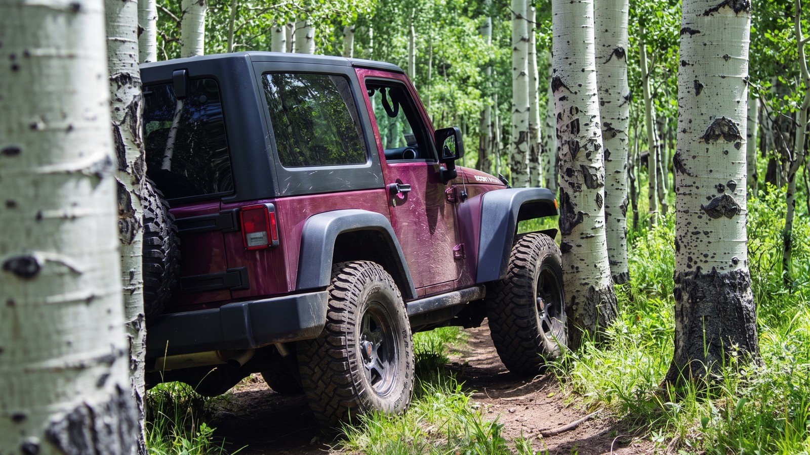 The tight aspen corridors are the trail’s real signature, and its real body-damage risk.
The loop closes at a tee about a mile from where it began. Right heads toward the closed mud bogs. Left takes you back to the trailhead, Deer Creek Road, and US-285. You can knock the whole thing out in about three hours, but if you want to actually enjoy it, poke around the clearings, and run some obstacles twice, plan on the better part of a half day.
The rig you actually need
Slaughterhouse is friendlier to a modest build than a lot of Difficult-rated trails, but “friendlier” is not “stock.” Here is the honest minimum.
You want a real 4WD with low range and decent ground clearance. A high-clearance SUV or truck with an aggressive all-terrain or a mud tire will do it on a dry day. Onboard, the things that actually earn their keep here are a little lift, 32s or bigger, and skid protection, because the rocks are the kind that reach up and grab a soft belly. Rock sliders are worth more than a front bumper on this trail, because the damage here comes from the sides: the trees, the off-camber leans, the ruts that tip you toward a trunk.
A rear locker is a genuine help on the articulation section and the off-camber descent, though plenty of open-diff rigs finish the loop with good tire placement and a spotter. Recovery gear is not optional. Bring a strap, recovery boards, and ideally a winch or a buddy with one, especially in the shoulder seasons when the mud sections are live. People have needed a pull out of the low mud more than once. And bring a spotter you trust, because the difference between a clean run and a caved-in quarter panel on this trail is usually a set of eyes outside the vehicle telling you how close that tree really is.
Stock daily drivers and crossovers: sit this one out, or ride along with someone built for it. The washouts and the tippy tree sections are exactly where an underbuilt rig gets hurt.
Rules, closures, and the reason this trail is still here
This is the part that matters most, so read it even if you skim everything else.
Slaughterhouse Gulch is a trail that exists on borrowed goodwill. The mud bogs east of Waypoint 05, at the east end of FSR 101 toward Crow Gulch, are permanently closed and under reclamation. That closure came out of real conflict, including a lawsuit over resource damage in the Pike-San Isabel forests, and the Forest Service plans to reopen the east end of FSR 101 only after the bog reclamation is complete. Do not drive the closed bogs. Do not build bypasses around obstacles, which the club specifically calls out as having caused more damage than the obstacles ever did. Do not cut Stump Hill. Every one of those choices is the kind of thing that gets a trail gated for good.
There is a seasonal gate here too. FSRs 101 and 105 are closed from January 1 to May 15 each year, a closure tied to the same litigation and to protecting the trail during its wettest, most fragile stretch. That gate stays open the rest of the year only as long as people recreate here responsibly. The club that maintains the trail is blunt about it: Slaughterhouse is one of many trails that could be closed because of a few people who will not Tread Lightly.
So run it like you want your kids to run it. Stay on the trail. Pack out everything, including other people’s trash if you have room. Yield to the horseback riders and hikers who share this forest, and slow way down around blind corners because oncoming traffic on a one-lane trail is a real thing here. For current conditions, the trail can close on short notice when it is too muddy, so call the South Platte Ranger District before you commit to the drive.
The best season, and the winter secret
Most Colorado 4x4 trails have a season that runs roughly June through September, gated by snow at altitude. Slaughterhouse is different, and this is its quiet superpower.
Because the high point is only around 9,500 feet and the whole loop lives down in the trees, Slaughterhouse is one of the best winter and shoulder-season wheeling options on the Front Range. FunTreks specifically flags it as a great route for winter snow runs. When the alpine passes are locked under ten feet of snow and every high trail is done for the year, you can be out here in December carving through fresh powder in the timber, an hour from the city. The forest canopy holds the snow and the low elevation keeps the gate reachable, so this becomes a legitimate cold-weather playground right when everything else has shut down.
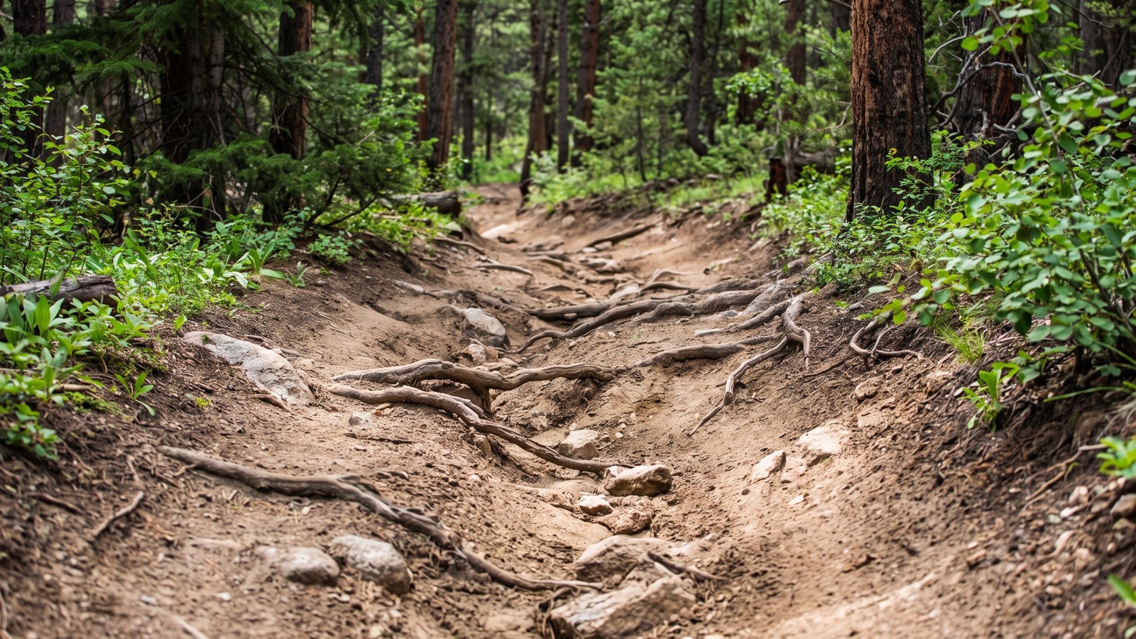 Washouts and ruts like these are what twist a rig up and push it toward the trees.
The official open window, outside the January-to-mid-May gate closure, runs roughly mid-May through the end of the year. Fall is genuinely pretty here despite the “not scenic” reputation, because the aspen groves go gold and pull in the leaf-peepers in late September. Summer weekends are the busiest by far, so if you can swing a weekday or an early start, you will trade crowds for solitude on a trail that really rewards having it to yourself.
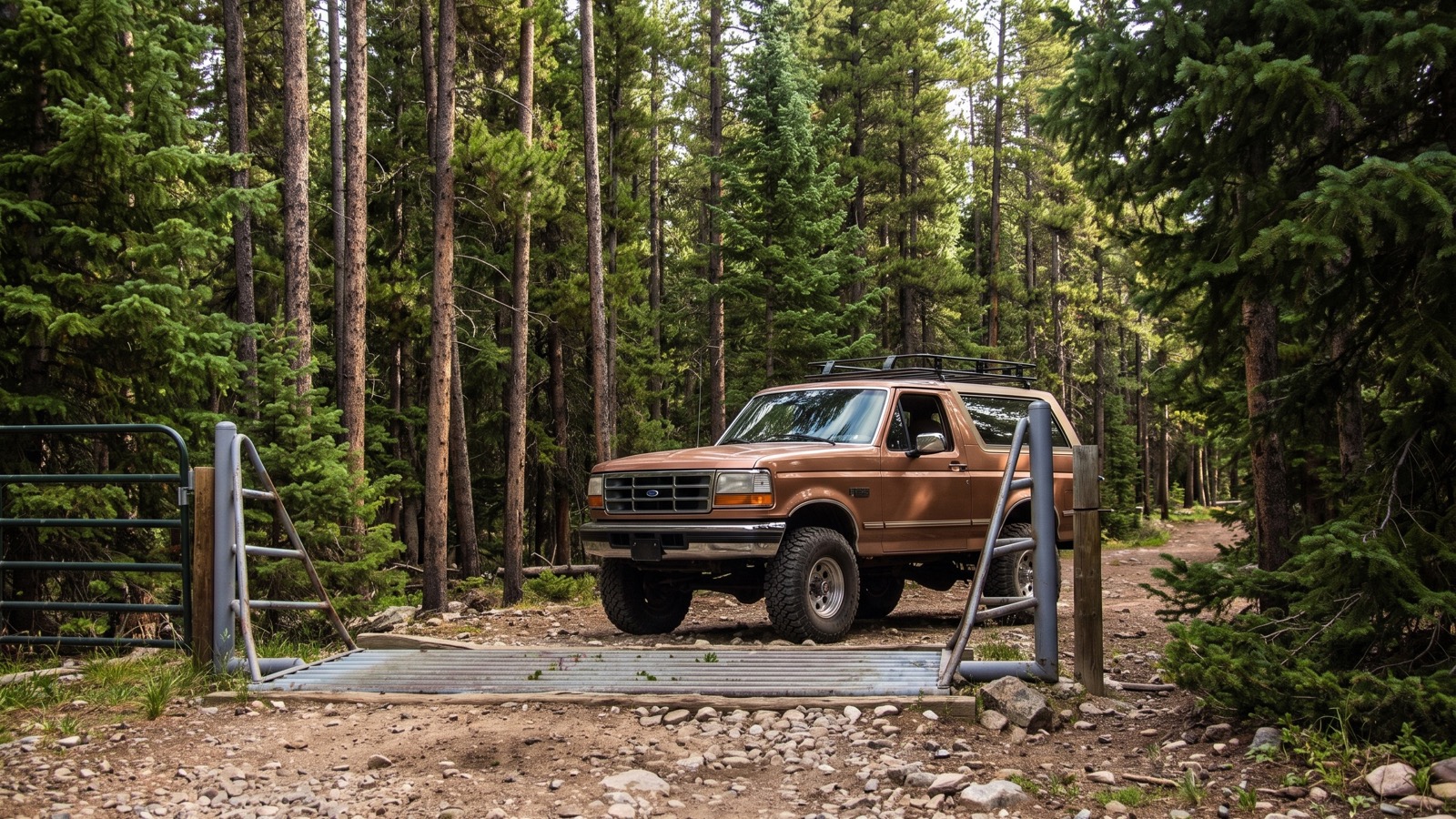 The gated access into the loop. When this gate is open, the trail is on.
Why Slaughterhouse earns its spot
There are prettier trails in Colorado. There are harder ones, and there are ones with a name that turns heads at the trailhead. Slaughterhouse Gulch has none of that, and it does not care. What it has is a rare combination: a genuinely fun, genuinely technical loop that you can reach from Denver in about an hour, that runs when the rest of the state is snowed in, and that forgives a modest build while still testing a serious one.
Treat it right and it will be here for a long time. Run it wet without the recovery gear, cut a bypass, or drive a closed section, and you become part of the reason the next generation finds a locked gate. Air down, keep a spotter out, protect your paint in the trees, and enjoy one of the Front Range’s most reliable little wheeling loops. Then go see it on the map and plan your run.