When people picture Florida off-roading, they usually think of beach driving or the deep-sand OHV parks in the center of the state. What they almost never picture is Tate’s Hell, and that is a shame, because this 212,000-acre state forest tucked between the Apalachicola and Ochlockonee rivers is one of the most genuinely wild places you can point a truck in the entire Southeast. It sits just north of St. George Island and the town of Apalachicola, so it is easy to fold into a Forgotten Coast trip, and it hides a web of sandy backroads that go on for what feels like forever.
This is not a rock-crawling destination. There is not a single obstacle here you would post to a hardcore wheeling forum. What Tate’s Hell offers instead is space, solitude, and a real sense of the old Florida frontier: bleached white-sand two-tracks running dead straight into pine flatwoods, tannic black-water mud holes that can swallow a tire after a rain, ancient dwarf cypress standing in the swamp, and the kind of quiet you only find where cell service dies and the next gas station is a long way off. If your idea of a good day is airing down, cruising slow, and disappearing into the woods for hours, this place was built for you.
What Tate’s Hell actually is
Tate’s Hell State Forest is one continuous tract of land, over 212,000 acres managed by the Florida Forest Service. The whole thing is also a Wildlife Management Area under the FWC, so you are sharing it with hunters in season. It got its strange name from an 1875 legend: a farmer named Cebe Tate went into the swamp chasing a panther, got lost for days, was snakebit, and drank the murky water to survive. He finally staggered out near Carrabelle long enough to say “My name is Cebe Tate, and I just came from Hell.” The name stuck, and once you have spent a hot afternoon lost on identical-looking sand roads with deer flies chewing on you, you understand exactly how he felt.
The reason there is anywhere to drive at all is a bit of industrial history. From the 1950s into the early 1990s, timber companies dug an intricate network of drainage ditches and built hundreds of miles of roads to grow pine plantations in the swamp. That plumbing wrecked the natural hydrology and hurt Apalachicola Bay downstream, so starting in 1994 the state bought the land and the Florida Forest Service has been slowly restoring it ever since. The upshot for us is that the old logging grid is still here: a huge lattice of named forest roads that opened the swamp up to public access. Locals have hunted and fished off these roads for generations, and today they are an overlander’s playground.
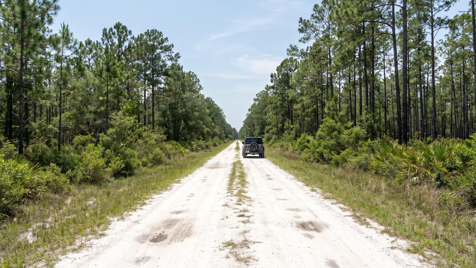
The terrain is flatwoods and savannah stitched together by an endless web of creeks and wetlands. You will roll past slash pine plantations marching in rows, cypress strands, pitcher-plant prairies full of carnivorous plants, and blackwater creeks the color of strong tea. It is beautiful in a low, subtle, distinctly Florida way that rewards people who slow down and pay attention.
The roads: sand, water, and a whole lot of it
The forest holds more than 150 miles of unpaved road, and the character is remarkably consistent: packed sand where it is dry, loose sand where it is soft, and standing water where it is low. The best single introduction is Trout Creek Road, a 10.6-mile route that runs north to south through Tate’s Hell Swamp in the southern part of the forest, connecting Gully Branch Road and Dry Bridge Road. onX rates it Easy with a technical rating of 3, and it is classified as a full-width road, which is the key detail: this is genuine full-size-vehicle terrain, not a sub-50-inch ATV-only trail.
The road conditions on Trout Creek are a fair snapshot of the whole forest. You get a mix of packed sand, loose sand, and some deep holes that turn into two-foot-deep mud holes after rainy days, plus a few permanent mud holes that never fully dry out. Most of it is easy going that a capable stock truck handles fine, but some sections do require four-wheel drive, and that is not marketing language. The Florida Forest Service and FWC both flatly state that the terrain is wet and boggy and that many roads require four-wheel-drive vehicles. Believe them.
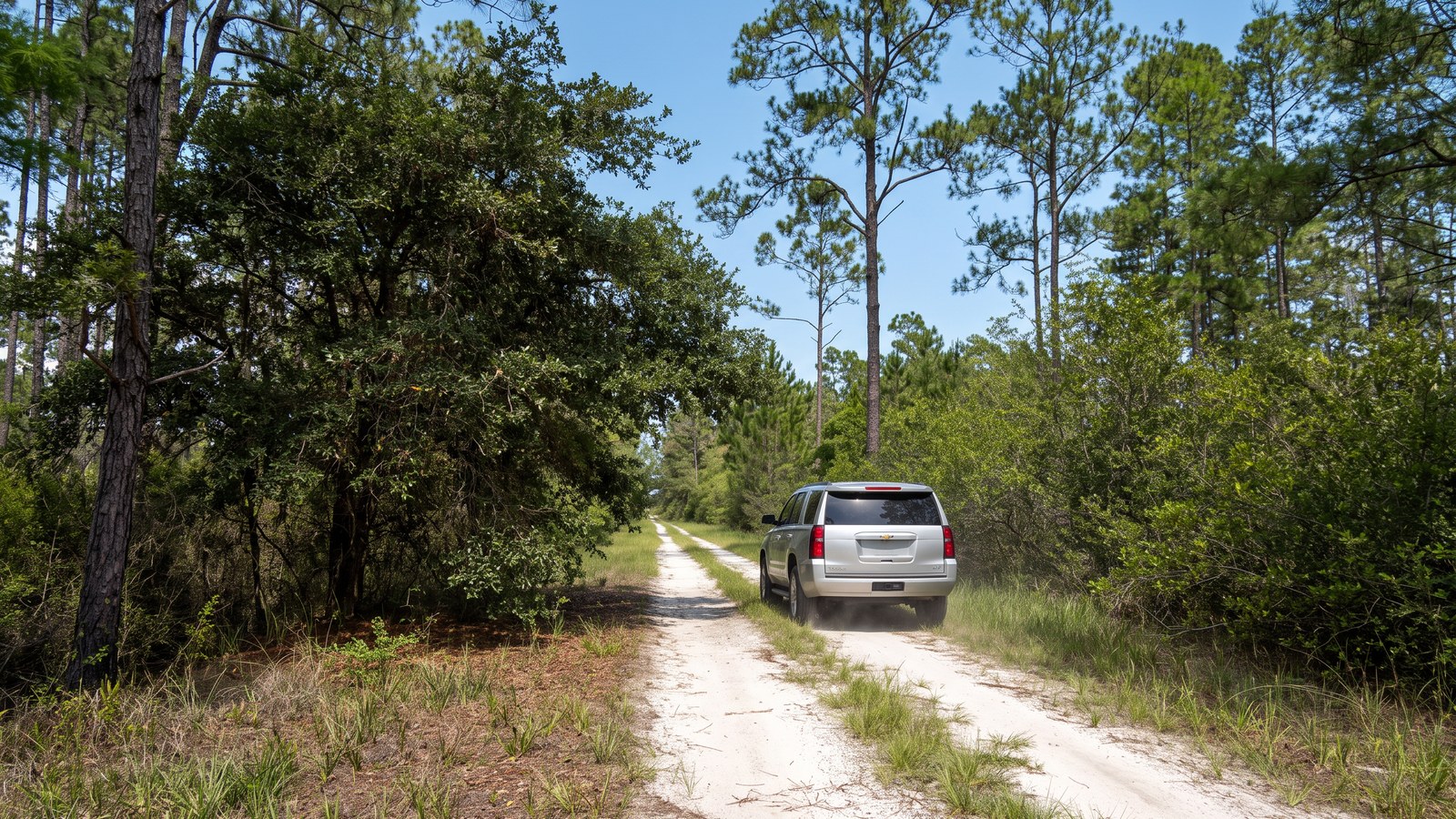
From Trout Creek you can branch off onto dozens of connectors: SFR 142, East and West Double Bridge Road, East River Road, and a long list of others, most of them rated Easy on their own. The fun of Tate’s Hell is not any one road, it is the exploring: linking roads together, poking down a spur to see where it goes, and building your own loop across the grid. The trade-off is that everything looks the same out here, the signs are inconsistent, and it is genuinely easy to get turned around, so treat navigation as a real task and not an afterthought.
The mud holes and the wet-season reality
The single most important thing to understand about Tate’s Hell is water. This is a swamp that people tried and failed to drain, and it stays wet. In the dry season the sand roads are firm and the mud holes are manageable. After a summer thunderstorm, or during the June-through-September wet months, those same low spots become axle-deep tannic soup, and roads that were easy in March become genuine bog traps.
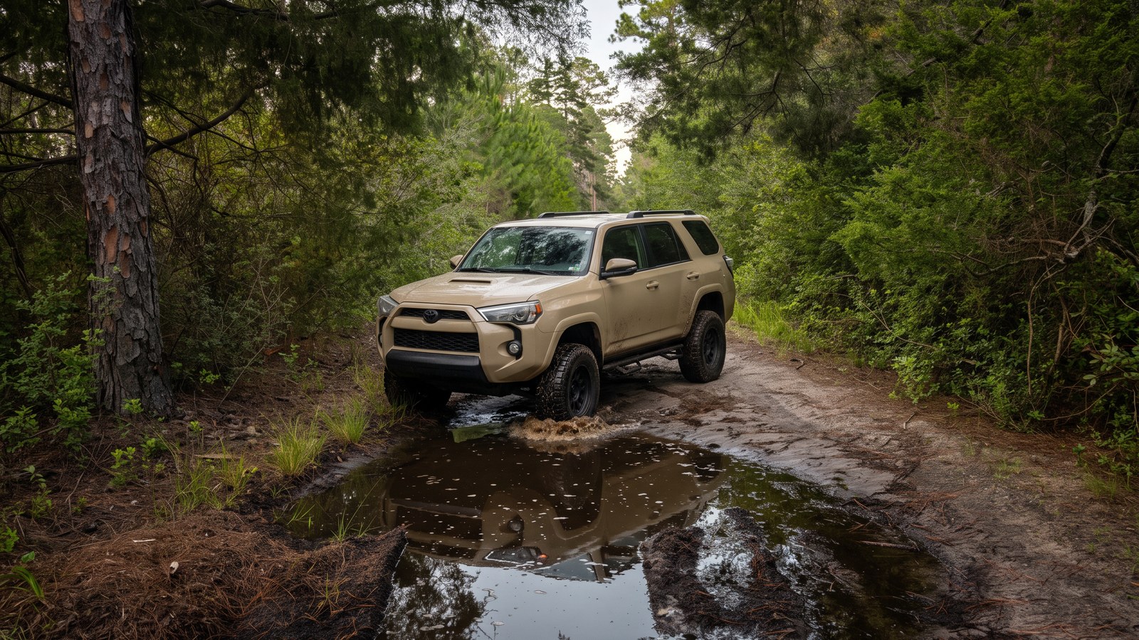
The official guidance from the Carrabelle side is blunt: all forest roads are unpaved and should not be attempted in wet weather or after dark. That is good advice. Getting stuck out here is not a quick recovery. There is often no cell signal, help is far away, and the mud is the kind of bottomless organic muck that eats momentum and traction. A mud hole that looks like a puddle can be a hidden hole deep enough to float your bumper. Walk the sketchy ones first, air down for flotation on the soft sand, and if you are solo, turn around rather than commit to a crossing you are not sure about.
Landmarks worth pointing the truck at
The forest is huge and featureless enough that having a destination helps. A few are genuinely worth the drive.
The Ralph G. Kendrick Dwarf Cypress Boardwalk is the signature stop. Tate’s Hell is home to stands of dwarf cypress, also called hat-rack or miniature cypress: some of these trees are over 100 years old, and a few push past 300, yet none stand taller than about 15 feet, stunted by the poor soil and standing water. A boardwalk and observation tower let you look out over an entire prairie of them, and it is one of the strangest, most memorable sights in Florida.
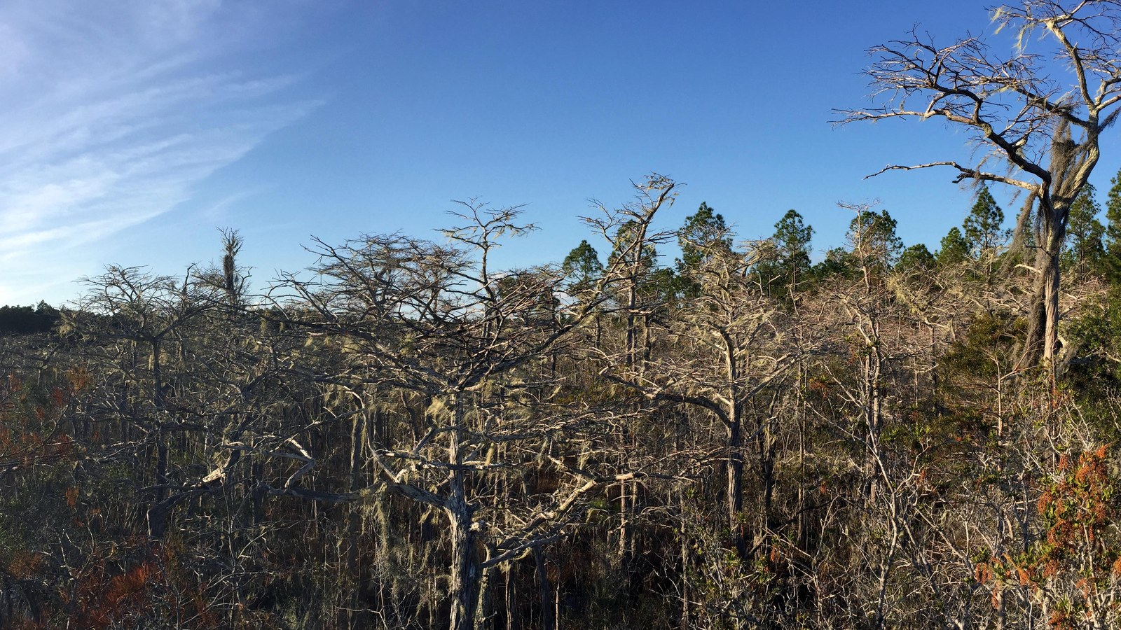 Photo: Doug McGrady / Wikimedia Commons (CC BY 2.0) To reach it, from US Highway 98 go north on Highway 65 for 5.5 miles, turn right on North Road for 1.7 miles, then right on Dry Bridge Road; the boardwalk is 2.7 miles down on your right.
The forest also touches the Big Bend Scenic Byway and holds miles of blackwater river frontage on the New, Crooked, and Ochlockonee rivers. Cash Creek has a concrete boat launch and a day-use area, and primitive campsites are scattered along the riverbanks. 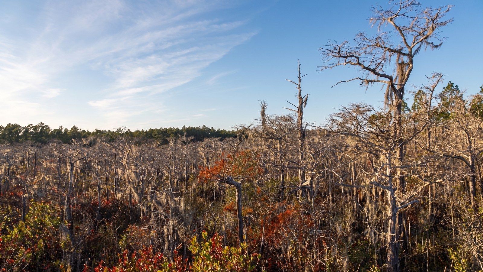
Wildlife is a real part of the experience here: this is Florida black bear country, with bald eagles, gopher tortoises, alligators, and the endangered red-cockaded woodpecker all making their home in the forest. Give the bears space and store your food properly if you camp.
The rig you actually need
Here is the honest minimum. For dry-season cruising on the main roads, a stock four-wheel-drive SUV or pickup with decent ground clearance and all-terrain tires will get you through the vast majority of Tate’s Hell without drama. This is Easy terrain by design.
Where you get into trouble is soft sand and mud, so build for those two things. All-terrain or mud-terrain tires matter more than lift here. A way to air down, and a compressor to air back up before you hit pavement, is the highest-value gear you can bring, because dropping your pressure into the low teens turns loose sand from a trap into a non-issue. Bring real recovery gear even though the trail is Easy: traction boards, a rated recovery strap, a shovel, and gloves. The failure mode out here is not a broken axle on a rock, it is a stuck truck buried to the frame in a mud hole with nobody around. Recovery gear and a buddy rig are what get you home.
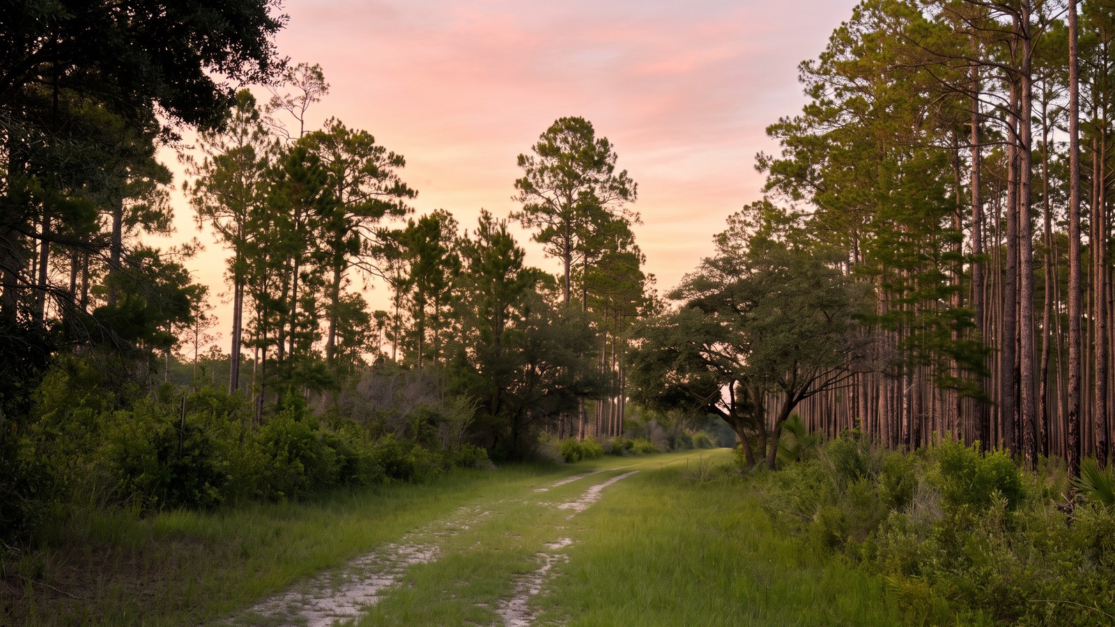
Two-wheel-drive vehicles can make it onto the firmer roads in dry conditions, but the Forest Service warns that soft and wet sections will stop them, so do not push a 2WD car deep into the grid. And skip it entirely in the wet.
Permits, fees, and the rules that matter
Access is refreshingly cheap and simple, but there are two very different permit tracks, and confusing them is the most common mistake people make.
If you are driving the forest roads in a street-legal, licensed four-wheel-drive truck or SUV, you are using the general forest, and all you need is the standard State Forest day-use pass, which runs $2 per day, or $45 for an annual pass good at all Florida state forests. That is it. You drive the maintained forest-road network as ordinary road traffic, obeying all posted signs, staying on designated open roads, and keeping to the 30-mph maximum.
The separate Tate’s Hell OHV Trail System is a different animal. That is a 150-mile permitted trail network built in 2005 for off-highway motorcycles, ATVs, and ROVs (side-by-sides) that meet the state’s OHV definition: 55 inches or less wide and 1,500 pounds dry weight or under. Full-size trucks and Jeeps do not qualify for the OHV trail program and do not need an OHV permit. The OHV pass costs $15 for a three-day use permit or $80 annually, and it is only for those smaller unlicensed machines, which have to be trailered in to the staging areas. If you are in a full-size rig, ignore the OHV pass; you want the plain forest day pass.
A few universal rules: legal daytime use, pack out everything you pack in, do not cut or damage vegetation, and stay on designated open roads. The entire forest is a hunting WMA, so during hunting season wear blaze orange and know the season dates through the FWC before you go. Camping is only allowed at designated sites and requires a permit from the Florida Forest Service. When in doubt on any current rule or closure, call the forest office in Carrabelle at 850-697-3734, because roads and conditions here change with the weather.
Best season and a few honest warnings
Run Tate’s Hell from late fall through spring. onX flags spring, fall, and winter as the best times, and that lines up with reality: the roads are firmer, the water is lower, and the bugs are tolerable. Summer is the wet season, and it brings three problems at once: flooded mud holes, oppressive heat and humidity with no shade on the open roads, and clouds of deer flies and mosquitoes that DEET barely slows down. It can genuinely be miserable out there in July.
Two other cautions. First, navigation: the roads are a repetitive grid, signage is spotty, and GPS routing will happily send you down a road that is impassable or barely a road at all. Download an offline map (onX Offroad or the georeferenced Florida Forest Service PDF map) before you lose signal, and keep track of where you are. Second, self-sufficiency: cell reception is weak to nonexistent, the nearest fuel is back toward US 98, and if something goes wrong you are on your own for a while. Top off the tank, carry water and recovery gear, and tell someone your plan.
Tread lightly out here
Tate’s Hell is a restoration project as much as a recreation area. The state spent decades and a lot of money buying this land back and undoing the damage the drainage ditches did to Apalachicola Bay, and the forest is home to bears, eagles, gopher tortoises, and rare carnivorous plants that exist in very few other places. The privilege of driving open, legal, free forest roads across 212,000 acres of it comes with a simple deal: stay on the designated roads, do not carve new lines through the wet prairie, do not blast the mud holes for fun and tear up the margins, pack out every scrap of trash, and give the wildlife room. This is public land that came back from the brink. Drive it like you want it to still be here, and still be open, the next time you point the truck toward the Forgotten Coast.