

El Dorado Canyon is one of those runs where the history is as wild as the terrain. You drop off US 95 onto State Route 165, roll down into a crease in the Eldorado Mountains southeast of Las Vegas, and within a few miles you are passing the bones of one of the richest and most lawless gold strikes in early Nevada. Keep going and the pavement gives way to dirt, the canyon tightens, and a desert wash carries you all the way down to the Colorado River at Lake Mohave. It is not a rock-crawling test piece. The challenge here is the country itself: raw Mojave heat, a canyon that funnels flash floods, and a remoteness that punishes anyone who shows up unprepared.
That mix is exactly what makes it worth the drive. You get a real off-pavement route with genuine scenery, a ghost town you can actually walk through, and a finish line on the water that almost nobody expects to find at the bottom of a Nevada canyon. Here is the honest version: what the run actually is, how to get on it, what the canyon throws at you, the rig you need, and the rules and hazards that keep this from going sideways.
What El Dorado Canyon actually is
El Dorado Canyon is a desert canyon in southern Clark County that drains east out of the Eldorado Mountains down to the Colorado River. Gold and silver were discovered here around 1859, the rush to the canyon kicked off in 1861, and for decades this was one of the biggest mining booms in Nevada history. The town of Nelson sits in the upper reach of the canyon today, and the historic Techatticup Mine sits midway down it. The whole corridor produced several million dollars in gold, silver, copper, and lead, and the mines stayed active right up until World War II.
As an off-road run, the route most people mean when they say “El Dorado Canyon” is the dirt road that continues past Nelson and the Techatticup site, dropping through Eagle Wash and Aztec Wash to a small cove on Lake Mohave. onX catalogs this as Aztec Wash Road and lists it as a 20.8-mile out-and-back. It rates the main road as Easy, technical rating 2, the kind of thing a high-clearance two-wheel-drive can manage in good conditions and any 4x4 handles without drama. That rating is honest for the terrain. What it does not capture is the environment, which is the part that actually demands respect out here.
The vibe is pure Mojave. Mineral-streaked hills, open desert vistas, the canyon walls closing in and opening back up, and at the end a startling band of blue water where the canyon meets the river. It is a half-day adventure that feels a lot bigger than its mileage because of the history layered into every wash.
How to get there and where to stage
Getting to the canyon is simple. From Las Vegas, take US 95 south toward Searchlight and watch for State Route 165 (Nelson Road) near the community of Nelson, roughly 25 miles southeast of the city. Turn east on SR 165 and follow it down into the canyon. Nelson is about 8 miles southeast of the US 95 junction, and the paved road continues east toward the old Nelson’s Landing site at the river.
The staging area is right around the town of Nelson, near the Techatticup Mine, where the dirt route into the lower canyon begins. The trailhead pin for the Aztec Wash Road / El Dorado Canyon run sits at roughly 35.7028, -114.8190, just east of the Nelson townsite off SR 165. Air down here, top off your fuel and water before you ever leave US 95, and make sure someone knows your plan. Cell service gets thin fast once you drop into the wash.
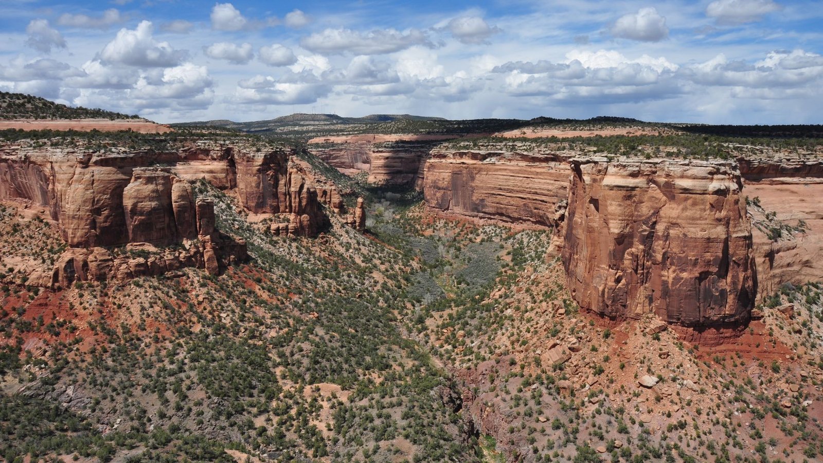 Photo: Tom Fournier / Pexels
A note on public land versus private land
This is the part to get straight before you go, because it is easy to assume the whole canyon is open public land. It is not.
The town of Nelson and the Techatticup Mine site are private property. The weathered buildings, the rusted cars, the old gas-station facades, and the mine itself are owned and operated as Eldorado Canyon Mine Tours. You are welcome to visit, but it is a paid attraction, not a free-roam ghost town. The underground mine tour runs about $20 for adults and $12.50 for kids, lasts roughly 90 minutes, and is the only legitimate way to actually go into the workings. Walking onto the private buildings or poking around the structures without paying is trespassing, and the operators are clear about that.
The dirt route below town that carries you down to the river runs through public land managed by the Bureau of Land Management and the National Park Service. The lower canyon falls largely within the Lake Mead National Recreation Area, and the surrounding high country is the Eldorado Wilderness, a 31,950-acre area designated in 2002 and managed jointly by BLM and the Park Service. Two rules matter here. First, motorized vehicles are not permitted in designated wilderness, so stay on the established road and washes and do not cut off into the wilderness terrain. Second, inside the National Recreation Area, licensed, street-legal vehicles only are allowed on the roads. That means this is not a place to trailer in an unregistered side-by-side or a plated-out trail rig and turn it loose. Bring a vehicle you can legally drive on the highway.
If you keep those two facts straight, pay for what is private and stay legal on what is public, you will not have any problems out here.
The run, wash by wash
Below Nelson the road turns to dirt and starts working its way down toward the river. The surface is classic desert two-track and graded wash: rutted in spots, rocky and loose in others, with patches of slippery gravel and stretches of washboard that will rattle your fillings if you carry too much speed. The canyon is narrow and scenic, with switchbacks, a few ledges in the two-to-three-foot range, and the occasional obstacle that rewards a spotter if you are running a longer wheelbase.
The route threads through Eagle Wash and Aztec Wash on its way to the water. These are dry most of the year, which is exactly why they are also the danger zone in a storm (more on that below). In dry conditions they are a pleasure to drive, with the canyon opening into wide desert views of the high country and then funneling back down toward the river. The grades are manageable, the loose gravel is the main thing keeping your tires honest, and the scenery does most of the heavy lifting.
The payoff at the bottom is a small cove on Lake Mohave, the reservoir behind Davis Dam that fills this stretch of the Colorado River. This is the area around the former Nelson’s Landing, once a marina and village at the mouth of the canyon. The water against the dark desert rock is a genuine surprise the first time you see it, and it is a popular put-in for paddlers and a cliff-jumping spot for people who do not mind a long, hot walk back up if anything goes wrong. Turn around here and the run back up the canyon gives you the whole thing in reverse, with the light usually better on the return.
The ghost town and the Techatticup Mine
Even though the mine site is private, it is the reason most people make the trip, and it is worth building your day around. The area known as Nelson was originally called Eldorado, named in the 1850s after the Spanish-era gold discoveries, and it earned a reputation for being rough and lawless almost immediately. During the Civil War, deserters from both the Union and Confederate armies drifted out here figuring it was the last place anyone would come looking. Labor disputes and ownership fights at the Techatticup Mine turned violent so routinely that killings were treated as ordinary.
Today the site is a preserved, photogenic ghost town that doubles as a working film location. The buildings, the rusted-out cars, the old fuel pumps, and the vintage signage have shown up in feature films, and the place leans into its outlaw past. If you have ever seen a desert ghost-town photo from southern Nevada with a faded gas-station front and a junked car out in the dirt, there is a good chance it was shot here. Pay for the tour, take your time with the cameras, and treat the structures with respect. This is somebody’s livelihood and a real piece of Nevada history, not a free playground.
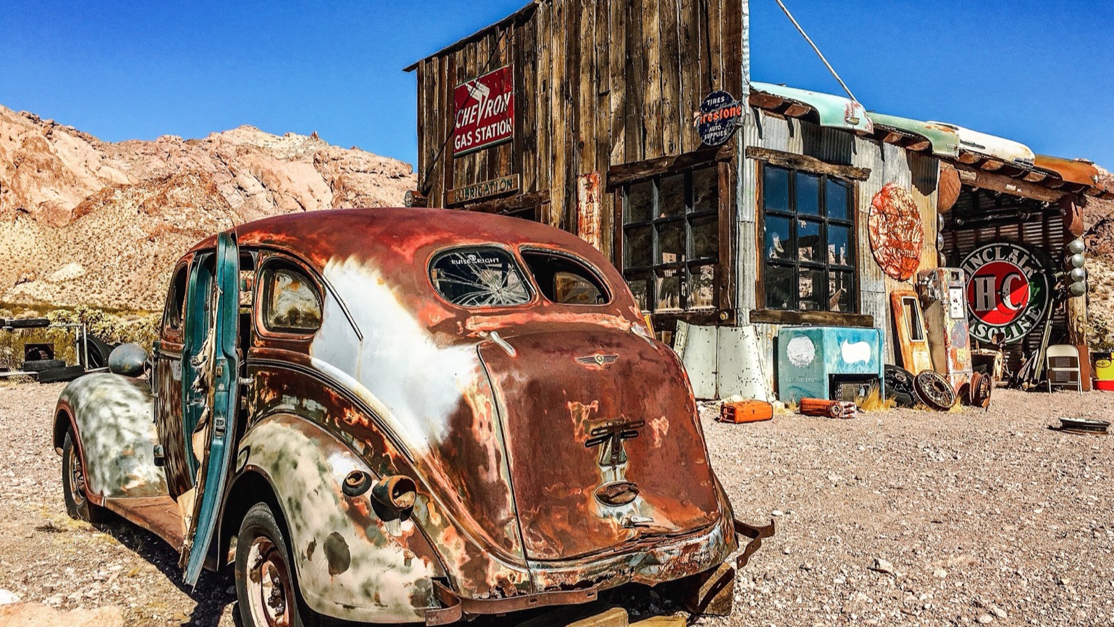 Photo: Agnieszka Kwiecień (User:Nova) / Wikimedia Commons (CC BY-SA 4.0)
The rig you actually need
For the main canyon road in good conditions, you do not need a built rig. A stock high-clearance SUV or truck with decent tires will get down to the river and back. onX rates the route Easy and notes that high-clearance two-wheel-drive or any four-wheel-drive can travel it, and that lines up with what is on the ground: the technical demands are low.
That said, “low technical difficulty” is not the same as “bring anything.” Here is the honest minimum for this canyon:
- Real tires and a way to air down and back up. The loose gravel and washboard chew up worn highway tires, and airing down smooths the ride and improves grip. Carry a compressor.
- Ground clearance. Those two-to-three-foot ledges and rutted sections will scrape a low crossover. A truck, a Jeep, a 4Runner, a side-by-side that is street legal, anything with clearance is fine.
- A full-size spare and basic recovery gear. You are a long way from help. Traction boards, a tow strap, and the knowledge to use them belong in the truck.
- More water than you think you need, plus sun protection. This is the real survival gear out here. See the heat section below.
- A paper map or downloaded offline maps. Cell coverage drops off in the canyon. Do not rely on live navigation.
If you want to push past the easy main road into the rougher spurs and side routes around the area, that is when four-wheel drive, lockers, and a spotter start to earn their keep. But for the classic canyon-to-river run, the bar is honest gear and good judgment, not a heavily modified rig.
Flash floods: the hazard that actually kills here
This is the single most important section in this guide, so read it twice. El Dorado Canyon has a deadly history with flash floods, and the terrain that makes it beautiful is exactly what makes it dangerous.
On September 14, 1974, a flash flood roared down the canyon and destroyed Nelson’s Landing, the marina and village at the river. There are five wide channels that drain the local mountains and funnel together into the narrow outlet where the landing sat. A strong downpour up in the high country, miles away and not even visible from the river, sent a wall of water and debris reported at around 40 feet high down the canyon. The landing and village were wiped out and roughly nine to ten people were killed. The marina was never rebuilt, and the empty cove you drive down to today is the scar that flood left behind.
That is not ancient history you can wave off. The same conditions exist right now. A thunderstorm well outside the canyon, with blue sky directly overhead, can put a flash flood through these washes with very little warning. onX flags the route specifically for passing through potential flash-flood areas, and the managing agencies say the same. The rules are simple and non-negotiable:
- Check the weather before you go, including the forecast for the mountains upstream, not just the canyon itself.
- Never enter the washes if rain is in the forecast anywhere in the region. You cannot outrun a flash flood in a canyon.
- If it starts raining while you are down there, get to high ground immediately. Do not try to drive out through the wash.
- Do not camp or park in the bottom of a wash. Ever.
Treat the canyon as a place that will flood, because it will, and plan your trip around staying out of it when conditions are wrong.
Heat: the other thing that hurts people
The second killer here is plain desert heat. Summer temperatures in this part of the Mojave can reach 120 degrees, and aside from the river itself, there is almost no water in this country. People get into trouble out here every year by underestimating it.
The fix is preparation, not toughness. Carry far more water than you think you will drink, run the canyon in the cooler months, and start early so you are not stuck down at the river in the worst of the afternoon. From roughly October through April the temperatures are reasonable and the run is genuinely pleasant. May through September is when the heat turns this from an adventure into a hazard, and midsummer is the part of the calendar to simply skip unless you really know what you are doing. If anyone in your group starts showing signs of heat exhaustion, that is the trip over. Get them cool, get them hydrated, and get out.
One more desert note: watch for open mine shafts and ventilation holes scattered through the canyon’s mining history. Some are unmarked. Keep kids and dogs close, and do not go poking into old workings on foot.
Best season and final planning
Plan this run for the cool half of the year. October through April gives you mild temperatures, lower flash-flood odds outside of storm systems, and the best light for the canyon and the ghost town. Spring and fall are the sweet spot. If you go in the shoulder months, still check the forecast, because the desert can throw a storm any time of year and the flash-flood rules do not take a season off.
A realistic day looks like this: leave Las Vegas early, fuel and water up before you commit to SR 165, do the Techatticup tour, then run the dirt down to the river and back before the afternoon heats up. It is an easy half-day that delivers history, real desert driving, and a payoff at the water that most people never knew was there.
Tread Lightly and keep it open
This canyon stays open and drivable because people treat it right. Stay on the established road and washes, and keep your wheels out of the designated wilderness entirely, since motorized travel is not allowed there. Pack out everything you bring in. Respect the private mine site and pay for what is private. Give hikers, paddlers, and the tour traffic plenty of room. And remember that this is a working historic site and a recovering desert ecosystem, not a place to leave a mark.
El Dorado Canyon rewards the driver who shows up informed, fueled, watered, and watching the weather. Do that, and you get one of the most history-soaked, scenery-rich half-days of desert driving anywhere near Las Vegas. Show up careless about the heat or the floods, and the canyon has a long, hard record of making people regret it. Drive it smart, and it is a classic.
Hero photo: Tom Fournier / Pexels