There are off-road trails, and then there are journeys. The Mojave Road is squarely the second kind. It is not a rock crawl, it will not fold your rig on an obstacle, and you can run most of it in a stock four-wheel drive. What it demands instead is that you drive across an entire desert, roughly 140 miles of it, mostly the same way travelers found it a hundred and fifty years ago. This is one of the great overland routes in North America, and it earns that reputation not with difficulty but with distance, isolation, history, and a run of oddities you will not find anywhere else.
Most people plan two to three days for it, and that is the right way to think about it. This is not a Saturday loop you knock out before lunch. It is a point-to-point crossing of the eastern Mojave, spring to spring, the way the Mohave people, then the Spanish, then the US Army, then Dennis Casebier’s crowd of history-obsessed four-wheelers all traveled it. Knowing what the road actually is, how to get on it, and what it takes to cross it safely is the difference between a trip you talk about for years and a very long, very hot walk for water.
What the Mojave Road actually is
The Mojave Road is a historic east-west route across the Mojave Desert, running from the Colorado River near Needles to the Mojave River out near Afton Canyon, with the vast bulk of it crossing the Mojave National Preserve. Depending on which authority you trust and where you start and stop, the drivable route runs somewhere between 133 and 147 miles. The National Park Service calls it “roughly 150 miles,” Wikipedia puts the historic route at 147 miles and the practical modern drive at about 133, and AllTrails measures the popular GPS track at 137.6. Call it about 140 miles and plan accordingly. The point is that it is long, and there is no cell service, no fuel, and no water for most of it.
This was a Native American trade route long before it was anything else, a chain of watering holes the Mohave people used to move goods between the Colorado River and the Pacific coast tribes. Spanish missionaries traveled it with Mohave guides in the 1770s. Jedediah Smith brought the first US citizens across in 1826. The Army built a string of outposts along it in the 1860s to guard the springs and protect the mail. Then it faded, until a historian named Dennis Casebier resurrected it in the 1980s, mapped it mile by mile, and turned it into the overland pilgrimage it is today. His Mojave Road Guide is still the definitive mile-by-mile reference, and if you are serious about the trip you should own a copy.
What makes the road special is that it has been deliberately left alone. It is not graded, not signed like a highway, and not paved. Long stretches look and drive exactly as they did to the wagon travelers, which is the entire point. You are not driving past history here. You are driving through it.
How to get there and which way to run it
Almost everyone runs the Mojave Road east to west, starting near the Colorado River just outside Needles and finishing at the Mojave River near Afton Canyon and Interstate 15. There is no registration fee and no permit for a normal-sized group, which is part of the appeal. You simply show up prepared and drive.
The eastern trailhead sits near the Avi Casino and Ahi Macav Parkway on the California side of the river, around 35.0462 north, 114.6403 west. From there the road climbs west up a wash toward the Dead Mountains, drops into the Piute Valley, crosses US-95, and begins the long march across the Preserve. The western end comes out at Manix Wash and the Afton Road access off I-15.
Run it east to west and you finish closer to the services along I-15, which is convenient. More importantly, you want to hit Soda Lake, the big dry lakebed crossing near the western end, when you have a feel for the trip and, ideally, when the lakebed is bone dry. More on that below, because Soda Lake is the one place on this road that can genuinely strand you.
If you cannot do the whole thing in one push, the route breaks naturally into segments. The eastern portion from the river up through Fort Piute is its own rewarding day. The middle, from the Lanfair Valley through the springs to Marl Spring, is the historic heart. The western third takes you across Soda Lake and down the Mojave River to the finish.
The terrain and the obstacles, in order
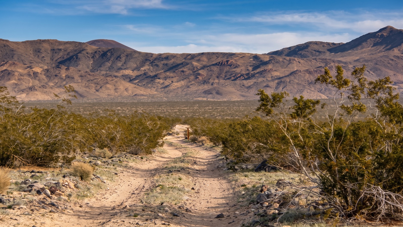
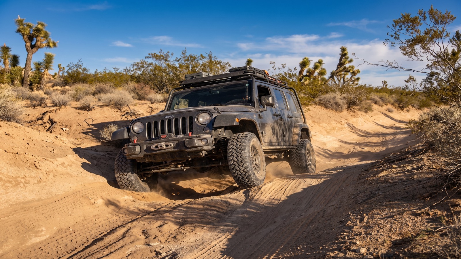
The honest truth about the Mojave Road is that the driving is Moderate, and most of that rating comes from a handful of specific spots and from the sheer commitment of the distance, not from any single scary obstacle. A stock high-clearance four-wheel drive with good tires handles the great majority of it. Here is what you are actually dealing with, roughly west from the river.
Out of the river bottom, the road climbs a rocky wash into the Dead Mountains. This first stretch is loose and rocky and not always well marked, so patience and a good GPS track matter. You cross US-95 and climb toward the Piute Range, where a short, rough spur drops down to the stone ruins of Fort Piute and Piute Spring, one of the few reliable water sources on the whole route and worth the detour.
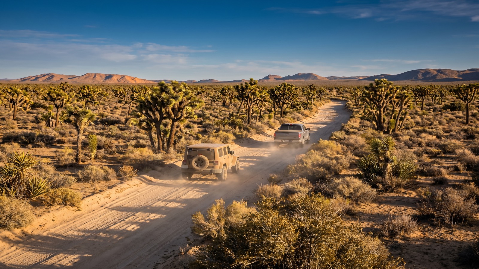
From there you roll across the Lanfair Valley, a wide-open basin thick with Joshua trees, on generally easy graded two-track. This is classic desert cruising, big sky, big distances. You pass Rock Spring and Bert Smith’s stone rock house, a photogenic ruin with a pit toilet, then Government Holes. The middle miles run past the Death Valley Mine and up to Marl Spring, another historic Army watering point.
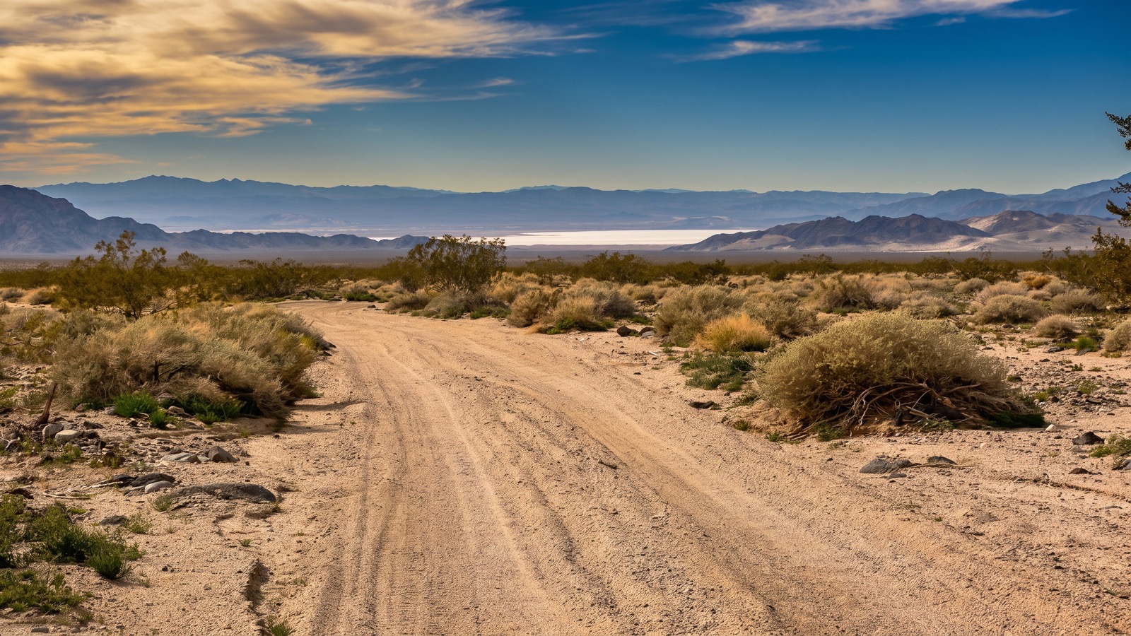
The signature driving challenge is Soda Lake, near mile 100. This is a three-mile crossing of a dry lakebed, and it is easy and almost surreal when the surface is dry, a flat white expanse where you can watch your dust hang in the air behind you. When it is wet, it is a trap. The Soda Lake mud will swallow a truck to the axles and it does not let go easily. Never cross Soda Lake if the surface looks damp, cracked-and-shiny, or if there has been recent rain. People get badly stuck out there every year, and there is no one coming to pull you out.
The far western end has a few sandy sections along the Mojave River corridor and, depending on conditions, one or more shallow water crossings of the Mojave River itself before you climb out to Afton Road. Air down for the sand, keep your momentum, and you will be fine.
The oddities that make the trip
Half the reason people run the Mojave Road is the collection of strange, wonderful landmarks scattered along it. These are the stops that turn a desert crossing into a genuine adventure.
The Mojave Mailbox sits out in the empty middle of the route, a lone mailbox on a post with a logbook inside where travelers sign in and leave notes. It has been there in various forms for decades, and adding your name to the register is a rite of passage.
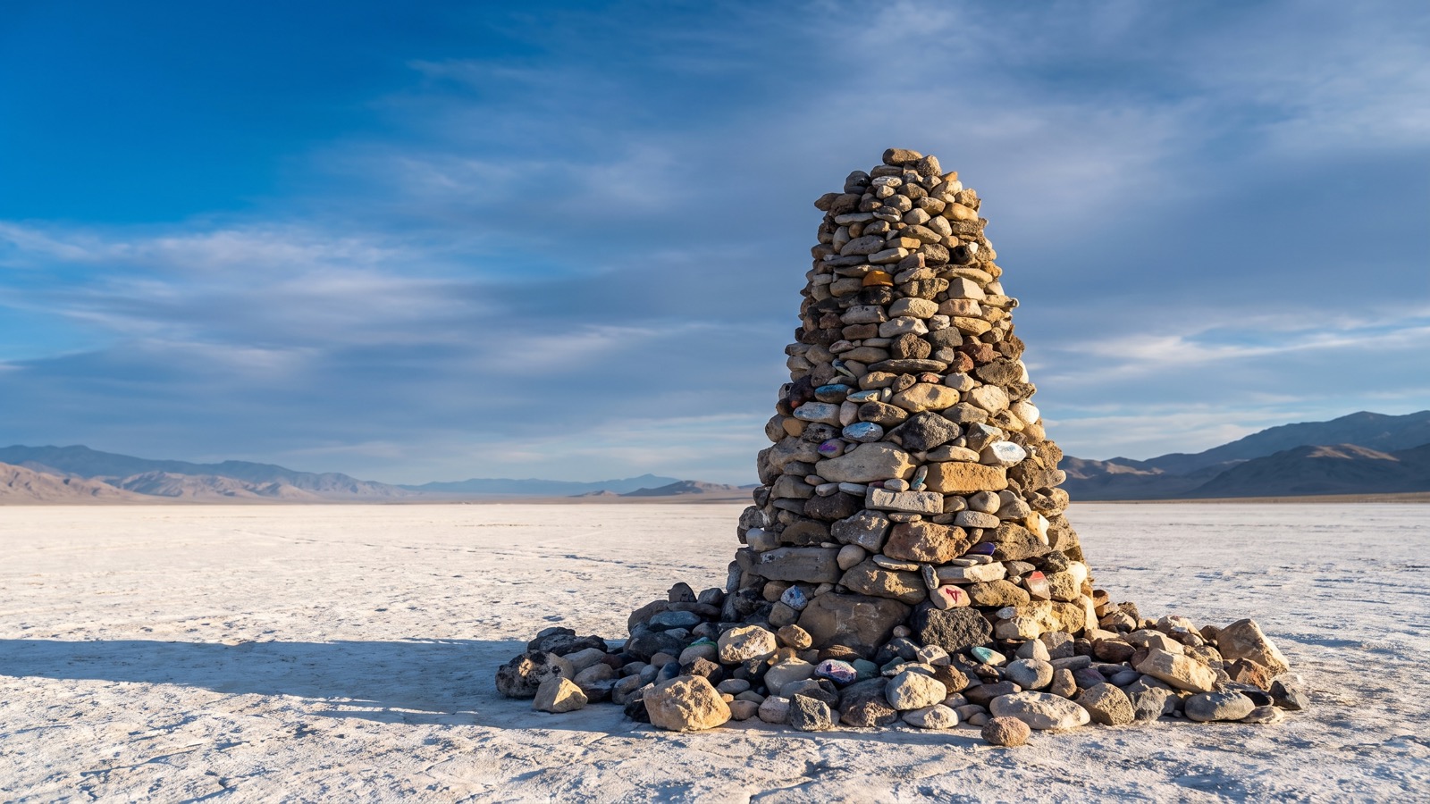
The Travelers Monument stands on the dry bed of Soda Lake, near mile 100, a large and growing pile of rocks in the middle of nowhere with a California flag flying over it. Tradition says you carry a stone from the start of the trip and add it to the pile when you cross the lakebed. It is one of the most photographed spots on the road, and approaching it across the white dust of the dry lake is a genuinely unforgettable piece of the drive.
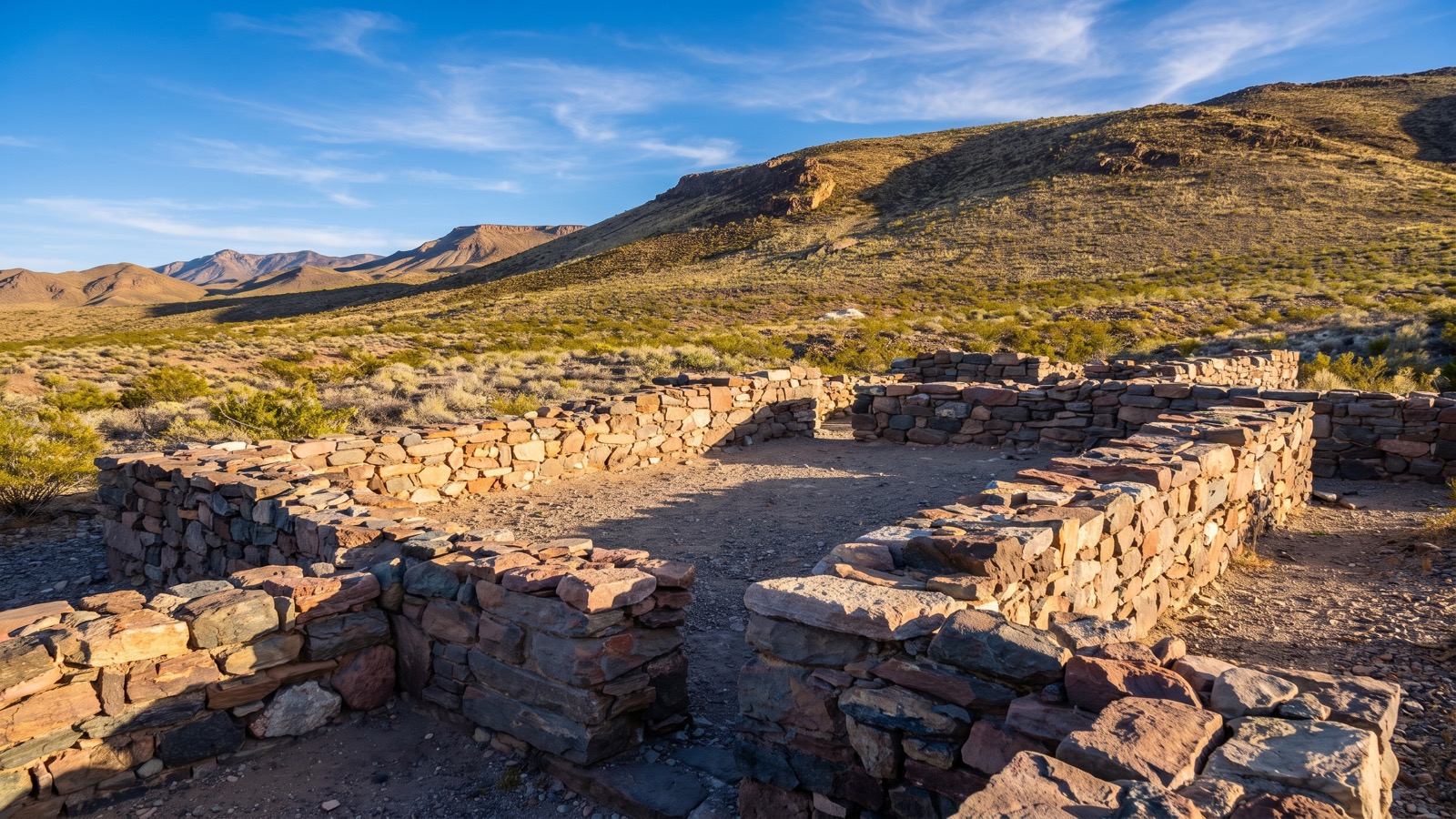
The old Army outposts and mining relics are scattered across the route too. The dry-stacked stone walls of places like Fort Piute and Rock Spring still stand where soldiers once guarded the water, weathered but intact after more than a century in the desert.
Along the way you will also pass the Lava Tubes, a short detour into an underground volcanic tube reached by a small set of stairs, where shafts of light beam down through holes in the ceiling. There is a famous shot-up abandoned school bus rusting in the desert grass, the old Penny Can, mining relics at the Death Valley Mine and Aiken Mine, and a buried boxcar near the western end. None of these are on any highway map. That is what makes finding them feel earned.
The rig you actually need
You do not need a built rock buggy for the Mojave Road. You do need a reliable, high-clearance four-wheel drive and the discipline to prepare it like your life depends on it, because out here it can. The Park Service is explicit: four-wheel drive is recommended, the road is unmaintained, and some sections are rough and sandy.
Honest minimums:
- A high-clearance 4WD in good mechanical condition. Check tires, belts, fluids, and your spare before you leave pavement. A stock 4Runner, Tacoma, Wrangler, or full-size truck all do this trail regularly.
- Good all-terrain tires and the ability to air down for the sand sections. Bring a way to air back up.
- A full-size spare, ideally two tires’ worth of repair capability. Sharp desert rock and long distances chew tires. A plug kit and a real compressor are not optional.
- Recovery gear. Traction boards, a shovel, and recovery straps, mostly for sand and for the very real chance of a soft spot near Soda Lake. Winching options are limited in open desert with nothing to anchor to, so self-recovery gear matters more than a winch here.
- Far more water than you think you need. Plan on at least a gallon per person per day plus a large reserve, because a breakdown can strand you for a long time in serious heat.
- Extra fuel. There is no gas on the route. Carry enough to cross the whole thing plus a healthy margin, especially since sand and low range burn more than you expect.
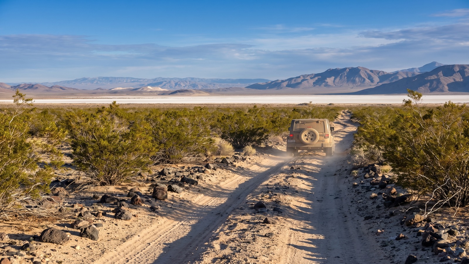
One vehicle rule to underline, because it is enforced: this route runs through the Mojave National Preserve, and inside the Preserve only street-legal vehicles are allowed. No ATVs, no side-by-sides, no sand rails, no RZRs, regardless of what sticker they carry. Jeeps and trucks licensed in any state are fine. If it is not street legal in California, it cannot legally drive the Preserve section, and the rule is enforced with citations.
Permits, rules, and pack-out
There is no fee and no permit to drive the Mojave Road as a normal group, which is refreshingly simple. A few rules do matter, and the Preserve takes them seriously:
- Groups larger than 7 vehicles or 25 people need a Special Use Permit. Apply well ahead, the Park Service asks for up to a month of lead time.
- Stay on the established route. Do not create new tracks, do not drive in the washes where prohibited, and respect every Wilderness Boundary sign. This is strictly enforced, and it protects the desert tortoise, a threatened species that burrows underground right where a tire would go.
- Pack out everything, including used toilet paper. In the desert, TP does not decompose, animals dig it up, and it becomes both a health hazard and an eyesore. Carry it out.
- Camping is dispersed and first-come, first-served, with no reservations and no fee. Leave every primitive site better than you found it.
Because much of the route is on National Park Service land rather than BLM, the rules are stricter than the open OHV areas nearby. Treat it like the protected historic and natural landscape it is.
Best season and weather
Timing is everything out here. The prime window is mid-October through April, when daytime temperatures are manageable. Summer on the Mojave Road is genuinely dangerous, with heat that can kill a stranded traveler in a day, and it is not the time to attempt a long desert crossing.
Even in the cooler months, watch the weather. Winter can bring snow or ice at the higher elevations along the route. Summer monsoon storms, which can linger into early fall, cause flash floods and washouts and, critically, they put water on Soda Lake. Always check current conditions with the Preserve before you go, because a road that is easy one week can be impassable the next. And remember the one hard rule: if Soda Lake is wet, do not cross it.
Tread lightly and carry the history forward
The Mojave Road exists in its authentic, unmaintained state because people have chosen to protect it. That is a responsibility you take on the moment you drive it. Stay on the route. Do not disturb the ruins, the mines, or the artifacts, which are protected by law and are part of why this trip means anything. Pack out your trash and everyone else’s when you can. Sign the mailbox, add your stone to the monument, and leave the rest exactly as you found it.
This road has carried Native traders, Spanish priests, Army soldiers, and a century and a half of travelers. Run it prepared, run it respectfully, and you become a small part of that long line. There is nothing else quite like crossing an entire desert the slow, old way, and the Mojave Road remains the best place in the country to do it.