

Schnebly Hill Road is the drive that makes people fall in love with Sedona from behind the wheel. It starts down in the red rock country just outside town and grinds its way up roughly 2,000 feet of elevation to the pine forests near Interstate 17, and the whole way up it hands you one of the best red rock views in all of Arizona. Pink Jeep tours have been running people up here for decades, which tells you two things: the scenery is world class, and the road is rough enough that most folks would rather pay someone else to drive it.
Here is the honest truth about Schnebly that the tourism brochures skip. It is not a technical trail. There is no rock crawling, no obstacle that will stop a capable rig, nothing that requires a spotter. What it is, instead, is relentlessly rough. Mile after mile of broken rock, ruts, and ledgy washboard that beats on your truck and your spine the entire climb. People who treat it like a gentle scenic drive in a rental SUV get a rude surprise. People who show up with the right vehicle and the right expectations have a blast.
What Schnebly Hill Road actually is
Schnebly Hill Road is Forest Road 153, a route that climbs out of Sedona’s red rock basin up onto the edge of the Mogollon Rim. It sits entirely within the Coconino National Forest, managed by the Red Rock Ranger District. The road has been here a long time. It started life in the 1900s as a wagon route ranchers used to move cattle and goods between Sedona and Flagstaff, and it is named for Theodore Schnebly, one of the town’s early settlers.
The full run is about 12 miles from the Sedona end to where it tops out near the Schnebly Hill exit (320) on I-17. Most of the punishment is concentrated in the lower stretch, roughly the first 5 or 6 miles climbing up from town. Once you crest near the rim, the surface mellows into a normal graded forest road for the final miles out to the interstate.
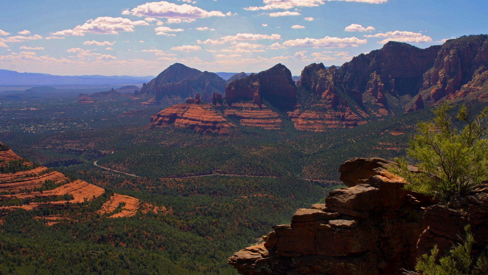 Photo: Brienne Magee / Coconino National Forest, via Wikimedia Commons (CC BY-SA 2.0)
Most people run it east to west, dropping down from the I-17 side into Sedona, because the views get better and better as you descend toward the red rocks and you finish in town. But plenty drive it the other way, climbing up from Sedona, which is the more dramatic way to experience the elevation gain. Either direction works. The road is the same rough ride no matter which way your nose is pointed.
Getting on the road
From Sedona, the start is easy to find. From the junction of State Routes 89A and 179 in the heart of town, head south on 179 for about a third of a mile, then turn left onto Schnebly Hill Road just past the Oak Creek bridge. The pavement ends quickly and the rock begins. That lower trailhead area is where you commit to the climb.
From the top, take Interstate 17 to the Schnebly Hill exit, number 320, between Phoenix and Flagstaff. From there you follow the graded upper road in toward the rim and the vista before the rough descent begins. This is the access a lot of folks use when the lower road is gated for winter, since the upper graded section and the Vista often stay reachable from the I-17 side.
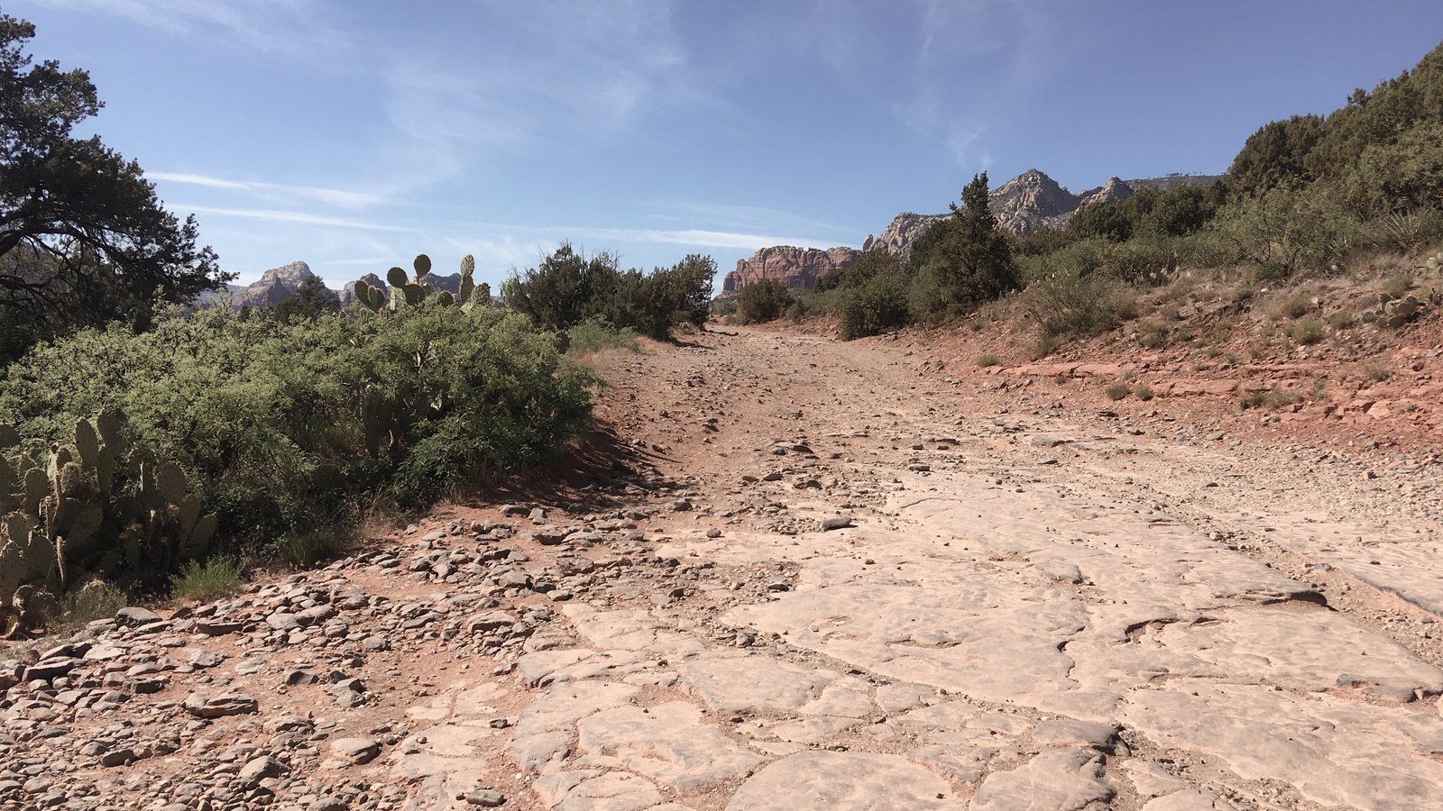 Photo: Clyde Charles Brown / Wikimedia Commons (CC BY-SA 4.0)
One thing worth knowing: you do NOT need a Red Rock Pass to simply drive Schnebly Hill Road. The Red Rock Pass is required for parking at many developed Sedona trailheads and day-use sites, but driving the OHV route itself does not require one. If you stop and park at a fee site along the way, that is a different story, so read the kiosk signs where you stop.
The rough ride and the difficulty question
Let me settle the difficulty debate, because you will see this road rated everywhere from easy to brutal depending on who is talking. The Forest Service describes it plainly as a very rough and rutted road that needs high clearance. Mapping apps that score it on technical obstacles call it easy, because there genuinely are no obstacles to crawl. Off-road guidebooks and the people who actually drive it call it moderate, because rough and rutted for 5 straight miles is a different kind of hard than a single big ledge.
Both camps are right, and that is exactly why we rate it moderate. You will not need lockers or a winch. You will need patience, ground clearance, and a tolerance for being shaken around. Plan on it taking an hour to an hour and a half to cover the rough lower 5 or 6 miles. That is not slow because it is dangerous. It is slow because going any faster will rattle your fillings loose and risk damage to a vehicle that is not built for it.
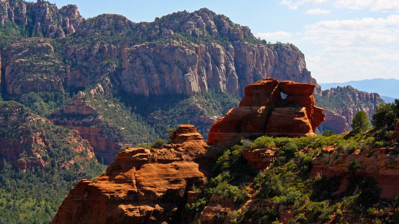 Photo: Brienne Magee / Coconino National Forest, via Wikimedia Commons (CC BY-SA 2.0)
The road has also gotten rougher over the years. Erosion and heavy traffic keep chewing at the surface, and recent reports describe sections noticeably worse than they used to be. None of it is impassable for a proper rig, but go in expecting a workout, not a Sunday cruise.
The vista and what you came for
The payoff is the Schnebly Hill Vista, an observation site near the top that delivers one of the best views of eastern Sedona and the red rocks below. On a clear day you are looking out over the whole red rock amphitheater, with Mitten Ridge, Munds Mountain, and the layered buttes spread out beneath you. It is the kind of view that stops conversation in the truck.
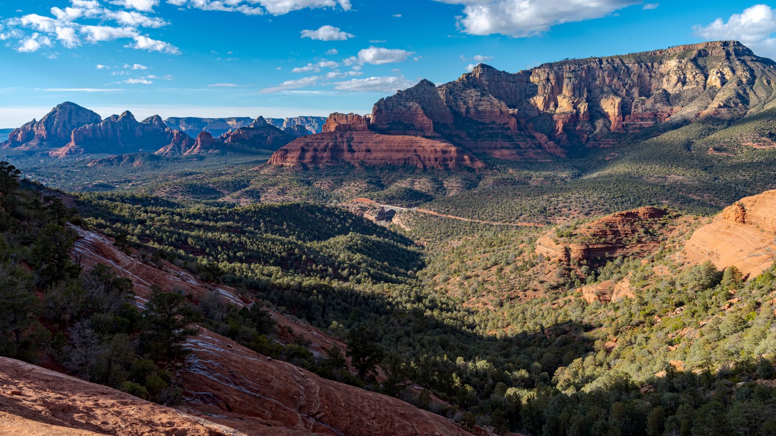 Photo: deborah.soltesz / Wikimedia Commons (CC0)
Take note of the rules at the Vista: no camping and no campfires are permitted there. It is a day-use viewpoint, not a campsite, and the Forest Service is strict about it because of the fire risk in this country. Pull over, soak in the view, take your photos, and move on. There are plenty of legitimate camping options elsewhere in the Coconino if that is your plan.
The rig you actually need
The Forest Service is direct about this: high clearance, four-wheel-drive vehicles are needed to get to the Vista from the Sedona side because of the road conditions. That is the honest standard. A stock 4Runner, Tacoma, Wrangler, Bronco, or any high-clearance truck or SUV will handle Schnebly comfortably as long as you take your time.
What gets people in trouble is showing up in a low-clearance rental car or a street-tire crossover and trying to drive up from Sedona. Every season the locals watch sedans and soft-roaders scrape, bottom out, and turn around a half mile in, or worse, ground out partway up and block the road. If your vehicle sits low and rides on highway tires, do not attempt the lower climb from Sedona. Drive in from the I-17 side to the Vista instead, where the graded upper road is far more forgiving.
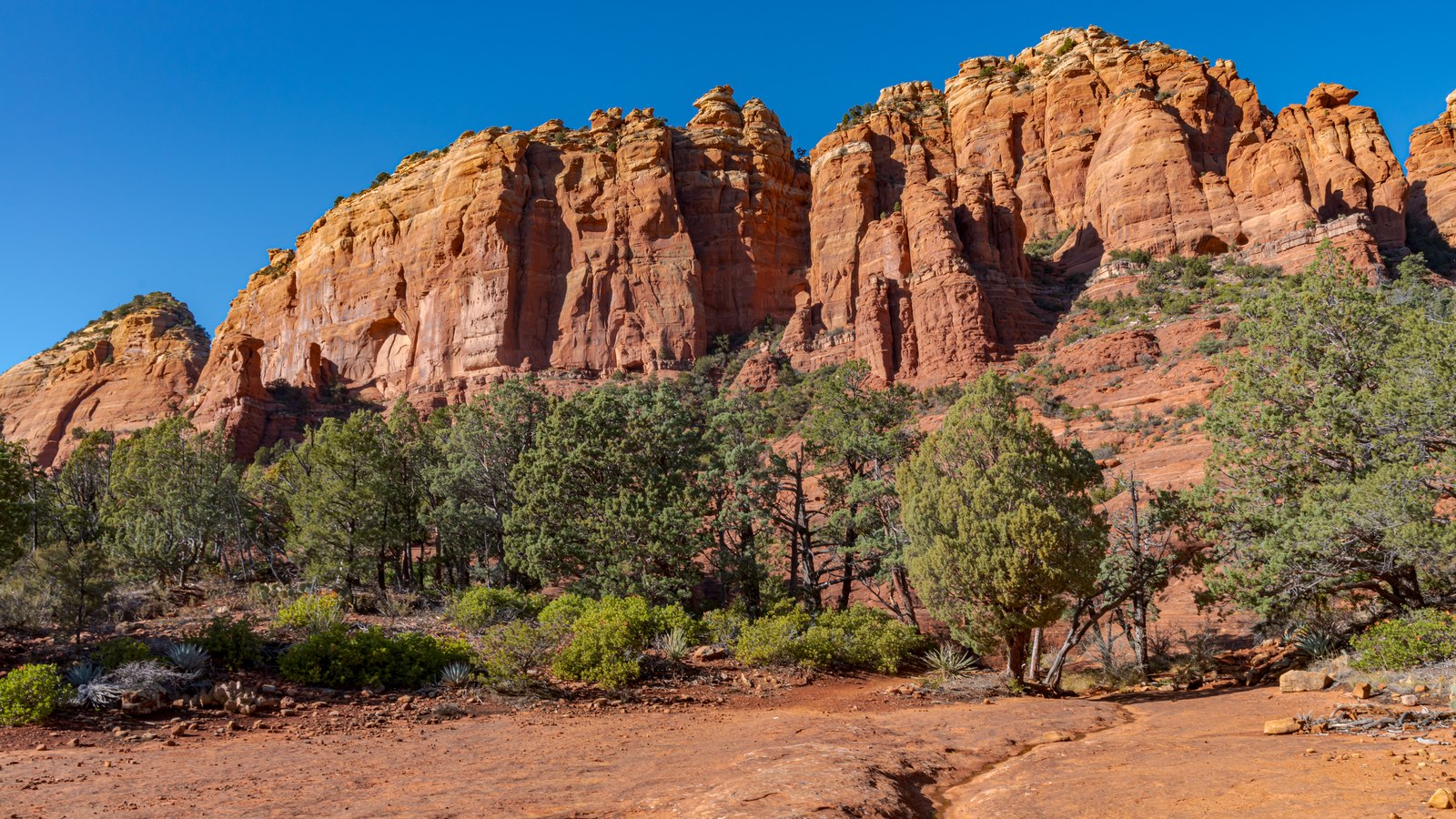 Photo: deborah.soltesz / Wikimedia Commons (CC0)
Air down a bit to take the edge off the washboard, bring more water than you think you need (the Arizona sun is no joke, plan on more than a gallon per person on a summer day), and carry a real spare. The rough rock is hard on tires.
When to go
Schnebly is technically open year-round, but the seasons matter more than the calendar. In the winter months the Forest Service often gates the road for seasonal closures, specifically the stretch from the Merry-Go-Round area in Sedona up to the top of Forest Road 153, and from the Huckaby Trailhead lot on up. When snow and ice hit the rim, the rough rock turns genuinely dangerous, so the gates go up. Always check the Coconino National Forest’s Forest Roads Status page for FR 153 before a winter trip.
Spring and fall are the sweet spots. The temperatures are comfortable, the light on the red rocks is gorgeous morning and evening, and the road is reliably open. Summer is fine too, but go early to beat the heat, because there is no shade on the lower climb and Sedona bakes. After heavy rain or snow the road can be temporarily closed to let it dry out and to prevent damage, so a quick conditions check before you head up is always smart.
Tread lightly and keep it open
Schnebly Hill Road stays open to the public because people respect it. Stay on the established road, do not create new tracks or shortcuts across the fragile desert and slickrock, and pack out everything you bring in. This is a heavily used route right next to a major tourist town, which means it is also heavily watched. One person carving a new line or leaving trash gives the agencies a reason to add restrictions.
Yield with common sense, give the commercial tour rigs and oncoming traffic room on the narrow rough sections, and slow down around the hikers and bikers who share this corridor. Schnebly has been carrying people up to that red rock view for over a century. Drive it well and it will keep doing exactly that. Few drives in the country pack this much scenery into a single rough, rewarding climb.
Hero photo: deborah.soltesz / Wikimedia Commons (CC0)