

Some roads are a means to an end. The Beartooth Highway is the destination. This is the one Charles Kuralt famously called the most beautiful drive in America, and after you crest the 10,947-foot pass and look out over a hundred miles of glacier-carved peaks, alpine lakes, and snowfields that linger into August, you will understand why nobody argues with him. It is a paved highway, not a rock-crawling trail, but it belongs on every off-roader’s list because it is the high road into some of the wildest country in the Lower 48, and the jumping-off point for a ton of dispersed camping and dirt spurs once you are up there.
Let me be straight about what this is so you go in with the right expectations. The Beartooth is a two-lane paved byway. You do not need four-wheel-drive or high clearance to drive it. What you do need is to respect the altitude, the weather, and the season, because this road climbs higher than almost any highway in the country and the mountains up here make their own rules.
What the Beartooth Highway actually is
The Beartooth Highway is the stretch of U.S. Route 212 that runs between Red Lodge, Montana and the Northeast Entrance of Yellowstone National Park near Cooke City. It is designated an All-American Road, the top tier of the national scenic byway system, and it crosses back and forth between Montana and Wyoming as it climbs. The high point is Beartooth Pass, sitting at 10,947 feet up on the Wyoming side, though the heart of the route and its best-known access town, Red Lodge, are in Montana.
The full run is about 68 miles end to end. Plan on roughly three hours of driving without stops, and a lot more than that in reality, because you will stop constantly. The road passes through two national forests, the Custer Gallatin on the Montana ends and the Shoshone in Wyoming, and it climbs up onto the vast Beartooth Plateau, a high tundra world above treeline that feels more like the Arctic than the American West.
This is not a quick connector. It is one of the highest and most dramatic paved roads on the continent, and it exists purely because the scenery is worth it. From the switchbacks above Red Lodge to the plateau lakes to the long descent toward Yellowstone, every mile earns its reputation.
The drive itself
Coming from Red Lodge, the road wastes no time. It climbs out of the Rock Creek valley on a series of dramatic switchbacks that stack up the mountainside, gaining thousands of feet and opening up bigger and bigger views with every turn. This is the section people photograph the most, the classic Beartooth shot of the highway folding back on itself against a wall of peaks.
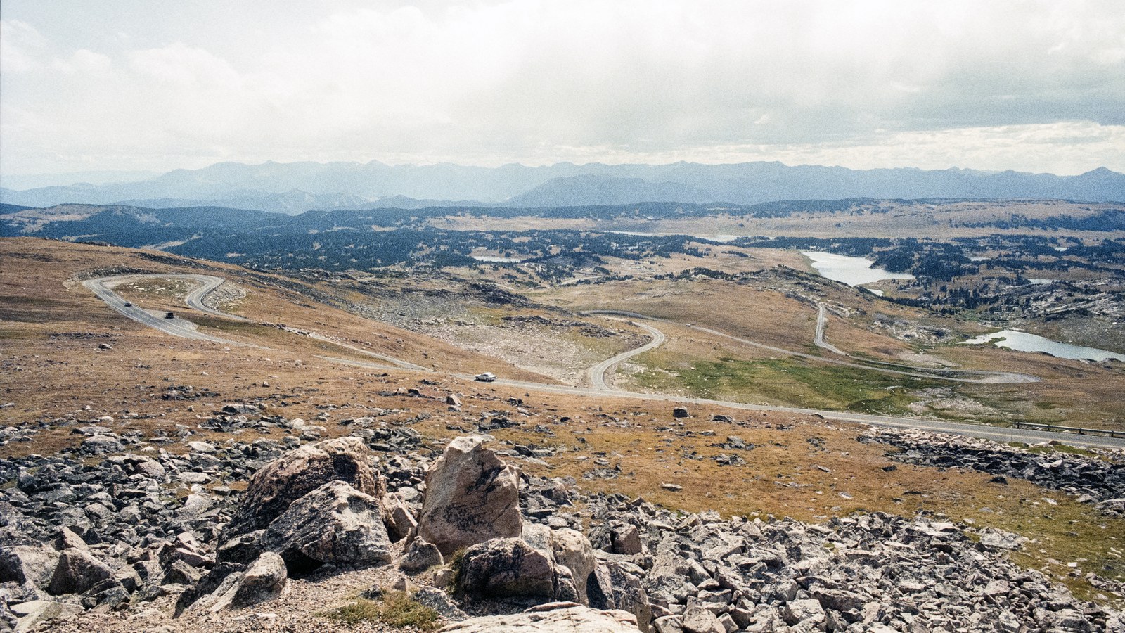 Photo: Acroterion / Wikimedia Commons (CC BY-SA 4.0)
Once you are up on top, the character changes. The plateau is broad and rolling, dotted with alpine lakes and snowfields, with the road threading across the tundra. You will likely see snow up here even in midsummer, because at this elevation it never fully gives up. The pass summit itself is marked with a sign, and there are pullouts where you can park, breathe the thin air, and take it all in. Then the road begins its long descent on the Wyoming side toward Beartooth Lake, Island Lake, and eventually Cooke City and the Yellowstone gate.
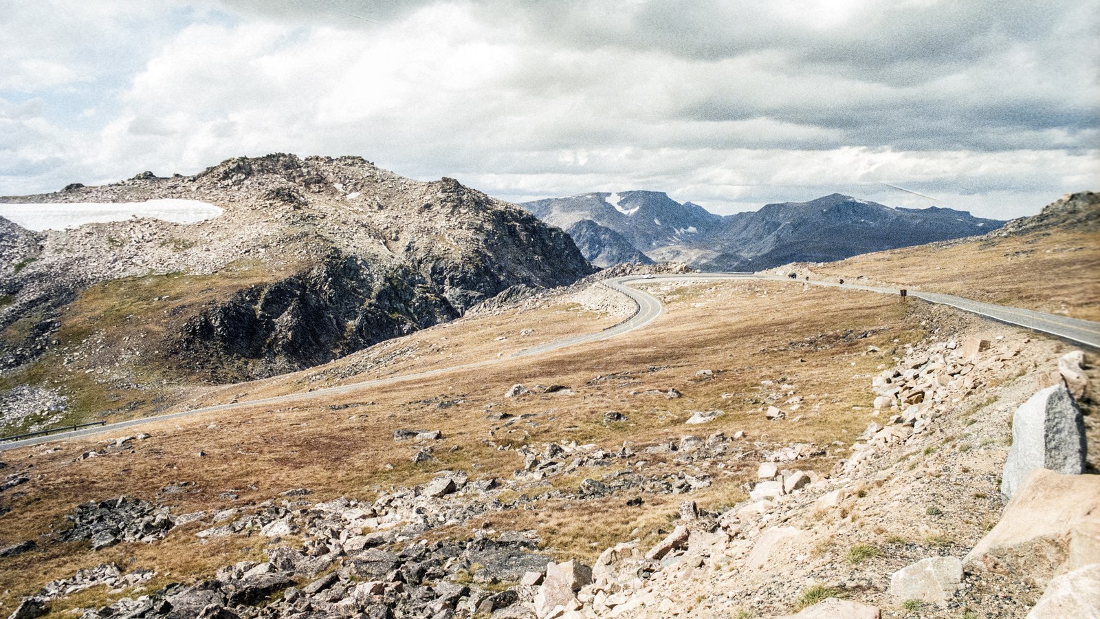 Photo: Acroterion / Wikimedia Commons (CC BY-SA 4.0)
The driving is easy in the sense that the road is paved and well maintained. It is not easy in the sense that it is casual. The switchbacks are steep, there are stretches with no guardrail and big drop-offs, and the altitude affects both you and your vehicle. Take it slow, use lower gears on the long descents to save your brakes, and pull over for faster traffic rather than riding your brakes downhill.
Why off-roaders should care
You might be wondering why a paved highway is on an off-road site. The answer is everything that branches off it. The Beartooth is the gateway to a world of dispersed camping, dirt forest roads, and trailheads scattered across the plateau and the surrounding national forests. Well-maintained dirt spurs like the climb to the Clay Butte Lookout Tower peel off the main highway, and the Beartooth Plateau is laced with backcountry routes for those who want to get off the pavement.
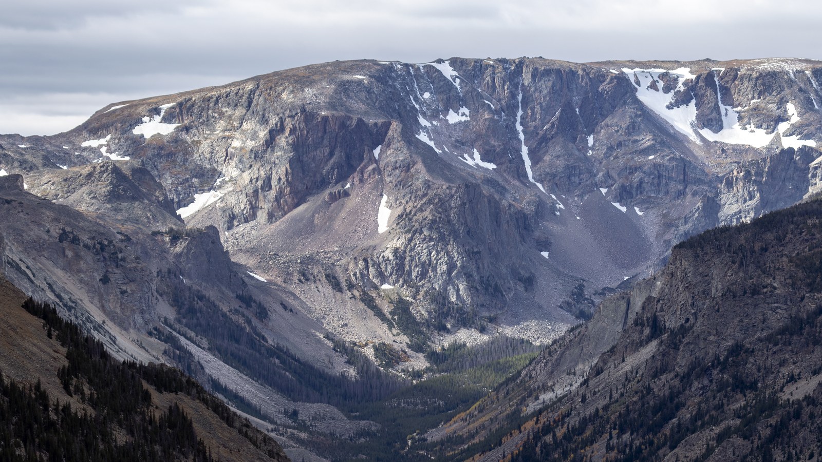 Photo: Acroterion / Wikimedia Commons (CC BY-SA 4.0)
This is also some of the best overlanding basecamp country in the Northern Rockies. There are six Forest Service campgrounds on or near the highway on the Red Lodge side alone, and several more up on the Beartooth Plateau in the Shoshone and near Cooke City. Most of the high-country campgrounds are first-come, first-served, so the rig that can get up early and grab a spot wins. Use the highway as your spine and explore the side roads and trails that spider off it, and you have got a week of adventure right there.
Season: this is the whole game
If there is one thing to burn into your memory about the Beartooth, it is that it is only open part of the year. The highway runs from the Friday of Memorial Day weekend through about October 15, and every bit of that is weather dependent. Montana’s Department of Transportation closes the road every winter, and even in summer, sudden snowstorms at the pass can shut it down temporarily with no notice.
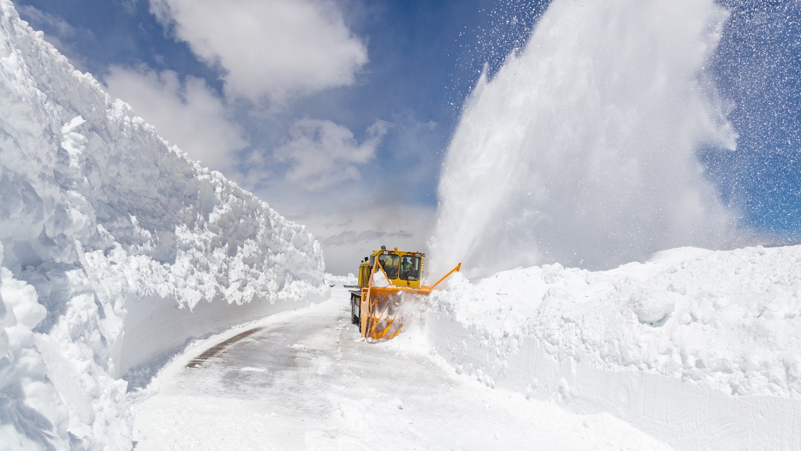 Photo: Yellowstone National Park (NPS), via Wikimedia Commons (Public domain)
Snow usually lingers at the higher elevations until early to mid-July, which is why those spring-opening photos show cars driving between walls of plowed snow taller than the vehicles. In May and June, and again from late September into October, you should expect genuine winter temperatures and the real chance of snow even when it is summer down in the valleys. The plowing operation to open this road every spring is a massive undertaking that the crews document because it is that involved.
The sweet spot is mid-July through early September, when the road is reliably open, the wildflowers are out on the tundra, and the high lakes have thawed. Even then, pack warm layers. It can be 80 degrees in Red Lodge and snowing at the pass on the same afternoon. Always check current road status before you commit, because conditions change fast up here.
What to bring and know
Treat this like the high-altitude trip it is. Bring warm clothing regardless of the forecast, because the pass is a different climate than the towns below. Top off your fuel in Red Lodge or Cooke City, because there is nothing in between for 68 miles. Carry water and snacks, and do not count on cell service across much of the route.
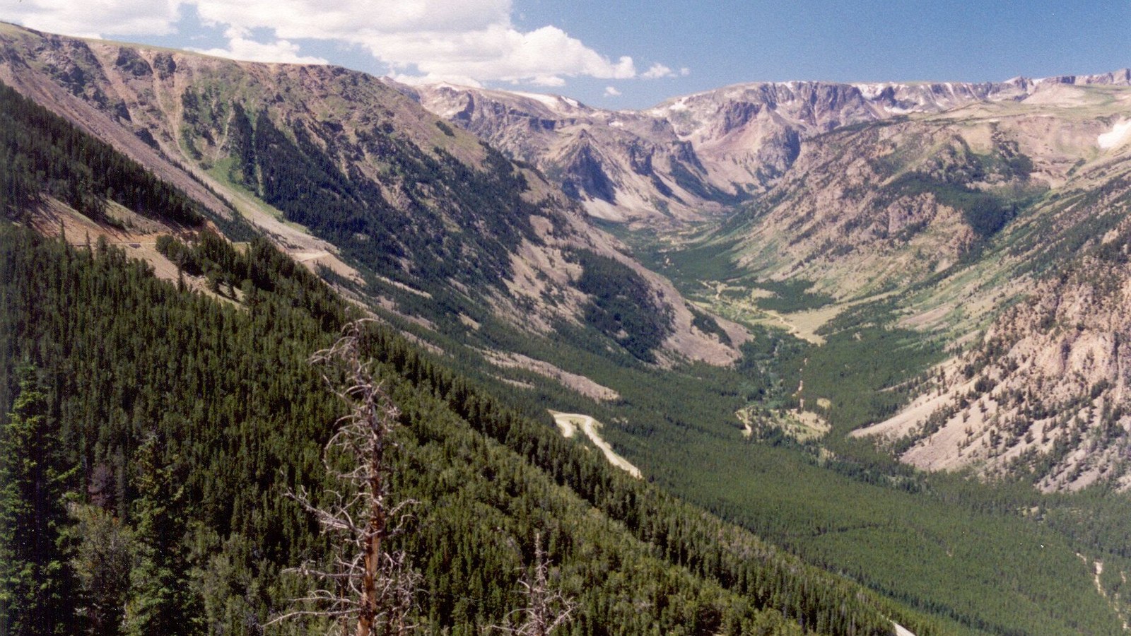 Photo: Chris Light / Wikimedia Commons (CC BY-SA 4.0)
This is also bear country, and not casually. The greater Yellowstone area has a healthy population of both black and grizzly bears, and any hike you take from the pass or the plateau leads straight into their territory. If you are getting out to explore, carry bear spray, know how to use it, and store your food properly at camp. Watch for wildlife on the road too, especially at dawn and dusk.
Drive it right
The Beartooth is a treasure that stays open and beautiful because people respect it. Stay on the established roads and pullouts, especially up on the fragile alpine tundra, where a single set of tire tracks off the pavement can scar the ground for decades. Pack out everything, give wildlife a wide berth, and be patient with the crowds at the famous overlooks in peak season.
Whether you run it as a bucket-list scenic drive or as the launchpad for a week of plateau camping and backcountry exploring, the Beartooth delivers like few roads on Earth. Time it for a clear summer day, fuel up, layer up, and point the rig toward the high country. You will see why people drive across the country just to make this one crossing.
Hero photo: Chris Light / Wikimedia Commons (CC BY-SA 4.0)