

Most people who roll into Gardiner, Montana never look past the Roosevelt Arch. They snap a photo, point the rig south through the North Entrance, and disappear into Yellowstone with the rest of the summer crowd. That is a shame, because the best dirt in the area runs the other direction. Climb northeast out of town on Jardine Road and within a couple of miles the pavement, the tour buses, and the crowds are gone. What replaces them is open sagebrush benchland, a real gold-rush ghost town, and a rough forest road that dead-ends at the doorstep of one of the wildest chunks of country in the Lower 48.
We call this run the Gardiner Basin Backroads. It is not a single signed trail with a fancy name on a kiosk. It is the classic dirt line locals have used for over a century: up Jardine Road to the old mining camp of Jardine, then onto Bear Creek Road (Forest Road 493) until the road quits at the Absaroka-Beartooth Wilderness boundary. It is scenery-first wheeling with a heavy dose of Montana history, and it is one of the most underrated ways to spend a morning in the whole Yellowstone country.
What This Trail Actually Is
The Gardiner Basin is the wide, dry, sagebrush-covered bowl the town of Gardiner sits in, where the Yellowstone River spills out of the park boundary and the Gallatin and Absaroka ranges pinch in from either side. It is a transition zone. Down low it is high-desert benchland, all sage and bunchgrass and pronghorn. Climb a few thousand feet up the drainages and you are into dense conifer forest and, eventually, alpine wilderness. This route strings that whole gradient together in about ten and a half miles.
The road starts as a county-maintained gravel road out of Gardiner and stays civil for the first five miles or so. Most stock high-clearance vehicles handle that opening stretch without trouble in good weather. It passes through the community of Jardine, a former gold-mining town, then transitions onto Bear Creek Road (FR 493) inside the Custer Gallatin National Forest. From there it narrows, roughens, and climbs into the timber before ending near Bear Creek Campground at the wilderness access. This is a point-to-point run: you drive up, you soak in the country, and you turn around and come back down the same way.
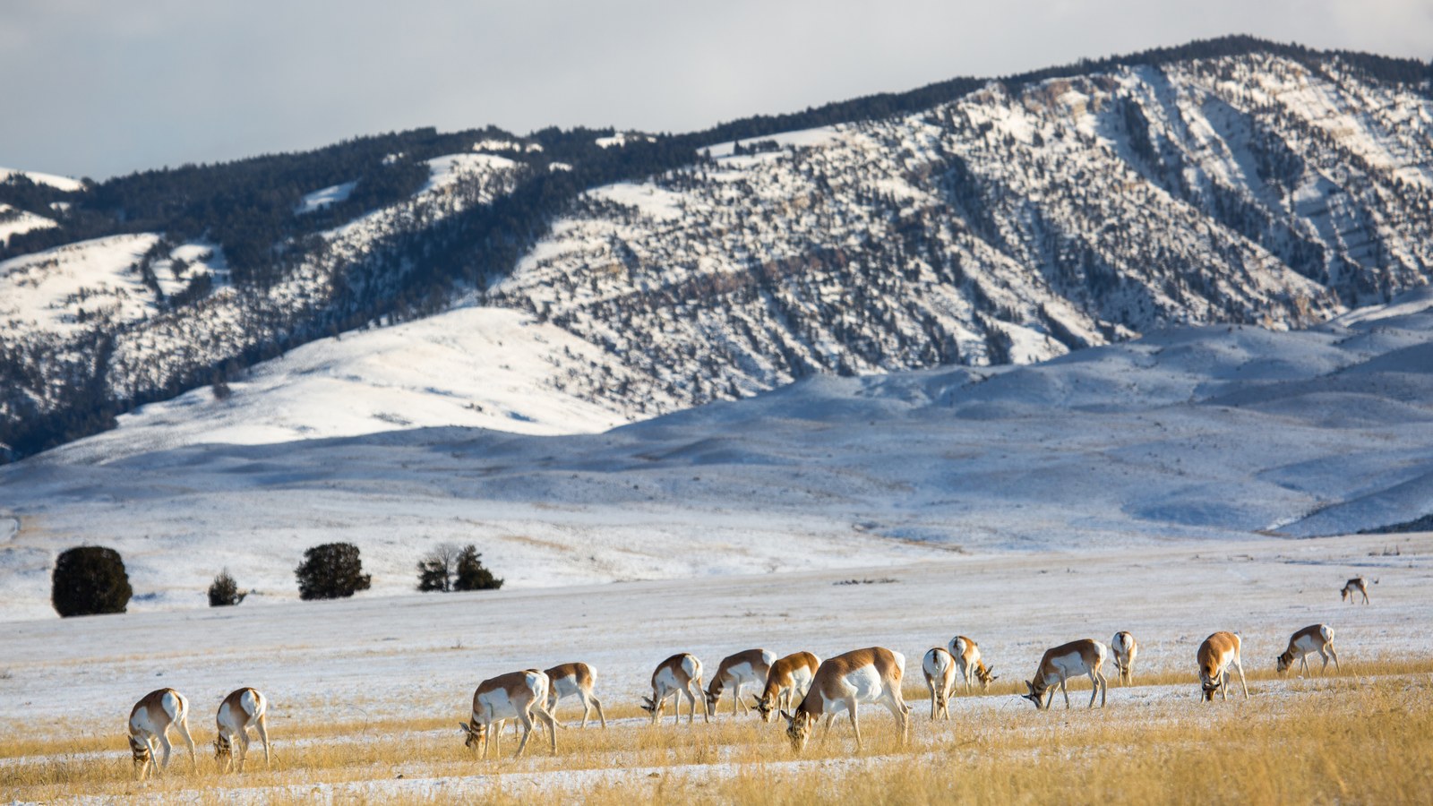 The Gardiner Basin is high-desert benchland: sage, bunchgrass, and some of the most reliable wildlife viewing in the region. Photo: NPS / Yellowstone National Park (public domain).
The character here is not rock-crawling. Nobody is stacking rocks or airing down for ledges. This is a moderate scenic-and-historic backroad where the reward is the country, the ghost town, and the wildlife, not the difficulty of the terrain. Set your expectations accordingly and you will love it. Show up expecting Moab and you will be confused.
How to Get There and Where to Stage
Getting on this route is dead simple, which is part of the appeal. Start in downtown Gardiner. From the main drag, find Jardine Road (it heads northeast, uphill, away from the river and the park entrance) and follow it. There is no trailhead gate and no permit booth. The town itself is your staging area. Fuel up, grab water, hit the restroom, and top off anything you need in Gardiner, because there is nothing past it. Jardine has no services, and once you are on Bear Creek Road you are on your own.
The road climbs immediately and steadily. Within the first mile you get your first big look back down over the Gardiner Basin and the north end of Yellowstone. By mile five or six you reach Jardine. Continue following the signs toward Bear Creek Campground; it is roughly eleven miles from Gardiner to the campground area if you run the whole thing. One thing worth knowing before you commit: the Forest Service specifically notes that the upper campground road is not suitable for long or towed vehicles and there is no turnaround for them. If you are towing or driving something long, this is not your road past Jardine. Leave the trailer in town.
The Run, Mile by Mile
The opening miles out of Gardiner are the easy part. Graded gravel switchbacks lift you out of the basin through sagebrush and scattered aspen, with pullouts that beg you to stop and glass the hillsides. This is prime wildlife country, so take it slow. The Gardiner Basin is one of the most reliable spots in the region to see pronghorn, elk, mule deer, and bison, and it is genuine wolf and bear habitat. Early morning and evening are when the animals move.
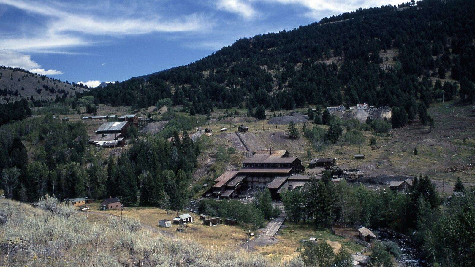 The old gold camp of Jardine still stands on the hillside about six miles up from Gardiner. Photo: William W. Dunmire, NPS (public domain).
Around the five-to-six-mile mark you roll into Jardine. Slow down and look around. The old camp still has miners’ cabins and mining remains scattered across the hillside, relics of a gold operation that ran on and off from the 1860s until the mill burned in the late 1940s. It is private property in places, so look, do not touch, and stay on the road and public ground. More on the history below, because it is genuinely good.
Past Jardine the road becomes Bear Creek Road (FR 493) and the personality changes. The grade tips up, the surface gets rougher with embedded rock and washboard, and the forest closes in around you. This is where the high-clearance and four-wheel-drive advice earns its keep, especially if the road is wet. You climb through timber alongside the Bear Creek drainage, gaining elevation and trading the wide-open basin views for tight, green, creek-bottom country. The road ends near Bear Creek Campground at roughly 7,200 feet, right at the edge of the Absaroka-Beartooth Wilderness.
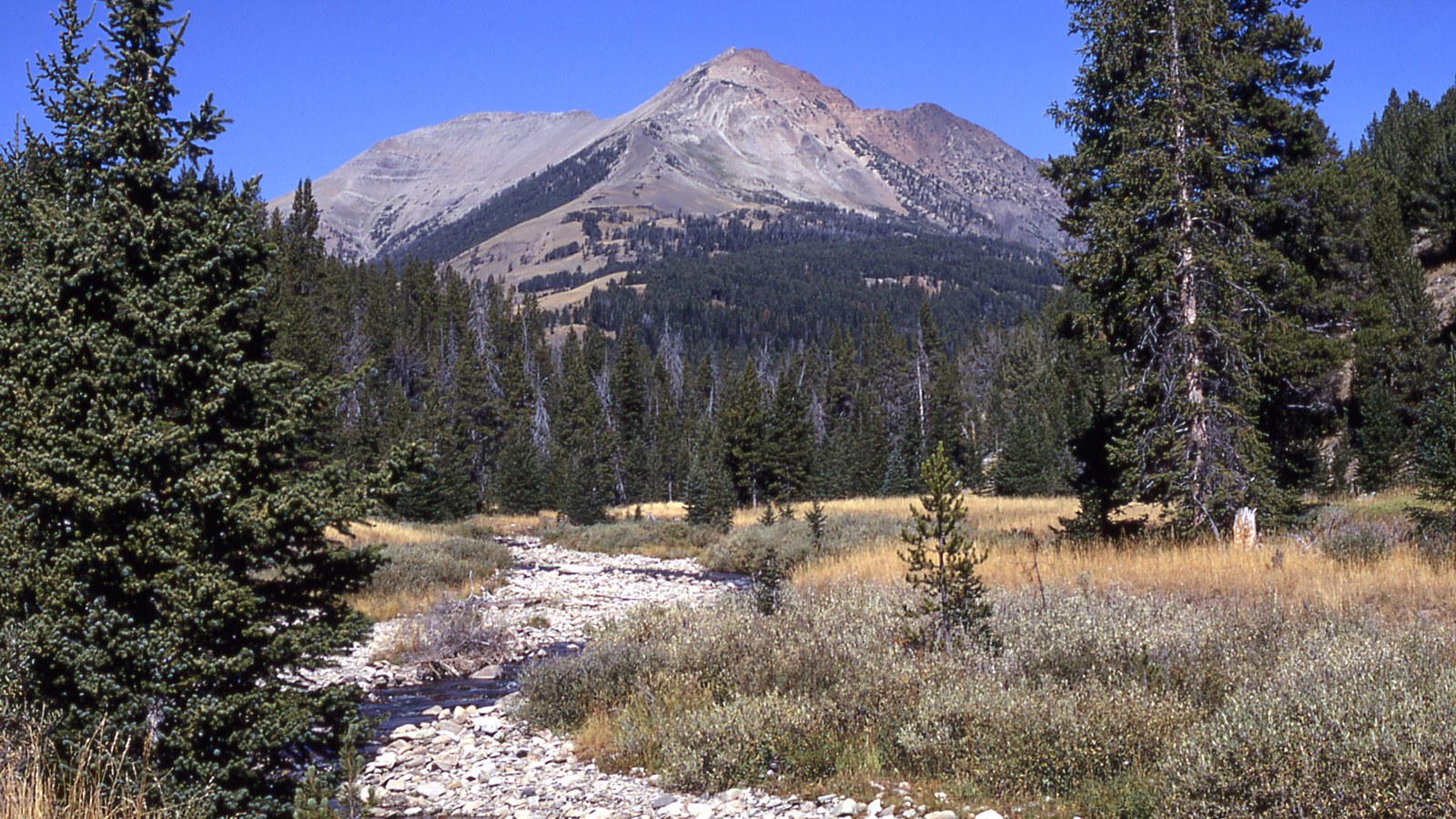 The upper road trades wide basin views for tight, green creek-bottom country in the Absaroka foothills. Photo: William S. Keller, NPS (public domain). That boundary is the hard stop. No motorized travel goes past it, period. Park, get out, stretch your legs on foot, and take in the fact that the country in front of you runs wild and roadless for hundreds of thousands of acres.
The Jardine Ghost Town
The history is the soul of this route. Gold was first found in Bear Gulch back in 1866, but the camp did not really boom until 1898, when a promoter named Harry Bush showed up, bought and leased a pile of claims, enlarged the mill, and laid out a settlement. Within a year the place had something like 130 buildings and a flood of miners. The town was renamed Jardine in 1902.
What followed was a very Montana story of boom, bust, and stubbornness. Company after company took a swing at the ore. A cyanide plant went in, then more stamp mills, then air compressors for underground drilling. The operation produced gold and low-grade tungsten (scheelite) ore, and later even an arsenic plant that ran off and on into the 1940s. A fire finally took out the cyanide plant in 1948 and the mill shut down for good. What is left today is a scatter of weathered cabins and industrial bones on the hillside, about six miles northeast of Gardiner. Driving through it is like reading a history book with your tires. Respect it, photograph it, and leave it exactly as you found it.
The Rig You Actually Need
Be honest with yourself about conditions and you will be fine. In dry summer weather, the lower five miles to Jardine are doable in most any high-clearance vehicle, and plenty of stock crossovers make it up to the old town on a nice day. The upper Bear Creek Road stretch is where four-wheel-drive, real ground clearance, and decent tires matter. Rough surface, loose rock, and grade add up, and if it has rained the clay-and-dirt surface turns slick fast.
Here are the honest minimums for the full run to the wilderness boundary:
- High clearance, and four-wheel-drive strongly advised for the upper section and any time the road is wet.
- All-terrain tires in good shape. You do not need 35s, but bald highway tires on a wet grade are asking for trouble.
- Recovery basics: traction boards, a rated strap, and gloves. It is unlikely you will need them on a dry day, but this is remote country.
- A full tank and real water. There are zero services past Gardiner, and potable water is not available at Bear Creek Campground.
Leave the long-wheelbase towables and anything you cannot turn around in town. The upper road genuinely has no turnaround for long rigs.
Rules, Access, and Pack-Out
This route crosses a mix of county road, private ground around Jardine, and Custer Gallatin National Forest land. The rules are simple but they matter. Stay on the established road. The private mining ground around Jardine is exactly that, private, so do not go poking into cabins or wandering off the roadway there. On the Forest Service land, standard Tread Lightly practice applies: pack out everything you pack in, do not create new tracks, and do not drive around obstacles and widen the road.
The absolute hard rule is the wilderness boundary. Bear Creek Road ends at the edge of the Absaroka-Beartooth Wilderness, and wilderness is closed to all motorized and mechanized travel. That means no vehicles, no dirt bikes, and not even mountain bikes past the line. If you want to keep going, you go on foot. Bear Creek Campground itself is a small, free, primitive Forest Service site with vault toilets and no water, open roughly June through October depending on weather. If you camp, camp there or on legal dispersed sites, and follow all fire restrictions, which in this country can shut down campfires entirely in a dry late summer.
This is also serious grizzly country. Carry bear spray, keep a clean camp, and know how to behave around wildlife. You are on the northern edge of the greater Yellowstone ecosystem, not in a park with rangers around every bend.
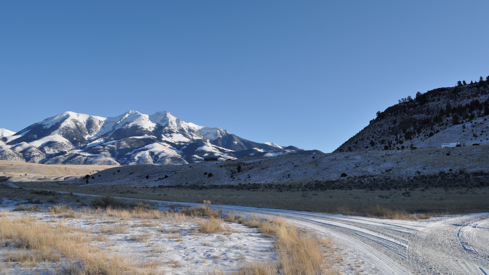 Early and late in the season the high peaks hold snow while the lower road runs dry. Photo: Mike Cline (public domain).
Best Season and Weather Window
The workable season runs roughly June through October. Bear Creek Campground opens around June 1 and the upper road generally holds snow and mud well into spring, so early-season attempts on the top stretch can be a slog or flat-out impassable. Late June through September is the sweet spot: the road is dry, the wildflowers are up in early summer, and the wildlife is active. Fall brings gold aspen and elk bugling, which is arguably the best time of all to be up here, right up until the first hard snows close the high country.
The single biggest variable is moisture. This surface is fine when dry and genuinely sketchy when wet, particularly on the graded switchbacks and the upper grade. If a thunderstorm is building, or if it rained overnight, give the road time to dry or save it for another day. Winter turns the whole thing into a four-wheel-drive-and-chains proposition even on the lower miles, and the upper road is not maintained for winter travel.
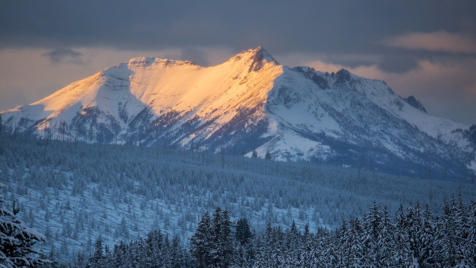 Electric Peak and the Absaroka high country catch the last light above the forest this road climbs into. Photo: NPS / Yellowstone National Park (public domain).
Why It Is Worth Your Time
The Gardiner Basin Backroads will not test your rig or your nerve. What it will do is hand you a quiet morning of real Montana that ninety-nine percent of Yellowstone tourists drive right past. You get big-sky basin views, a legitimate gold-rush ghost town you can drive straight through, a genuine shot at pronghorn and elk and maybe a wolf, and a road that ends where the wild country begins. Run it slow, run it respectful, and treat the history and the wildlife like the treasures they are. This is the kind of low-key backroad that reminds you why you bought a capable vehicle in the first place: not to conquer something, but to go see the places the pavement will never take you.
Hero photo: NPS / Yellowstone National Park (public domain)