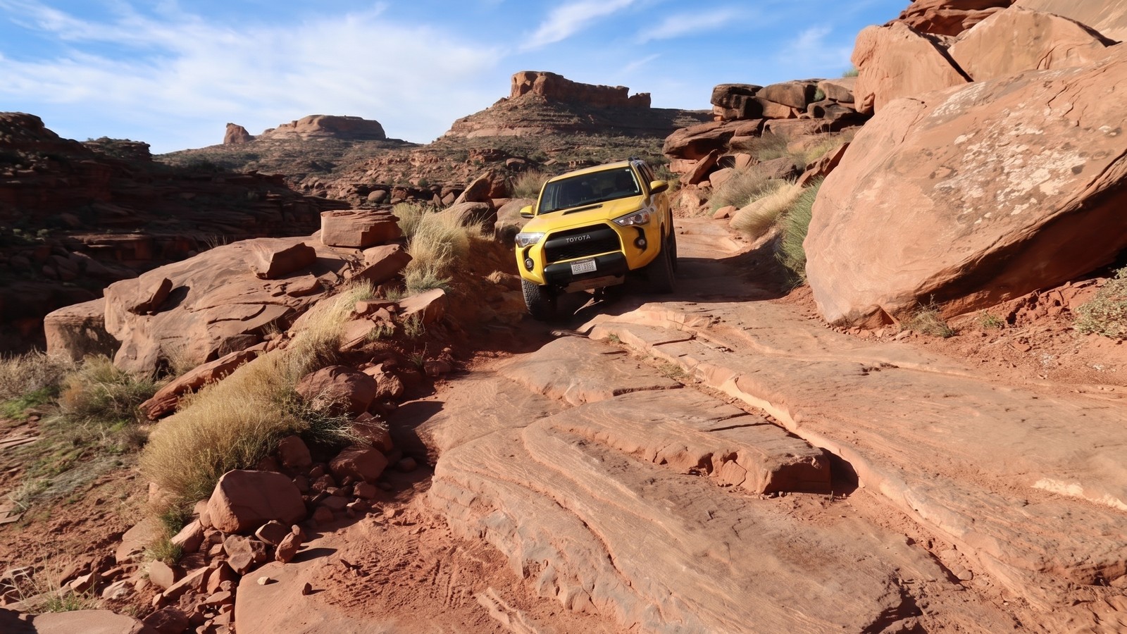
Cliffhanger doesn’t hide what it is. The name is accurate, the terrain is relentless, and the narrow shelf section that gives this trail its name, a big sandstone ledge on a cliff edge above Jackson Hole, is the kind of moment that separates drivers from passengers. If you’re the kind of person who thinks rock ledges are a feature and not a bug, Cliffhanger will become a benchmark in your Moab rotation.
The trail is the only motorized route onto Amasa Back, a high isolated mesa bounded by Kane Springs Canyon, Hurrah Pass, Jackson Hole, and a sweeping bend of the Colorado River. Once you’re on the mesa, you’re committed, there’s no other way off. Every obstacle you descend on the way in, you climb on the way out. Plan accordingly.
It’s a relatively short trail at 4.3 miles one way, but expect three to four hours for a full out-and-back with a small group. The terrain is that demanding. The views from the top are that good.
What Cliffhanger Actually Is
This is a sandstone ledge trail, not a rock garden and not a mud pit. The surface is mostly exposed Entrada sandstone in stacked layers, which creates the endless series of stair-step ledges that define the route. Between ledges there’s red sand, patches of slickrock, and narrow dugways carved into canyon walls. The elevation gain is modest by mountain standards, roughly 840 feet from trailhead to mesa, but the ledges pack it into a relentless format that will stress even well-built rigs.
Cliffhanger also shares the access road with mountain bikers, who use the same route to reach the trail network on Amasa Back. Encounters are common, especially in the afternoon. Give them space and pass carefully, many of these sections are narrow enough that it matters.
One thing to understand before you go: this is not a trail that gets easier on the return trip. It’s the same ledges in the opposite direction, with gravity no longer on your side for the steep ones. Before you drop into anything gnarly on the way in, walk it and ask yourself whether you can climb back out. Some groups have made it to the bottom of the first hill and broken their transfer case trying to get back up. The tow-out from here is expensive.
Getting There
Cliffhanger is about 5.3 miles from downtown Moab via Kane Creek Boulevard. Head south out of town on Hwy 191 and turn right (west) onto Kane Creek Blvd at the McDonald’s. Follow Kane Creek Blvd as it parallels the Colorado River. The pavement ends and turns to well-graded dirt as the road enters the canyon. You’ll pass the Jackson Hole trailhead at around 4.6 miles.
At approximately 5.3 miles from the Hwy 191 intersection (about 5 miles west of Hwy 191, per BLM), look for a marked parking area on the right and a steel sign cut with “CliffHanger.” That’s the trailhead. The sign is posted on the right side where the trail drops steeply off the county road toward the creek.
BLM Moab Field Office: 435-259-2100 for current conditions.
Note on the gate: A livestock gate crosses the trail near the entrance. The BLM has issued a grazing permit to a rancher running cattle on Amasa Back. Leave the gate in whatever position you found it, open or closed.
The Trail: Obstacles in Order
There is nothing subtle about Cliffhanger’s opening move. You drop immediately off the county road down a steep cascade of rock ledges to the Kane Creek bottom. Before you descend, walk this section. There are twists and turns in the line, the drops are real, and this hill has to be re-climbed at the end of the day. Multiple people have come down and been unable to get back up. Look at it carefully.
The mean shelf. At the bottom of the first descent, after the steel CliffHanger sign, a narrow shelf drops off aggressively. Rocks are usually stacked here to help the line, but even with them your skid plate takes a hit. A twisting route to the right is generally better. This is not a warm-up.
The angled ledge. A second shelf angles taller from right to left, with loose ground dropping off on the left side. The angled surface wants to slide you that direction. Most drivers favor the left side but it’s a commitment, pick your line before you start the drop and don’t change your mind halfway down.
Kane Creek crossing. Usually a trickle, sometimes dry sand, occasionally quicksand or ankle-deep water depending on the season and recent weather. Flash flooding is possible if there’s been heavy rain upstream in the canyon system. Check conditions with the BLM office if there’s been recent rain. After the crossing, wet tires pick up sand for the first vehicle lengths, which matters for the next obstacle.
The post-creek angled ledge. Right after the crossing, before the sand wears off your tires, an angled shelf must be climbed. Longer wheelbase rigs can take the taller right side; shorter rigs typically tackle the left, where a large rock on the left edge waits for any body panel that gets too close. The angled surface slides you that direction too. During the 2011 Easter Jeep Safari, the Moab club chiseled a notch into this ledge to give tires something to bite against. It helps.
The dugway climb. Past the creek bottom, a narrow dugway with a couple of tight switchback turns climbs rapidly up from the canyon floor. From here the trail continues upward on the face of Kane Springs Canyon, with sheer sandstone walls on one side and increasingly exposed drops on the other.
The upper mesa ledges. From the dugway to the top, the trail is a continuous series of irregular ledges, rock shelves, angled sandstone benches, boulder-filled passes, and patches of smooth slickrock. The obstacles aren’t individually named the way they are on some Moab trails, but they don’t stop either. There’s no place to coast. The sandstone layers create natural steps at various heights, some easy, some requiring careful line selection.
The Cliffhanger obstacle. Near the end of the trail, the namesake feature: a big ledge on a narrow shelf trail with a roughly 400-foot exposure into Jackson Hole on one side. This is what the trail is named for. The correct line through it changes as the rock erodes over time and also varies with wheelbase, what works for a short-wheelbase TJ may not work for a JT. Interestingly, most drivers who’ve done this trail report that the Cliffhanger ledge itself is not the hardest thing on the route. It’s the obstacles on the way up, and especially the two obstacles near the bottom that must be re-climbed on the way out, that filter people.
Landmark Views and Waypoints
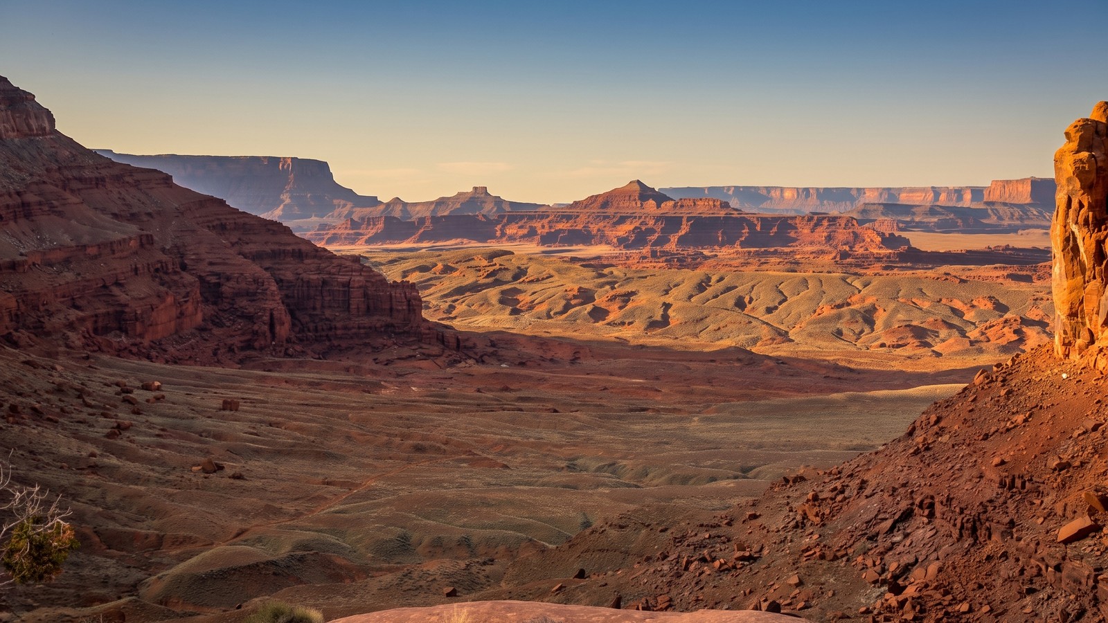
The views from Amasa Back are genuinely unusual. The mesa sits at the intersection of several canyon systems, which means you get multiple perspectives that most Moab trails don’t offer.
Kane Springs Canyon. On the way up, you’re driving along the base of sheer Entrada sandstone walls with the canyon walls towering on one side and the creek cutting below. The fins of Behind the Rocks Wilderness Study Area come into view, and the LaSal Mountains anchor the eastern horizon.
Jackson Hole. This is an abandoned meander of the Colorado River, a sealed oxbow canyon with a central butte, cut off from the river thousands of years ago. The cliff edge at the Cliffhanger obstacle looks directly into it. The exposure is real and the view is striking.
Colorado River overlook. A spur trail branches right at about 2 miles in, leading to an overlook of Poison Spider Trail and Highway 279 along the river below (the one that ends at the Potash plant). The farthest viewpoint at the end of the trail sits atop a sheer cliff with a long vista down the Colorado River canyon.
LaSal Mountains and Behind the Rocks. On the afternoon return trip, with the sun lower and the light better, the views back into the canyon system and across to the LaSals are some of the best in the area.
Petroglyphs. There are multiple petroglyph panels along the route. The first major panel can be spotted on the high canyon wall to the north across the creek, bring binoculars. Watch for additional panels on the rock faces as you climb. These are fragile cultural resources; observe from a distance and do not touch.
Rig Requirements
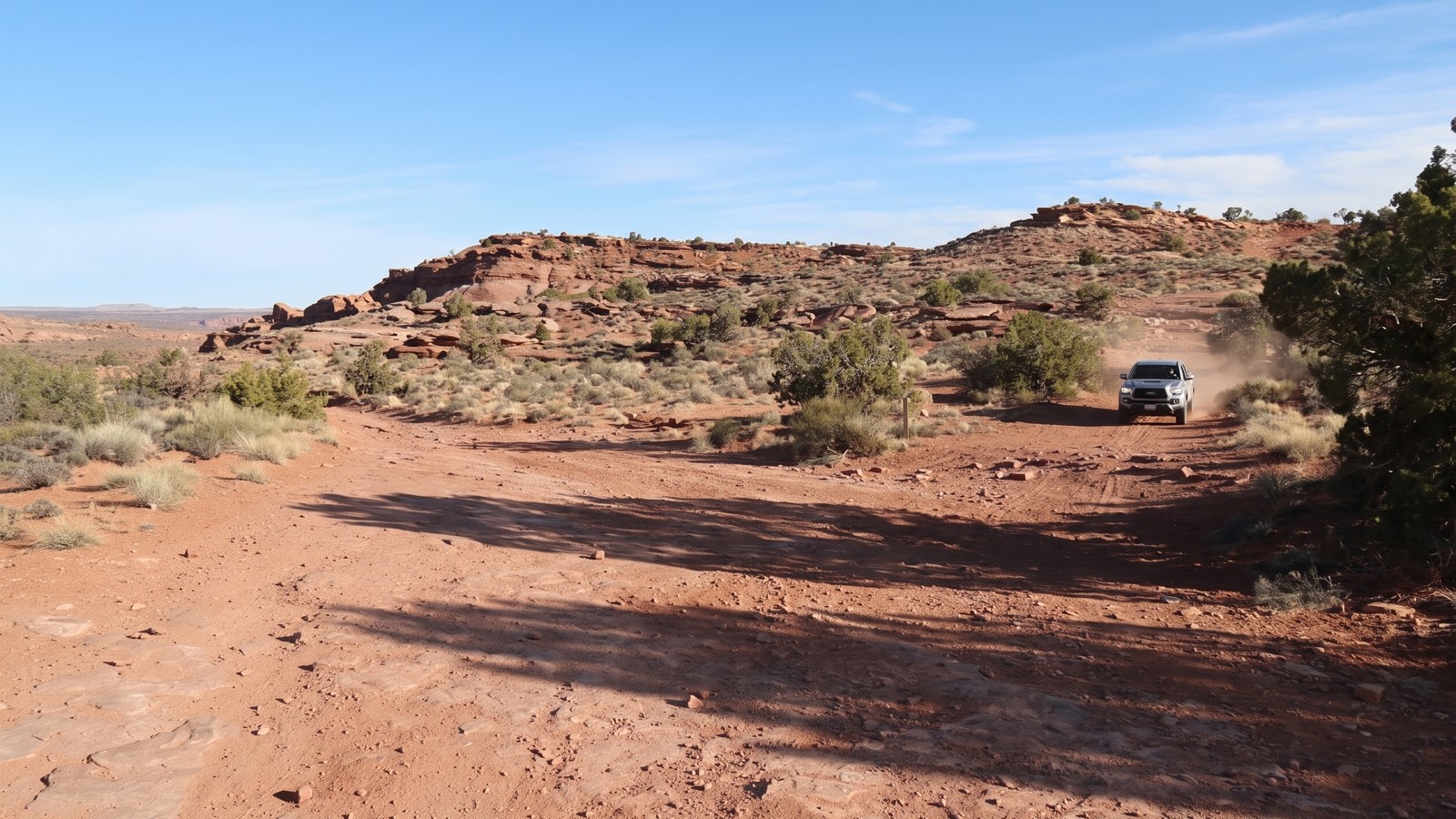
This is not a trail for stock SUVs or lightly modified rigs. The ledges are tall, the sandstone is abrasive, and body damage is a realistic possibility even on a well-prepared rig.
Minimum setup:
- 35-inch tires, minimum. The ledges require the ground clearance and sidewall height to step up without dragging the frame or axles.
- Front and rear lockers. Both. Not limited slips, not open differentials with momentum. Lockers. The angled sandstone surfaces and high-centered ledge situations require axle-level control.
- Solid skid plate protection. Your belly will contact the sandstone on multiple obstacles. Plan for it.
- Quality suspension with good articulation. The irregular ledge heights want to lift wheels; articulation keeps tires on the rock.
Strongly recommended:
- A winch. While not everyone uses one, some groups winch the post-creek shelf and the exit ledges on the way out. Trail conditions change as the rock erodes, so what was driveable last season may require a winch pull now.
- A spotter for every obstacle. This trail has no shoulder and no recovery space. Spotting saves paint and prevents rollovers.
- Tow hooks, front and rear. If someone in your group gets stuck, recovery requires attachment points.
- Recovery gear: tow straps, shackles, hi-lift jack, boards or traction mats for the creek-bottom sand.
The trail is also open to 50-inch and 60-inch wide vehicles per onX, which gives some flexibility on vehicle type. But width matters on the shelf sections.
Wheelbase note. Cliffhanger is one of those trails where wheelbase genuinely affects which line works at specific obstacles. Shorter-wheelbase rigs (TJ, short-bed trucks) have more options on the creek-side shelf; longer-wheelbase rigs (JT Gladiator, 4-door Wrangler, full-size trucks) handle the upper mesa ledges more smoothly but need to check their specific approach and departure geometry at the tight turns.
Permits, Fees, and Rules
No permit is required. No fee to access. The trail sits on BLM land administered by the Moab Field Office.
Key rules:
- Stay on the designated trail. Amasa Back is shared with mountain bikers using singletrack routes throughout the mesa. The 4x4 route is the Cliffhanger road; do not venture onto the singletrack trails designated for bikes only.
- Pack in, pack out. No trash facilities at the trailhead. Everything you bring in leaves with you.
- Livestock gate: leave it as you found it (open or closed). The rancher holding the BLM grazing permit depends on this.
- Leave petroglyphs untouched. Do not chalk, trace, or get within arm’s reach of the panels.
There is no designated campsite on Amasa Back itself. Dispersed camping is available along Kane Creek Road within BLM boundaries, check with the Moab Field Office for current guidance on camping zones.
BLM Moab Field Office: 435-259-2100 or visit the office at 82 E. Dogwood Ave, Moab, UT 84532.
Best Season
Spring (March through May) and fall (September through November) are the sweet spots. Moab’s desert heat in summer is manageable for experienced groups but miserable for breakdowns and extended recovery operations, temps regularly hit 100°F or above from June through August. The canyon walls trap heat. Carry far more water than you think you’ll need.
The trail can be accessed year-round in dry conditions. Kane Creek crosses a lot of canyon drainage, so it’s sensitive to weather upstream. Flash flood season (July and August monsoons) warrants checking conditions before driving the creek crossing. A small creek that was ankle-deep in the morning can move fast after a storm.
Snow can close the higher mesa sections in winter, but Moab’s lower elevation means the trail often clears faster than high-country Colorado routes. Call the BLM office for current conditions in shoulder seasons.
Current status as of any visit: check onX trail reports and the BLM Moab Field Office, recent user reports on onX indicate the trail has been open through spring 2026.
Stewardship: Protecting Amasa Back
Amasa Back sees significant traffic from both motorized and non-motorized users. The two communities share the access road, and the relationship works when everyone gives appropriate space and respects the terrain.
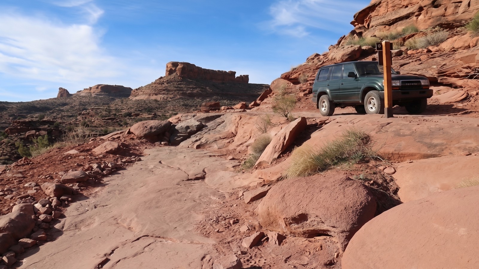
Rock stacking and trail modifications: some rock stacking at key obstacles is an established practice here and has been done for years to help maintain usable lines as the rock erodes. Don’t remove stacked rocks from obstacles. The Moab 4-wheel drive clubs that maintain these trails put real work into keeping them driveable.
Multi-use etiquette: you will encounter mountain bikers on the upper mesa, particularly in the afternoon when they descend the singletrack back to the road. Treat them like oncoming traffic, slow down, pull over where you can, and let them pick the line through any narrow sections.
The petroglyphs. These panels are thousands of years old. The oils from human skin accelerate decay on petroglyph surfaces. Look, photograph, admire, and stay back.
Tread Lightly applies on Amasa Back the same as anywhere else: stay on the established trail, minimize wheel spin on the slickrock, and leave the terrain better than you found it.