

There are a handful of trails that belong on every off-roader’s Moab list, and Poison Spider Mesa is near the top of all of them. It is the one that gives you the whole Moab experience in a single day. Steep slickrock switchbacks off the canyon floor, a string of named ledge obstacles that reward clean tire placement, miles of open sandstone fins to wander, and a rim view 1,000 feet above town that is honestly worth the whole trip on its own. It is hard enough to feel like a real accomplishment and forgiving enough that you do not need a buggy to enjoy it.
It is also the gateway to Moab’s most famous chain of hard trails. The first miles of Poison Spider feed straight into Golden Spike and Gold Bar Rim, the route locals call the Trifecta, so this mesa is both a great day on its own and the on-ramp to some of the most serious wheeling in the country. Here is the honest version of what Poison Spider Mesa is, how you get on it, every obstacle in the order you will meet it, the rig you actually need, and the rules that keep this BLM route open.
What Poison Spider Mesa actually is
Poison Spider Mesa is a cliff feature northwest of Moab, bordered on the east by Moab Valley and on the south by the Colorado River. The trail climbs from the river-level Potash Road up the sloping rock layers to the top of the mesa, then runs a loop across the rim before retracing the same obstacles back down. onX measures the full run at about 14.3 miles round trip, and the managing agency, the BLM Moab Field Office, describes the broader Poison Spider Mesa system as roughly a 16-mile network. Most people allow around five hours from the trailhead and back, longer if you stop to hike and shoot photos, which you will.
The name is great and the mileage is real, but the black widow population up here is no worse than anywhere else in the desert. What sets this trail apart is the mix. You get genuine technical obstacles, long stretches of fun slickrock cruising, blow-sand hills to play in, and a rim panorama that takes in Moab, the Colorado River corridor, the fins of Behind the Rocks, and the La Sal Mountains. Few trails anywhere pack that much variety into one loop.
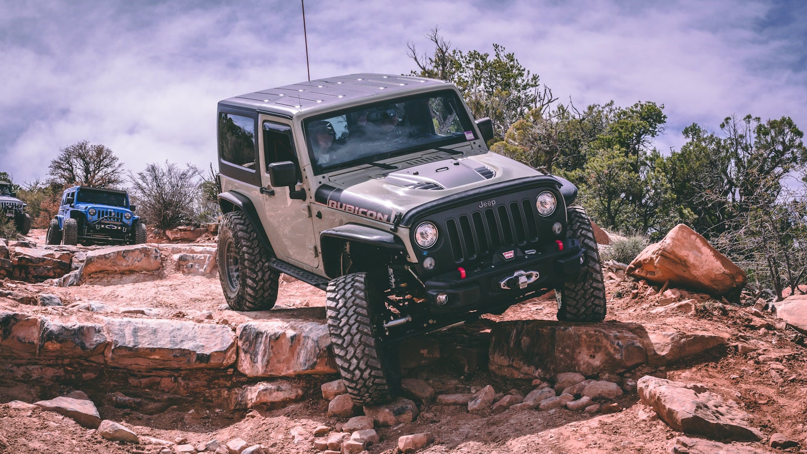 Photo: Cody Lannom / Unsplash
A word on difficulty, because the rating depends on who you ask. The respected guidebook source FunTreks rates Poison Spider Difficult, AllTrails calls it a challenging route built for modified vehicles, and the Red Rock 4-Wheelers, the club that runs Moab’s Easter Jeep Safari, treat it as one of their staple technical-but-fun trails. onX scores it a 6 out of 10. Translation: this is not a beginner trail, but it is also not a vehicle-buster like neighboring Pritchett Canyon. A capable, well-equipped rig with a careful driver has a great day here. An under-built rig gets stopped, or worse, broken, at the Waterfall.
Getting there and staging
Access is simple, which is part of the appeal. From Moab, drive north on US Highway 191 and turn west onto Utah State Route 279, the Potash Road, which runs along the Colorado River below the cliffs. Follow Potash Road roughly six miles to the signed Poison Spider Mesa Trailhead on the right. The trailhead coordinates are about N38° 31.96’, W109° 36.53’.
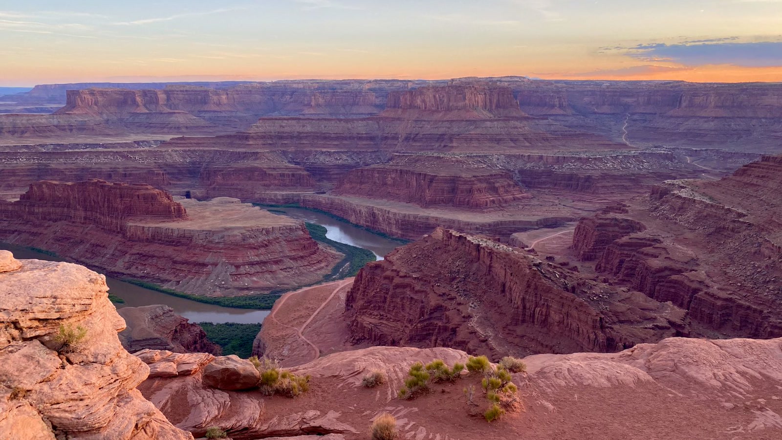 Photo: Colon Freld / Pexels
The trailhead is where you air down. There is a vault restroom and a parking area, but read the BLM signs carefully: the lot is sized for single vehicles in standard spaces, and trailer parking and staging are not allowed in or along the entrance road. If you are towing, use the designated pullouts along Potash Road or the overflow at the nearby Gold Bar Recreation Site, and make sure your rig and trailer are completely off the highway and outside the white line. There is no drinking water and cell service is spotty, so bring your own water and do not count on your phone. Right at the trailhead there is a short hike to a dinosaur tracksite and petroglyph panel that is well worth ten minutes before you climb.
The obstacles, in order
This is the heart of the guide. Poison Spider front-loads its hardest driving in the first few miles, then opens up onto the mesa. Route finding is part of the challenge up here, so follow the painted “P.S.” markers and the white dashes on the rock, and run it with a group.
The switchbacks. The trail starts by climbing the cliff face through a set of rocky switchbacks, gaining the first big chunk of elevation in the first mile. There are steps, ledges, and small waterfalls to climb right out of the gate. It is a fitting introduction: you are working almost immediately, and the exposure builds as you gain the rim.
Tie-Rod Flats. After you exit the switchback section near the top, the trail crosses a rocky stretch that the guidebooks call Tie-Rod Flats. It has been described as unorganized mountain speed bumps, a jumble of rock that you pick your way across. Most of it can be run in 4-High at a patient pace. The name is a warning to mind your steering components on the awkward rock.
The 10-foot slickrock climb and the Waterfall. Around the 2.4-mile mark the real obstacles begin with a roughly 10-foot slickrock climb, which leads straight into the trail’s signature challenge, the Waterfall. The Waterfall is a winding set of slickrock ledges that runs for about 100 meters up a tight, stepped section. It is the first mandatory obstacle that will actually stop an under-built rig, and it is the spot that gives the trail much of its rating. Take your time, let a spotter put you on the right line, and respect it when there is water in it.
The V-Notch. Immediately past the Waterfall comes a series of slickrock climbs and then the V-Notch, a notched section that makes for dramatic photos, triumphant or tragic depending on the rig. With careful tire placement it tends to look worse than it drives, but it is a real obstacle and a great spot to spot each vehicle through and get the camera out.
High Speed Mesa. After roughly another mile of slickrock obstacles, the trail mellows into a stretch the locals call High Speed Mesa, a mostly sandy track across the open top of the mesa. This is your breather, a chance to air out and enjoy the scenery after the technical climb. Stay on the marked route. The sand here is soft and the temptation to wander off-line is exactly how the desert gets scarred.
The Down and Up Ledges and the Golden Spike intersection. Next come the Down and Up Ledges, which carry you to the intersection with the Golden Spike trail. This is the decision point. Golden Spike (rated a 7) and the even harder routes beyond it, like Where Eagles Dare (rated an 8), peel off to the north toward Gold Bar Rim. For the standard Poison Spider Mesa run, bear right here to enter the Poison Spider Loop.
The mesa loop, Little Arch, and the rim
The loop is about 3.5 miles around and it is the payoff for all that climbing. Much of it is on Navajo Sandstone slickrock, including one stretch of about 0.4 miles of bare rock, broken up by rock ledges, a sandy wash bottom, and a couple of blow-sand hills big enough to be fun. There are also giant potholes to drive around and a large sand hill that has to be negotiated.
The usual stop is the short hike out to Little Arch, a small span tucked into the rim rock with Moab Rim and the Potash Road laid out far below. From the rim the view opens into a panorama that easily clears 300 degrees: Moab a thousand feet below, the Colorado River cutting through its canyon, the sandstone fins of Behind the Rocks marching toward the snow-streaked La Sal Mountains, and Jeep Arch visible across the way. There are several spots along the loop where you can drive out to the rim edge and just sit with it. Do not skip the overlook to save time. The overlook is the trail.
Once you have run the loop, the standard day finishes by returning the way you came, running the same obstacles in reverse back down to the trailhead. Driving the Waterfall and the switchbacks downhill is a different challenge than climbing them, so stay sharp all the way to the bottom. The trail does not let you coast home.
The rig you actually need
Poison Spider sits in a sweet spot. You do not need a dedicated rock buggy, but you absolutely need a real 4WD rig set up for slickrock. Here is the honest minimum, drawn from the managing agency’s difficulty guidance and the trail databases:
 Photo: Mick Haupt / Pexels
- Tires: 33-inch tires are the practical floor, with 35s and up making the ledges noticeably easier. Air down at the trailhead. Low pressure is what makes slickrock grip.
- Traction aids: at least two traction-adding devices, meaning lockers or limited-slips front and rear. A single open-diff rig will struggle on the Waterfall and the V-Notch. The Red Rock 4-Wheelers list front and rear lockers for this trail.
- Clearance and suspension: good ground clearance and enhanced suspension travel. The steps and ledges can reach up toward 36 inches in the worst spots, so articulation and clearance both matter.
- Skid plates and recovery gear: real underbody protection, plus straps, a recovery kit, and a way to get unstuck. A winch is not strictly required on the standard route, but it is a smart plus, especially if you might continue onto Golden Spike.
- Driving skill: this is where Poison Spider earns its rating. Excellent tire placement and patient spotting matter more than raw horsepower. Bring a friend who can spot you up the Waterfall.
One honest note: this is a popular trail and a frequent guided-tour route, so you will share it. That is fine. Yield with courtesy, let faster groups by, and do not let a crowd push you into rushing an obstacle.
Permits, rules, and packing it out
Poison Spider Mesa is on BLM land managed by the Moab Field Office, and the rules here are straightforward but real:
- Stay on the designated route. In the Moab area, all vehicles and bikes must stay on marked, designated routes, full stop. The painted markers and dashes are the route. Cutting new lines across slickrock or sand is how trails get closed, and the damage lasts for generations in this terrain.
- No special permit, but respect the trailhead rules. You do not need a permit to drive Poison Spider, but heed the trailhead signs on parking and trailers, and do not stage trailers along the entrance road.
- Pack out your waste. There are no toilets on the trail itself and limited facilities in the backcountry, so plan accordingly and pack out all trash. Leave the dinosaur tracks and the petroglyphs alone. You may look and gently touch the tracks, but the oils from your hands damage the rock art, so do not touch the petroglyphs at all.
- Tread Lightly. This is shared, fragile country. The whole reason we still get to run these trails is that the community polices itself. Be the group that leaves it better.
Best season and conditions
Run Poison Spider Mesa in spring (March through May) or fall (September through October) for the best mix of workable temperatures and dry rock. The trailhead is open year-round, but summer heat in Moab gets extreme, shade is nonexistent up on the mesa, and a slow technical day in triple-digit heat is a real safety risk. Carry far more water than you think you need.
Wet rock is the other variable. The Waterfall and the slickrock climbs change character when there is water in them, and slickrock is famously deceptive when damp. If rain has rolled through, give the rock time to dry, and never push an obstacle that is running water. Check conditions before you go, and remember that mid-day light flattens the rim view, so an earlier or later run rewards you with better scenery and cooler temps.
Run it right
Poison Spider Mesa is the trail to put at the top of a Moab trip. It hands you the full menu in one loop: a genuine technical climb, a string of named obstacles you will talk about for years, miles of open slickrock to roam, and one of the best rim views in the Southwest. Bring 33s or bigger, two lockers, real clearance, recovery gear, and a group, air down at the trailhead, follow the P.S. markers, and take the time to walk out to Little Arch. Stay on the route, pack it out, and respect the country and the people who keep it open. Do that, and you will understand why this mesa has been a bucket-list trail for as long as people have been wheeling Moab.
Hero photo: Francisco Jaramillo / Pexels